Take a moorland walk with a peep into Dambusters country
This walk was published in June 2015, so the details of the route may no longer be accurate, we do advise these articles should only be used as a guideline for any potential route you take and you should double check an up to date map before you set off.
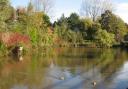
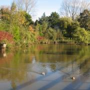
The eastern edge of the Peak District is studded with reservoirs large and small. This moorland walk circles the tiny one at Strines, on the outskirts of Sheffield, before climbing to breezy Derwent Edge to enjoy panoramic views across the national park as well as down to the Derwent reservoirs. Today this chain of three man-made lakes is a popular day out for families from the neighbouring city but in 1943 Ladybower, Derwent and Howden throbbed to the sound of Lancaster bombers as the Dambusters practised for the most famous raid of the Second World War. Happily today things are much more peaceful and this outing takes in woodland and a visit to an imposing folly on its way to the summit.
Directions
1 From the parking area, walk along the lane eastwards (away from Strines) for about ten minutes to where the reservoir becomes visible and turn right down a bridleway marked Stubbin House Farm and Broggin House (there is extra parking here if needed) heading down towards the water. When it reaches the house by the dam, turn right towards the dam but before crossing it turn almost immediately left to take an initially flagged path through a gate and down the banking into the trees. Cross a footbridge over the outlet but ignore a second footbridge ahead and instead fork right up to a stile in the wall. Go through this and then begin climbing the slope trending half rightwards above the reservoir.
2 As the path gains height the lonely crenellated tower of Boot's Folly comes into view. Although it resembles a medieval fortified peel tower, it is in fact a folly which never saw an assailant, having been built as recently as 1927 for a local landowner to provide work during the Depression. Originally it had a spiral staircase to an upper room but today it is an empty shell.
3 From the tower, head towards towards the impressive buildings of Sugworth Hall and look for a small gate near the left hand end of the perimeter wall. Go through this to enter a tunnel of trees which are quite low hanging in places. The path worms its convoluted way past the hall to emerge on the access drive. Turn left up this to leave the estate by an imposing gateway Turn right down the lane and follow it to a T-junction. This is the road which comes from the A57 Snake Road to Strines and could be used to miss out this first section, which would reduce the walk by about an hour.
4 At the junction go straight across to take a rough track heading onto the moor. Follow this between the buildings of Moscar House Farm and a couple of hundred yards later turn right uphill to climb the moor, passing a sign erected by the splendidly-named Peak and Northern Footpath Preservation Society and marked to Derwent Edge.
5 The track both up to and along Derwent Edge has been undergoing serious restoration recently and is now much easier to walk, though some sections still have to weather before they will blend into the peaty soil.
6 When the path reaches the watershed the view opens up with the Peak District hills rolling away to the south and west. Turn right on the unmissable track along the edge, passing strangely eroded boulders and outcrops with names like the Wheel Stones, Salt Cellar and Cakes of Bread while below the Derwent Reservoirs are strung out along the valley floor.
7 The way eventually becomes flagged, mimicking the jaggers' tracks which once crossed the Pennines as trains of pack ponies brought goods of all kinds over the moors. As the path nears the summit rocks of Black Tor, crowned by a white trig point with a distinctive anvil-shaped stone to its left, look out for a chest high standing stone marking a crossroads with a fainter path coming up from the two valleys about 300 yards before the summit. The path heading right as you approach it is the return route but it is worth first going on to the trig point to admire the view.
8 From the crossroads by the standing stone turn east towards Strines (now a left turn as you come from Back Tor). The upper section has suffered a little from use by vehicles involved in the restoration work but soon becomes firmer underfoot and provides a long gentle descent to the valley reaching the road just by the starting point.
Compass points
Start/finish: Strines Bridge a quarter of a mile north of the Strines Inn
Distance: 9 miles/14.5km
Ascent: 1550ft/470m
Time: 4 hours
Terrain: Moorland tracks, can be wet in places
Parking: Roadside near Strines Inn on a minor road between A57 Snake Road and A616 GR 221909
Refreshments: Strines Inn
Map: OS OL1 Dark Peak