Walk through scenery that is now recognised by millions of people around the world but is still very much about Yorkshire.
This walk was published in July 2011, so the details of the route may no longer be accurate, we do advise these articles should only be used as a guideline for any potential route you take and you should double check an up to date map before you set off.
For years the Holme Valley was the clandestine playground of the mill towns of the West Riding and their Lancastrian neighbours. Every weekend walkers would take to the lonely moors and woods with just the sound of grouse, curlew and the upland winds for company.
That all changed in the 1970s when three old men made the quaint villages and wide open views the backdrop for their second childhood and the area was re-Christened Summer Wine Country. For almost half a century millions of television viewers around the world tuned in, as much to enjoy the scenery as the antics of Foggy, Compo and Clegg. This outing takes in all the attributes of the valley from hamlets and cloughs to jewel-like reservoirs.
Directions
It starts - though it's probably best to delay a visit until the end of the walk - by the Fleece pub in Holme itself. Cross the road and walk for a few paces right to where a footpath sign points downhill between some cottages. Go through a garden and across fields with the great steel exclamation mark of the Holme Moss TV transmitter towering on the skyline.
Cross a footbridge and climb stone steps to a stile and head up onto the open moor, accompanied by a tumbledown wall on your right. Cross another stile and carry on in the same direction following the yellow and black arrows of the Holme and Holmbridge Walk.
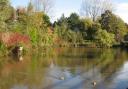
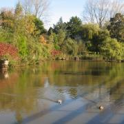
The final steep descent can be eased by following a diagonal track to the left. It cuts back to cross a footbridge. Cross it and turn left to climb the slope and up through a wood to a stile. Turn left along the lane to cross the Riding Wood Reservoir dam with views to the Ramsden Reservoir below.
On the far side continue leftwards along the lane for a few yards before taking a bridleway uphill between stone walls. After about 400 yards the lane turns sharp right. Instead take the track on the left which leads to a stile and a path rising gently across the hillside.
Soon the village of Holmbridge comes into sight. Ignore a wide grass lane on the left but 100 yards later take a stile and gate on the left helpfully marked with the yellow and black arrows. Take the path down the field and then a charming wooded clough fringed with silver birch.
Keep an eye out for a stile on the right which leads down to farm buildings. At the farm, cross straight over the track to a discreet stile in the corner, one of several awkward wall crossings on the route.
Carry on along the field edge and pass behind the houses to eventually drop to a footbridge and reach the road entering Holmbridge. Turn left downhill and at the school turn sharp left and follow the road as it curls downhill towards the church. Pass this and carry on to the Bridge Tavern to turn left up Field End Lane for a few feet before taking a flight on steps to the right.
This climbs between houses. Follow the path until it reaches fields Turn right though a stile and then climb directly up three fields. Where the final field narrows to a green lane take a stile on the left again marked with the now familiar arrows. Cross three fields to reach a green lane which is followed to a road.
Cross straight over and cross to the left of the large house via another discreet stile by the main gates. Behind the house a stile in the wall on the right gains the fields. Climb to a stile in the field corner. Cross this and go half right to reach a road, which is followed to the Digley Reservoir car park.
Ignore the car park and instead take the adjoining track above the reservoir. Just before it reaches water level take the broad track on the right. It is possible to shorten the walk by crossing the Bilberry Reservoir dam and following the track back to Holme but a more satisfying outing continues along the broad track above the reservoirs. This broad walled track continues up the valley. At a T- junction turn left towards the High Moors.
Follow the track for a mile until it passes the main landmark, the imposing bulk of Goodbeck Lodge. Four fields further along the track take a stile on the left and follow a wall down the hill. A broad green track curling off leftwards up the opposite hillside indicates the route but first it is necessary to follow the path down to a footbridge.
A delightful broad green track winds its way across the moor accompanied by the sound of grouse before it crosses a ford and climbs to join another track. This is the arrow-straight mile of Issues Road, which leads unerringly back to Holme.
Fact file
Start/finish: Holme village
Distance: 8 miles/13km
Terrain: Moorland tracks and green lanes. No major climbs but plenty of up and down and some steep descents. Many stiles.
Refreshments: Pubs in Holme and Holmbridge. Spoilt for choice in Holmfirth. Map: OS OL1 The Dark Peak