

A glorious walk, wonderful views and some famous Yorkshire landmarks – all in one fell swoop.

This walk was published in June 2018, so the details of the route may no longer be accurate, we do advise these articles should only be used as a guideline for any potential route you take and you should double check an up to date map before you set off.
It’s strange that a valley overlooked by two of Yorkshire’s most famous and highest hills, Ingleborough and Whernside, should be so little known to many walkers but Kingsdale, which thrusts a green finger into the western Dales is far more familiar to cavers than hikers. Beneath its placid surface lie some of Britain’s finest caves and miles of labyrinthine passages, some that can be explored only by cave divers with oxygen tanks and others that have yet to give up their secrets at all.

Happily, the fellsides are more accessible and this walk includes the old Turbary Road, used in past centuries to reach the peat diggings that provided fuel to heat local cottages. It also passes by the entrances to several potholes and a cave that legend says was home to the giant Yordas ,who had a taste for human flesh so take care where you tread.
DIRECTIONS
1. From the parking area walk back uphill towards Ingleton for a few paces to take a stile on the right hand side signed to Turbary Road. The track climbs steeply, initially over grass and then over shattered ground to reach a stile in a wall. Cross this and continue uphill following faint grassy trods through the rocks. Eventually the path levels out at a more grassy section and the expanse of Morecambe Bay comes into view away to the north west. Shortly afterwards the path reaches a wider track crossing the slope.
|
||||||||

2. Turn right aiming for a wall where it meets the Turbary Road itself, a hardened farm track. Again turn right along this heading up the valley with the flat-topped bulk of Ingleborough standing out on the other side of the dale. This is a high road indeed, giving easy walking along a near-level shelf traversing the lower slopes of the splendidly-name Gragareth and aiming for the huge whaleback of Whernside directly ahead.
3. The shelf coincides with a line of potholes and caves and just after passing the prominent wood around Braida Garth farmhouse on the other side of the valley you reach Rowten Pot. A small slit by the side of the track, which after rain may announce itself with the sound of rushing water is the first evidence of what lies below but just a few yards further on is the huge main entrance to Rowten, a deep unfenced pit, surrounded by trees and slippery grass. Needless to say, this is a dangerous area requiring great care and pets and children must be kept under very close control.
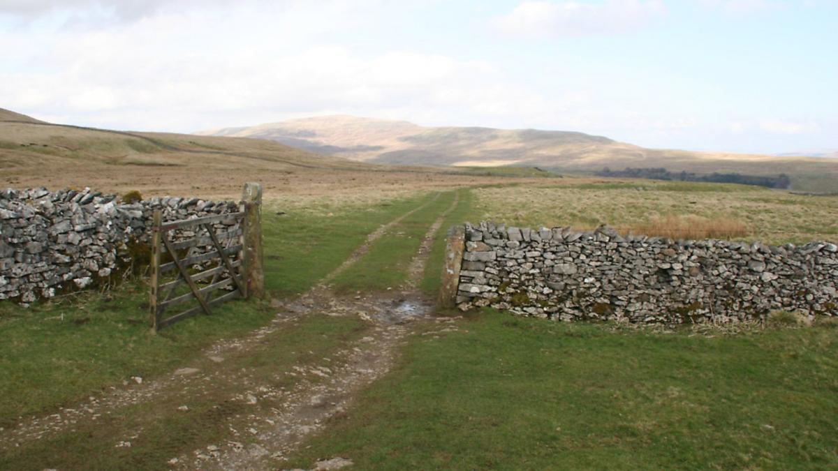
The track carries on along the hillside through a series of pastures until it comes to a gate – more a barricade really – with an incongruous No Vehicles road sign. Cross it via a ramshackle breeze block stile and continue beside the wall. This next section is frequently quite wet. Carry on until you reach a gate in the right hand wall by a corner formed by another wall coming up the hill. The gate is blocked with boulders, which create an impromptu stile. Cross this and head downhill making for Yordas Wood below.
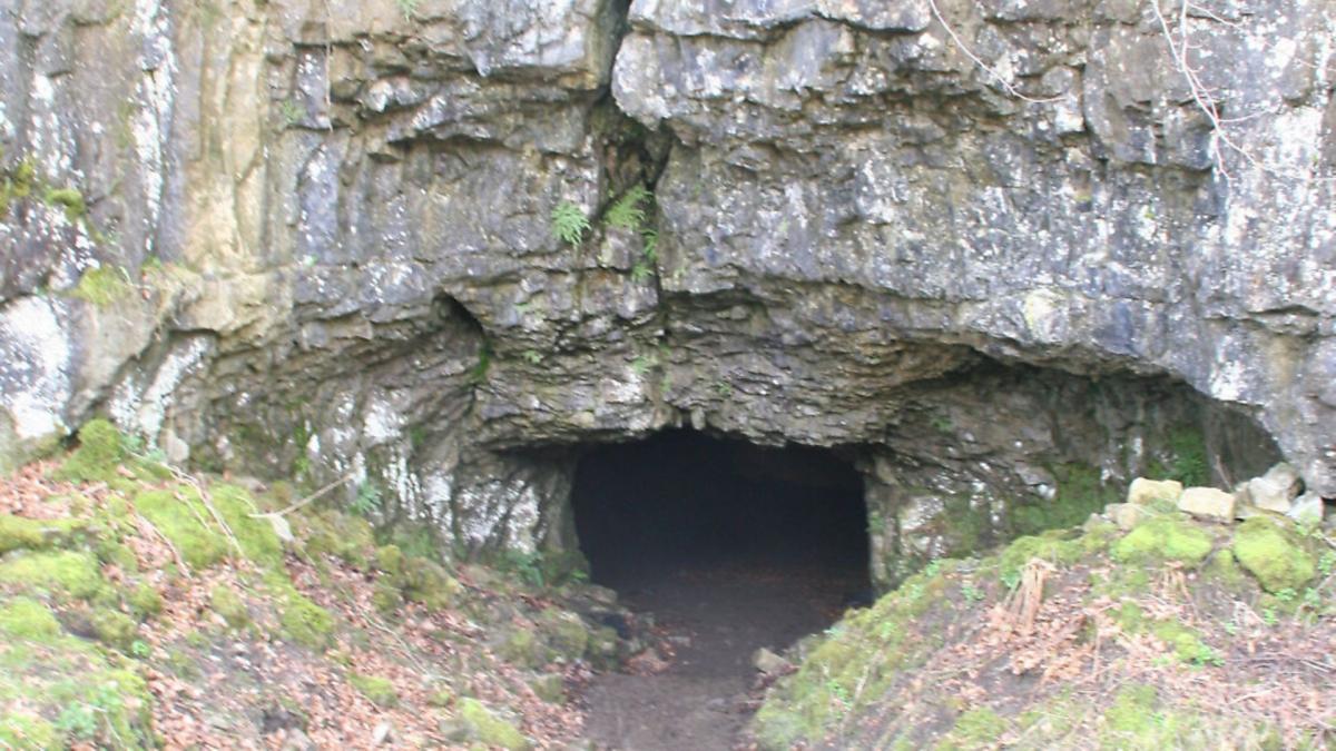
4. Tucked away in the wood is the square-cut entrance to Yordas Cave. According to legend, this was once the lair of a giant with an appetite for eating small boys. It was once a show cave but is now abandoned. Anyone who wants to peer inside will need a powerful torch.

From the cave, head downhill to the road and turn right back down the valley. Fortunately it is usually quiet and provided with wide verges for the most part.
5. After a mile or so of road walking a decision must be made. Where the Kingsdale Beck curls back to meet the road there is a stile on the left and a signpost to Scar End. This is the start of a more circuitous but often wet route which loops across the hillside to get back to the car park. It can only really be recommended after a dry spell and after wet weather the route back along the road is more enjoyable.
If taking the longer finish, cross the stile and footbridge to curl up through the buildings of Braida Garth before continuing along the fellside below the wood. When the path reaches the open hillside it can be boggy but press on to cross a stile in a wall, then drop down to the green lane. Turn right along this and follow it back to the parking area
COMPASS POINTS

Start/finish: Lay-by on Thornton-in-Lonsdale to Dent road 1.6miles after Thornton.
Distance: (Long version) 6.5miles miles/10.5km
Ascent: 920ft/280m
Terrain: Steep fell paths, some rough ground and sections which can be boggy after wet weather. Rickety stiles
Time: 3-4hours
Refreshments: Pub in Thorton-in-Lonsdale, cafés and pubs in Ingleton
Map: OS OL2 Yorkshire Dales Southern and Western
NOTE: The route passes caves and potholes where care, particularly of young children and pets is required.


