Terry Fletcher follows in historic footsteps when he takes a walk at Sheriff Hutton, near York

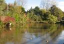
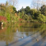
Today Sheriff Hutton is a peaceful commuter and agricultural village, tucked beneath the skirts of the sheltering Howardian Hills north east of York, the picture of rural charm. However, the stark towers of its ruined castle hint at a more dramatic past. In its day the fortress was the home of Richard Neville, better known as the mediaeval Warwick the Kingmaker, and passed through the hands of the ultimate winners and losers of the Wars of the Roses, Henry VII and Richard III. But the village’s history goes back much further than that or even the Romans who also passed this way. Flint tools dating back 8,000 years are another measure of Man’s occupation here.
This walk starts in the shadow of the castle before climbing the escarpment to enjoy extensive views over the surrounding hills and plain.
DIRECTIONS
1. From the centre of the village, walk a few yards down the York road to a signposted track on the left, marked Ebor Way and Centenary Way. It quickly leads to the castle ruins but they are on private property and cannot be visited. So instead take the path curving rightwards to admire the free-standing towers.
From the far side take the continuing path under a tunnel of branches and then go onwards towards some modern houses. Pass between these and take the road opposite, which leads quickly into Church End in the older part of the village. Here take the lower road rightwards, passing cottages until it becomes a farm track, still signed Ebor and Centenary Way.
It curls leftwards behind a line of conifers along the edge of fields to reach the Bulmer road. Go through the gap in the fence and turn right along the lane but almost immediately take a broad farm track on the left. After about 100 yards a gate set back on the right marks the start of a long fieldside path which crosses a wooden footbridge and reaches some all-weather gallops for horses from the nearby stables. Cross this and carry on along the side of the hedge, continuing in the same direction to reach a junction with a farm road.
2. The leftward branch is the Ebor Way and will form our return route. For now, follow the farm road slightly right through a gap in the hedges. The right of way here continues across the field, aiming for the gap between two plantations on the banking on the opposite side. When I was last there the field had just been ploughed and the evidence on the ground suggested people tended to walk rightwards around the edge of the field.
From the gap between the plantations follow the path uphill with trees to your left and open fields to your right. At a gate where the right of way emerges from the trees, take a narrow path heading off half right across the field aiming for the trees of Stittenham Wood. When you reach it, turn right for about 100 yards where a discrete gate appears with a path climbing up through the wood to reach the attractive collection of houses and barn conversions of High Stittenham.
3. Follow the waymarks between the buildings and at a triangular junction turn left to be quickly confronted by a muti-armed signpost with paths heading off in all directions. Stay on the tarmac lane marked to Mowthorpedale, Ganthorpe and Terrington. Carry on past the last houses and go through a gate when the lane continues as a farm track across the pasture.
At a fork take the left hand branch. From a second gate carry on down the field following its right hand edge to cross Bulmer Beck by a sturdy brick bridge and carry on up the opposite hill to Birkdale Farm (marked rather confusingly as Low Mowthorpe Farm on the OS map).
4. At the buildings, turn left to leave along the access track heading for a lone tree on the summit above. At the top, carry on along the lane passing Mowthorpe Farm on the left. Ignore this but a little further on take the next access road on the left signed to Sheriff Hutton and Primrose Hill Farmhouse.
As the track reaches the edge of the escarpment and begins to descend Sheriff Hutton, crowned by the castle’s ruined towers, appears in the valley below. Carry on downhill past the farm to reach the drainage ditch of Ings Beck.
5. Turn left along this and cross the simple metal bridge and walk away from it on the broad farm track, which is often muddy. Pick your way along it as best you can. There is much to be said for waiting for a dry spell or a hard frost to make the going easier. The track, which does eventually become firmer, leads back to the junction where we left it at the start of the walk. All that remains is to retrace your steps back to Sheriff Hutton. If you prefer a slight variation, it is possible on reaching the Bulmer road to turn right and follow the lane all the way back to the village.
Start/finish: Sheriff Hutton
Distance: 7 miles/11 km
Terrain: Field paths and woodland tracks
Time: 4 hours
Parking: Roadside
Refreshments: Pub and café in Sheriff Hutton
Maps: OS Explorer 300 Howardian Hills and Malton