
SIMONE STANBROOK-BYRNE finds a delightful springtime walk on the edge of Exmoor

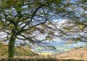
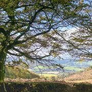
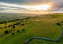
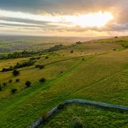
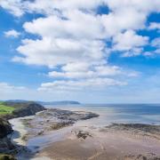
Some walks are so idyllic you just don't want them to end. This is one such. On a blue-sky spring day it is a perfect location, dripping with birdsong. The dreamscape views are heavenly; the wild flowers dazzling, so much so that we were yellow with buttercup pollen from the knees down.
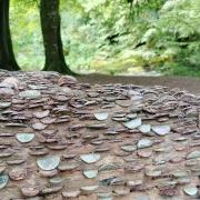
Part of the walk is adjacent to the old Mineral Line, the erstwhile 11-mile-long West Somerset Mineral Railway, which once took iron ore from mines on the Brendon Hills to Watchet. From here it was transported by sea to South Wales
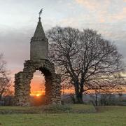
for smelting. The operation was unprofitable; the mines were closed in 1883 and the railway in 1898, but its heritage lives on - a memento of Exmoor's industrial past.
Pick a fine day and prepare for a delicious walk.
1. Taking note of the 'Directions to start' in the panel overleaf, the walk begins at the junction of the Mineral Line and Harper's Lane. Turn right out of the Mineral Line, uphill. In 50m turn right on the bridlepath towards Sticklepath. This is part of the Coleridge Way. The track passes through a wooden gate and continues grassily towards a house, whose roof and chimney are visible ahead. The path rises gently and enters trees. As it emerges from them, the views along the valley are beautiful. The old Mineral Line is in the valley to the right.
2. When the track forks (with a forestry track going straight on) keep left on the blue-marked bridlepath - a fingerpost directs. Within 100m, at another fingerpost and fork, keep right, heading down to a blue-marked gate less than 50m away. Go through and walk across the grass to a small, wooden-fenced bridge within 50m. After the bridge go right to a blue-marked gate, then continue on the well-trodden path along the side of the valley, soon entering trees. Keep ahead on the track, don't fork right down to the houses in the valley. A gate beneath a large oak leads into a field. Keep going, following the line of the fence on your right and passing a sculptural dead tree. Ignore a footpath going right and keep ahead, still on the Coleridge Way. At the end of the field a gate leads onto a narrow path, continue, soon passing through another gate and beginning to descend.
3. A bridlepath goes right to Leighland Chapel - ignore this and keep going along the Coleridge Way, enjoying valley views to the right and soon walking beside a lovely old tree-topped boundary. Continue on the clear path; the expansive views disappear as it enters Pit Wood (spellings vary).
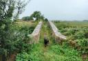
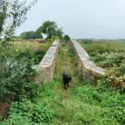
4. Within 200m of entering Pit Wood look for a low, blue-marked, two-way fingerpost and a track forking right, downhill. Those who wish to take the short option can take this right-hand fork to reach the lane at Pitt Mill, returning to the start point along the surfaced old Mineral Line
(4A) - a lovely stretch of easy walking. Those following the full route should keep left here on the higher path, passing a blue-blobbed tree trunk and walking through mainly conifer trees. Along here we spotted a goshawk. The conifers end, the views open up and the path passes through a blue-marked gate. Beyond here the route starts to swing left, with successive lovely views along the valley. Soon you are once more walking beside an old tree-topped boundary with lots of gnarled elbows. The pasture to the right gradually levels out until the field on the right is level with the path. Near the end of the field, almost ½ mile after leaving Pit Wood, bear right across the field corner, passing a splendid, stout oak, to reach a blue-marked gate out of the field.
5. Beyond the gate you find a four-way fingerpost. Take the left fork ahead, leaving the Coleridge Way and following the yellow-marked permitted path to Chidgley. The track emerges by farm buildings. Bear right, then swing left, round the buildings and out to the lane.Turn left, passing the farmhouse, then take the yellow-marked footpath immediately after it along a track, uphill. As the track swings left leave it and pass through the yellow-arrowed farm gate ahead (the nearby stile is overgrown), then walk up the small field following the left-hand boundary. You find another stile in the top corner, cross this and head uphill across the field bearing slightly right. As you crest the brow of the hill a farm track comes up from the left. Turn right along it;
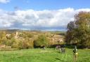
there are spectacular views
all over the place.
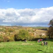
6. Go through a gate and then bear right off the track towards the corner of Kings Wood. At this corner pass through a yellow-blobbed kissing gate, glance into the woodland (it's good in bluebell season), then bear diagonally left across the field as directed by a two-way fingerpost. The path climbs away from Kings Wood and passes a small woodland on your left. The path reaches a yellow-marked gate with a magnificent view towards Dunster Beach. The distant white 'meringue' is the roof of Butlin's at Minehead. Go through the gate heading towards the meringue and, closer to hand, a gate in the far corner of the field. Go through this, keep ahead for about 30m, then turn left across a stile. Keep ahead through the next field, hedge to your right. Near the end of the field the path passes a tall, yellow-blobbed post and joins a track. Continue in the same direction, downhill on the track leaving the field. Pass a two-way fingerpost and bear left, still on the track and walking towards the view.
You reach a lane and fingerpost; Roadwater is ¼ mile away.
7. Cross the lane and enter a field, following the direction of the fingerpost. The field was cropped when we were here but walking in clear tractor marks made passage easier. Walk across the field, with woodland over to the left; two big masts are visible far to the right and the path is heading towards the sea. As the woodland on the left ends, don't go left through the gap but keep ahead through the gap in the hedge and walk down beside the left-hand boundary to reach the bottom corner in about 60m. Here you find a stile and three-way fingerpost. Cross the stile and continue down the left-hand boundary of the next field, signed Roadwater. In the bottom left corner you reach a stile and fingerpost. Cross and continue in roughly the same direction, down beside the right-hand boundary for about 20m, after which the path meanders slightly right and goes beneath trees. Follow the path as it descends to reach a stile. Cross this and turn right along the lane, back into Roadwater and the Mineral Line.u
COMPASS POINTS
Map: OS Explorer OL9 Exmoor 1:25 000
Directions to start: Roadwater is on the eastern side of Exmoor and can be accessed off the A39. Drive through the village, passing the shop on your left, and take the second left after this, Harper's Lane (you reach it quickly and it's very narrow; a sign indicates that you are heading for the old Mineral Line). In 50m take the first right, along the old Mineral Line.
Start point & parking: The old Mineral Line, along which there are several places to pull in. Please be considerate towards residents. Grid ref: ST031381. Nearby postcode: TA23 0QY.
Distance: 2.6 or 4 miles/ 4.2km or 6.5km.
Terrain: Field and woodland paths and tracks, short section on road.
Exertion: Easy-moderate: there is one long ascent, though not steep, on the second half of the longer option.
Dog friendly: Very quiet roads. Animals grazing. Some stiles may be tricky.
Refreshment & comfort stops: Very good village shop in Roadwater. Also Valiant Soldier Inn, Roadwater, TA23 0QZ (01984 640223).