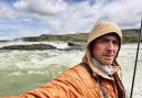
Lymington and Keyhaven Marshes make a great day out for an invigorating walk, a leisurely stroll or a spot of birdwatching says Peter Hutchings from the Wildlife Trust

Covering 740 hectares (about 1,820 acres) the reserve is made up of mudflats, saltmarshes, shingle banks, coastal grazing marshes and saline lagoons. They support important populations of birds as well as a number of rare and specialist plants and invertebrates. Hampshire County Council looks after the sea wall and inland marshes, while the Trust leases the coastal marsh and mudflats.
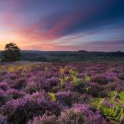
The Wildlife Trust’s nature reserves guide is a good place to look to get your bearings of the marshes and to plan your route. Stretching between Lymington and Keyhaven, the distance along the sea wall is about five miles and takes about 1 1/2 hours to walk; although you certainly won’t want to rush, as you admire the stunning vistas across the Solent to Henry V111’s Hurst Castle and the Isle of Wight.
There are also several attractive circular walks along the footpaths that cross the area. The compacted gravel paths along the sea wall are mainly flat, and you will find occasional kissing gates and benches at which to stop and appreciate the views.
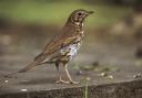
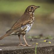
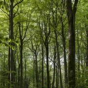
When you visit the reserve, particularly for the first time, you’ll be amazed at the scale of saltmarsh and mudflats, and the large numbers of breeding, feeding and roosting birds that the area supports.
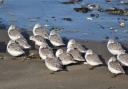
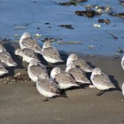
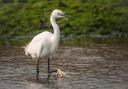
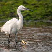
On my first visit, on a Wildlife Trust guided walk, we saw over 65 species of birds in just two hours. Several thousand Brent geese visit the marshes over winter, and you’ll also see dunlin, black-tailed godwit, curlew, lapwing and wigeon.
A feature of the nature reserve is a series of shallow, brackish lagoons that form a specialised habitat with its own distinctive plants and animals. In winter, the flooded lagoons are home to numerous geese, swans and ducks, such as mallard, shoveler and teal.
As you walk, you’ll notice the large creeks between the saltmarsh which are nursery areas for fish, which is why, at low tide it becomes a haven for the birds feeding on the exposed mud – and a great viewing and photo opportunity.
As well as the abundant wildlife, this area was used for salt production, which was important here from the Middle Ages until the mid-1860s, and now the reserve contains the best preserved examples of salt workings in southern England.
Lymington and Keyhaven Marshes offers a great day out with a chance to experience wildlife, scenery and history all at the same time.
Be sure to take binoculars and a camera to make the most of your visit. It’s worthwhile wrapping up warm for your winter trip as there’s often a ‘sea breeze’; and whichever route you choose around the reserve, Keyhaven and Lymington will not disappoint.
--------------------------------------------------------------------------
Getting there
Grid Ref: SZ 304 908
Train station: Lymington (1 mile). Turn left along Mill Lane. Go through the alleyway on the right, then straight along the cobbled street, past the quay and join Bath Road. Turn right round the bend when the road turns into Kings Saltern Road. After 1⁄3 mile turn into Lymington Yacht Haven and walk to the far end of the car park to the gate into the reserve.
Bus stop: Lymington town centre (1 mile). Southampton to Lymington route (Bluestar). Follow the High Street down to the quay and then follow the directions before.
Sat nav: SO41 3SE to Lymington Lifeboat Station car park.
Directions: From M27 junction 1, follow signs for A337 to Lyndhurst, continue on A337 towards Lymington. In Lymington follow signs for town centre (B3054). Go under the railway bridge. At the mini roundabout turn left, then go straight on at the next two roundabouts. At the sharp right at the bottom of the town centre go straight on to the narrow road – Captain’s Row – at the crossroads turn left, then immediately right onto Bath Road. Continue for 1⁄3 mile; the car park is on the left.
Parking: Available at Lifeboat station car park (pay and display). Turn right onto Kings Saltern Road, and then follow the directions before.
--------------------------------------------------------------------------
Getting around
Size: 740 hectares
Paths: Flat, compacted, mostly level gravel paths along the sea wall and in other parts of the reserve. It is not possible to access the coastal marshes and mudflats.
Gates: Kissing gates throughout the reserve.
Seating: There are several benches around the reserve.