Local author and historian Stephen Bailey has dedicated years to discovering the stories of Derbyshire’s roads; charting their development through the centuries in his book The Old Roads of Derbyshire.

From prehistoric ridgeways and Roman roads to medieval pilgrimage routes and turnpikes, Stephen Bailey has followed the same routes as those taken by travellers in the past. Sometimes walking alone, other times joined by his wife and daughter, or one of his walking friends, it was an equal love of walking and history that inspired Stephen’s interest in the history of old roads.
His first book on the subject, The Derbyshire Portway: Pilgrimage to the Past followed an ancient track that was still in use in the 18th century.
In his latest book The Old Roads of Derbyshire, written after five years of research, Stephen not only looks at Derbyshire’s old roads – including a detailed walking guide of the Portway – but offers a general study of travel and travellers in the county since prehistoric times.
‘I’ve always done a lot of walking in Derbyshire,’ says Stephen.

‘I started to wonder about the history of the roads and tracks I was following and my questions built up: How did people travel in the past? Where did they spend the night? How did they navigate?’
Stephen has a degree in English and History and for much of his working life he taught English abroad. However, he has always retained his interest in history.
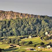
Derbyshire’s topography – in particular the north of the county – made it difficult to navigate with its rough terrain, steep sided valleys and fast flowing rivers that frequently flooded in winter.
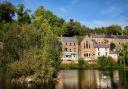
‘Crossing rivers has always been difficult for travellers. Until the Normans arrived there were very few bridges across the Derwent and people were reliant on fords – such as at Cromford.’ he says.

Due to the terrain and steep gullies, many of the routes were very narrow tracks which crossed rivers on yard-wide bridges. Then in the 18th century turnpikes came into operation, leading to a significant improvement in journey times, as Stephen explains.
‘Turnpikes were quite radical. You would pay to use the road and get a much smoother surface. Previously a journey from Derby to London might have taken five days in average conditions but on turnpike roads you could get from Derby to London in just one long day. Then the railways killed off road business.’
Roads are perhaps less interesting for some than the travellers who use them and in his book Stephen introduces those people who used the roads – badgers and swailers (who travelled from farm to farm buying goods such as eggs and milk which they would then take to market), jaggers (who led the packhorse trains), pilgrims, drovers, pedlars, tramps, and passengers in stagecoaches and wagons.
‘There were thousands and thousands of people on the move throughout history,’ explains Stephen.

‘People travelled more in the past than we give them credit for. Once we examine diaries and other records from the 17th and 18th centuries we find out that people travelled quite significant distances for various reasons. People weren’t as immobile as we think. Finding out their history is fascinating.’
How they travelled was also of interest to Stephen.
‘Before inns and hostelries sprang up, there must have been places where people spent the night when travelling long distances,’ he says.
‘I believe these were temporary settlements on hill tops about every ten miles, where people could graze horses and put up tents. They weren’t hotels but different defensive sites along all the major routes.’

Stephen’s favourite road is an old medieval route through Bow Wood, resplendent with bluebells in the spring.
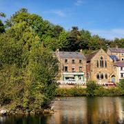
‘Since last winter’s floods, the road between Cromford and Lea Bridge has been closed because the River Derwent washed away part of the road,’ he says.
‘This was originally the Cromford to Langley Mill turnpike road built in 1766. However, there’s an alternative route you can take on foot through Bow Wood. It was once a medieval road but has now been downgraded to a path and brings you out near Cromford Station. This old road was superseded by the modern turnpike but now it’s closed we’re going back to the old route.’
Researching old roads can be challenging, as Stephen explains: ‘Roads are difficult to pin down and date. Discovering the age of a road isn’t always an easy task as routes often get downgraded. An old route might sink from being a carriage road to a track and then to a footpath. Or you can imagine you’re on a really old road when it’s not, whilst a lot of the old roads are buried under modern roads. It’s not a subject many historians have really looked at and sources are very thin on the ground.’
However, there are signs to look for that can give some clues to help date the age of a road and Stephen found himself visiting the Derbyshire Record Office, in Matlock.
Maps are one important source, says Stephen.
‘Maps can take you back into the past and the antiquity of a route can be checked. In general things haven’t changed much from 19th century maps – most footpaths that are shown can still be found today. If the route existed 200 to 300 years ago then the road could be much older.’ Another useful resource was finding out details of the various turnpike companies.
For Stephen, though, the most important aspect of his research was walking the routes, where he would look for clues. Some of these come in the form of milestones and the older guide stoops, which pointed the direction to the nearest market towns.
‘It can be quite exciting, especially when you find an almost lost milestone from 200 years ago that’s been sitting behind a bush.’ he says.
Hedges can also provide useful clues – if it is clearly very old and the route is hedged both sides then it may suggest a cart track. Stone gate posts may also indicate use by wheeled vehicles.
The landscape itself can also provide important clues, particularly those routes that are over 1,000 years old such as ancient ridgeways, which follow high ground.
‘The A61 from Stretton to Chesterfield is an example of a ridgeway still in use today with good views on both sides,’ he explains.
‘There is a fairly general supposition that prehistoric routes were ridgeways like this and could be several thousand years old.’
The opposite of a ridgeway is a hollow road, which in Derbyshire can often be identified by its name – Dark Lane.
‘Roads sank down into the ground as water washed down the roads,’ says Stephen. ‘Holloway is a perfect example – it’s a village with a hollow way running in the direction of Ashover.’
Despite the publication of his book, Stephen continues to walk the old roads of Derbyshire, always hoping to uncover more ancient tracks that help us better understand the history of travel.
The Old Roads of Derbyshire can be ordered by sending a cheque to S. Bailey for £9.75 (post free) to S. Bailey, Old Roads, 7 Hindersitch Lane, Whatstandwell, Matlock, DE4 5EF.