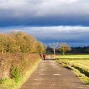
The Chester Millennium Greenway runs from Mickle Trafford through the northern half of Chester and continues through Blacon to the River Dee at Queensferry.
After a short stretch on the towpath of the Shropshire Union Canal, this route uses the portion across the Dee floodplain west of Chester, returning via a combined walking and cycling path along the northern embankment of the River Dee to give a flat, well-surfaced 13-mile round trip that is suitable for road bikes throughout.
Apart from a couple of hundred metres in Chester, the route is entirely traffic-free.
In mid-November the Greenway was temporarily closed between Blacon and Sealand for drainage works. These should be complete by the time you read this, but if by any chance the closures are still in place, follow the signposted diversion via Saughall village, which adds an extra mile to the stated distances.
THE ROUTE
1. From the wharf between the two arms of the canal, head north over the ‘roving bridge’ and a small swing bridge onto the canal towpath beyond. Pass under bridges 126E, 127 and 128.
2. Before the canal crosses the A5480 aqueduct, turn right (signposted Deva Link Road and Chester Greenway). Turn right at a T-junction, then left on reaching the Greenway. Cross the road and canal and continue to Old Station at Blacon. Continue along the former railway, passing under the road between Sealand and Saughall.
3. After 1½ miles, cross a bridge over the A494 trunk road and continue alongside the Deeside Industrial Estate. Continue towards Connah’s Quay.
4. At the next major fork, take the left-hand path, signposted to Hawarden Bridge and Connah’s Quay. Pass the Hawarden Bridge signal box and railway station on your right.
5. Rather than crossing the bridge, turn left down to the River Dee. Turn left onto the track along the top of the embankment, passing the flamboyant former offices of the John Summers & Sons steelworks, built in 1907.
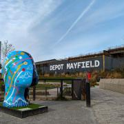
6. After a little under a mile, at the blue-painted Jubilee Bridge, bear left to the road by the Queensferry Hotel (currently closed). Turn right towards the bridge, then at the traffic lights turn left to rejoin the Deeside path, which shortly passes under the A494 road.
7. The next landmark, after 3¼ miles, is the slender footbridge at Higher Ferry, where the cycleway again briefly leaves the river, swinging left then right to return to the riverside. The Dee bends left as you approach Chester, passing within sight of the Deva Stadium across the fields on your left. When it swings right again, follow the path past a skate park and out to the main road.
Cross into the road opposite and follow it for 200 metres past the Chester Deaf Centre back to the canal wharf.

COMPASS POINTS
Area of walk: Chester and Queensferry
Start point: Canal Basin, Chester CH1 4EZ
Distance: Chester Greenway (one way): 5¾ miles; full circuit 13½ miles
Time to allow: 2 hours cycling, 4–6 hours walking
Map: OS Explorer 266 Wirral & Chester/Caer
Refreshments: Telford’s Warehouse, Chester, telfordsware housechester.com; 01244 390 090
Practicalities: Level throughout and suitable for road bikes. See note above about the possible temporary closure. Rail users can join at Hawarden Bridge station on the Bidston– Wrexham line, midway around the route.


