
At just 20 miles long, the river Kent is short by Cumbrian standards, beginning in the Lake District National Park and reaching Morecambe Bay at Sandside. What it lacks in length, it makes up for in cultural interest, passing close to historic houses and through the ancient town of Kendal, as well as taking in weirs and waterfalls and hosting precious wildlife.
The river is designated a national Site of Special Scientific Interest by English Nature and a Special Area of Conservation at international level for supporting the habitat of the white clawed and bullhead crayfish and white pearl mussel. In fact, South Cumbria Rivers Trust says the Kent is “one of the best, if not the best, river system in the world” for the native white clawed crayfish.
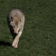
The river also contains salmon and, in the lower reaches, sea trout. Higher up, otters and kingfishers have been spotted.

The Kent starts life at Hall Cove above Kentmere Reservoir, which is hugged by fells – Ill Bell, Thornthwaite Crag, Harter Fell, Kentmere Pike and more – that together form the ‘Kentmere Horseshoe’.
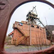
The reservoir was built in 1846 to provide a water supply to the mills – gunpowder, flour, wool and paper – down the valley. The last of the mills, James Cropper, in Burneside, continues to own the reservoir.
The LIFE R4Ever Kent Project started at the end of 2021, with the aim of restoring and reviving the River Kent Special Area of Conservation (SAC) to allow species and habitats to recover and making the designated features more resilient to environmental pressures.
The five-year, multi-million project has four partners – Natural England, South Cumbria Rivers Trust, Freshwater Biological Association and the Environment Agency – and is due to end in 2026.

Some of the work to protect, rehabilitate and improve the biodiversity of rivers and streams within the Kent catchment include in-channel improvements, creating fish refuges, green engineering, tree planting (2,350 across the catchment in 2023), creating leaky dams near Staveley, installing fencing to keep livestock safe and out of rivers and becks and removing invasive species.
Led by South Cumbria Rivers Trust, the project is working with local communities and schools volunteers have already given hundreds of hours to help deliver its initiatives.
Nevertheless the river and its catchment are not without their problems. Staveley with Ings Parish Council and the Clean River Kent Campaign (CRKC), which was established in autumn 2021, have been campaigning to end sewage discharges into the river and village streets. CRKC’s aim is to keep the river Kent clean for water-based recreation and to protect wildlife and ecology.
United Utilities has committed to planned improvements at Staveley Wastewater Treatment Works being completed by 2030, plans that villagers are watching closely.

Councillor Arthur Capstick, Staveley with Ings Parish Council, says: “The issue of sewage on the streets has been going on for years in this village – so far there has been insufficient action to deal with it. Residents have organised several projects which have enabled us to better understand the underlying problems. We now look forward to a new approach to joint working which recognises the contributions of the community. We believe that this could provide a template of good practice for other similar communities.”
After Staveley the Kent continues on through Burneside and into Kendal where the river contributes in no small part to the complex flooding issues that affect the town.
Although not without its critics, the Environment Agency is delivering a flood risk management scheme to better protect homes and businesses. Kendal is the first area to be delivered, followed by Burneside, Staveley and Ings, and upstream measures including flood storage.

In addition, natural flood management measures are being integrated into the plans which aim to slow the flow of water and provide wider environmental benefits across the catchment.
Challenges aside, developments along the riverside will encourage people to walk to many of the Kendal’s attractions, to sit in its parks and enjoy the river that is at the heart of the town.
Leaving Kendal, the Kent meanders through Helsington Laithes and continues its southerly course past Sizergh, under the A590 and on through Levens Deer Park where a delightful circular walk follows its banks. It is a short run then to the estuary, east of Foulshaw Moss Nature Reserve, and into Morecambe Bay.
![Cookham Barns 1925, Gilbert Spencer, Abbot Hall [credit Liss Llewellyn]](/resources/images/128x89/1x/17938067.jpg)
![Cookham Barns 1925, Gilbert Spencer, Abbot Hall [credit Liss Llewellyn]](/resources/images/180x180/1x/17938067.jpg)