Helen Moat's Monyash to Arbor Low ramble is a route full of prehistoric delights
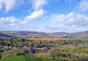
Of all the high-level White Peak prehistoric monuments, Arbor Low has the most breath-taking outlook.
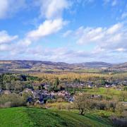
This is a walk that takes in the pretty Peak village of Monyash, country tracks, a large-scale Neolithic and Bronze Age site – and two dales, one well-known – Lathkill – and one less frequented by ramblers – Cales Dale.
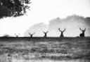
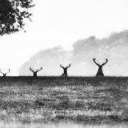
On my snowy walk, I had the good fortune to catch sight of a young fox leaping over a drystone wall – eye-balling me for a few seconds before bounding up the field. It’s encounters like these that makes walking in the Peak countryside such a pleasure.

1. From Monyash car park on Chapel Street (there’s also plenty of on-street parking throughout the village), head down to the junction of Tagg Lane and Church Street.
Turn left into Church Street and take the first public footpath that cuts alongside the graveyard of St Leonard’s onto Church Lane.
At its end turn left onto Rakes Road, keeping straight on where the road bends to climb up Derby Lane, used only by farm vehicles.
After a while the surfaced road becomes a stony farm lane and eventually it’s nothing more than a rutted track through a field. Keeping straight on, you’ll come to a wooden field gate leading to Long Rake.
2. Turn right onto the road. It’s a busy thoroughfare for lorries, but there’s no off-road path to Arbor Low from this point. Walk on the right and step onto the verge when traffic approaches.
At the signed Upper Oldhams Farm, head up the drive to the farm. They request a donation for the upkeep of the prehistoric site (the honesty box on your right).
Go through the farmyard and turn left towards the monument, following the field boundary. It’s an impressive sight: the expansive raised bank and ditch, the Bronze Age burial mound at one end and the multiple stones that make up the circle inside the henge.
Sadly, the stones lie flat on the ground, probably the work of medieval Christians, hostile to the pagan site.
READ MORE: Arbor Low stone circle: the Stonehenge of the Peak District
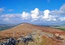
The henge was an important ceremonial meeting-place for Neolithic and Bronze Age peoples across Millenia. Excavations from the Bronze Age burial site revealed human bones, pottery, flints and an antler. It’s fun to circumnavigate the raised bank with breath-taking views across the Peak District.
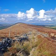
Head across to Gib Hill and climb the burial tomb. From here you can drop straight down through the field to the farm again.
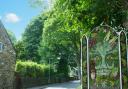
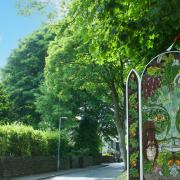
3. Retrace your steps along Long Rake, this time looking for a wooden gate beside a clump of trees. Notice the cube as you go into the field.
Carved into the stone are the words: Bright Under Green Limestone Edges. With Queen Ann Lace and Cranesbill in her Hedges. It’s part of The Sites of Meaning New Millenium project with stone engravings all along the Middleton and Smerill parish boundary.
Cut diagonally across the field to the farm track leading to Cales Farm. As the lane curves left then right to round the top of Cales Dale, look out for a gate on your right leading into the dale.
4. Drop down carefully to the dale and follow the concessionary path downhill. The ground is uneven and many fallen trees make the way a bit of an obstacle course in this forgotten place.
Towards the bottom, you’ll meet the Limestone Way. Cross it to continue descending towards Lathkill Dale, a tinkling brook on your right, the sheer wall of Lathkill ahead of you.

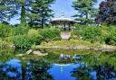
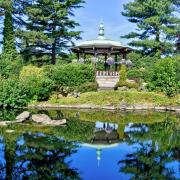
5. Cross the wooden footbridge and turn left to follow Lathkill Dale back towards Monyash. It’s a wild and majestic place, particularly in winter when the river courses through the dale.
You’ll come to a cave, where the water rushes out from underground streams. Walking this section in summer is a very different experience when this part of the river dries up. Continue to the dale head, where the path meets Church Street.
6. Turn left and tramp the verge-side paths into the village. There’s both a pub and café to replenish energy lost on this 7-mile circular ramble over the White Peak Uplands to one of England’s most impressive pre-historic sites – with a return through the spectacular upper section of Lathkill.
COMPASS POINTS
Distance: 7.2 miles
Map: OS Explorer Leisure OL24, The White Peak Area
Grid reference: SK14976663
Difficulty: Some tricky terrain underfoot in Cales and Lathkill dales, otherwise easy walking
Refreshments: Bring snacks and drinks as there are no pubs or cafes once you leave Monyash. The Bulls Head and The Old Smithy Tearooms are both good options in the village.