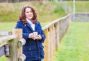
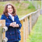
On a very up-and-down walk along the Torbay coast, Simone Stanbrook-Byrne encounters some rare birds.
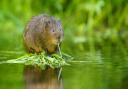
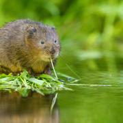
In 2008 something very good happened along the Torbay coastline. In order to help secure the future of a rare bird, the neat little cirl bunting, the RSPB bought an area of land at Labrador Bay. The site is now a nature reserve, farmed with wildlife in mind, and the cirl bunting, whose population is almost entirely restricted to south Devon, can be found here all year round – we saw a host of them along the hedgerows.

The farmland is non-intensively grazed by, at different times of year, cattle, sheep and Dartmoor ponies. After harvest, arable fields are left stubbly, providing good feeding habitat for the birds. It is a fine example of farming and conservation working well together.
Remarkably, the steep and inaccessible cliffs above Labrador Bay were, until the mid-20th century, the site of a small hamlet, with pub, tea gardens and a hotel, which was destroyed by fire in 1938.
Take binoculars, be prepared from some strenuously steep sections and enjoy the views.
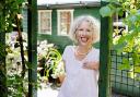
 Simone Stanbrook-Bryne")
The walk
1. Near the vehicular entrance to the car park a fingerpost points across the grass, past some green benches, towards a yellow-arrowed gate. Beyond this the path swings right between hedges. In about 100m, a footpath goes to left and right; ignore this and continue ahead, downhill, to the next fingerpost. From here go right on the acorn-waymarked coast path toward Maidencombe, entering a field and following the left-hand boundary down a steep, knees-in-gear descent. The sea is to your left and there are good views along the coast. We met a couple here who had just spotted a dolphin not far offshore, so keep your eyes peeled.
 Simone Stanbrook-Bryne")
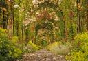
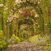
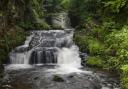
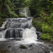
2. The coast path leaves the field, crossing some boardwalk and entering trees. It weaves about and starts to climb puffily, wooden-edged steps assisting the ascent. Ignore a footpath heading inland in about 300m and continue along the coast, now heading down a long flight of steps.
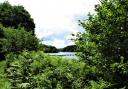
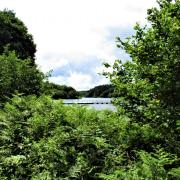
The path enters a field, still dropping, then climbs to a gate. Pause here – behind is a glorious view towards Shaldon, with Teignmouth beyond and, in the far distance, the coastline of east Devon.
Beyond the gate the path descends once more, hugging the edge of the field, to reach a kissing gate which leads into trees near an information board about the Labrador Bay nature reserve.
 Simone Stanbrook-Bryne")
3. The coast path soon reaches another board, this one welcoming you to Maidencombe. Here another footpath heads inland. Ignore this one too and continue along the coast, ducking in and out of shade, where dappled sunlight falls across the path.
 Simone Stanbrook-Bryne")
4. Half-a-mile from the last inland path, the coast path emerges into the view at another Maidencombe board. Here a footpath goes right – the fingerposts were broken but the authority has been asked to repair them – fingers crossed. (This is at grid ref SX928691 for those using GPS.)
Leave the coast and turn right here, heading inland along a rising path between hedges. You pass through a gate with a mauve-coloured arrow, keep going and the path soon widens out at a point where gates give good views along the coast in both directions.
Continue on the track, ignoring a footpath going left in 100m and in a further 40m you reach a footpath and stile on the right.
5. Cross this and enter a field, then follow the left-hand hedge, with sea views to your right. A well-placed bench sits outside the gardens of some equally well-placed houses. From the bench continue across the field, following the line of the left-hand boundary and dropping steeply down to the opposite hedge. When you reach it, pass through one of several gaps and continue across the next field to the opposite hedge.
When you reach this hedge turn right along it and follow the hedge-line, keeping it to your left. The path climbs and as it starts to drop there is a seaward view; depending on the time of day the fall of light shows lovely, shadowy folds in the surrounding fields.
The path descends, passing a gate on the left that leads to an obviously private flight of steps with its equally non-public chrome banister. But our way lies ahead, through the nearby field gateway, after which turn immediately left, following the left-hand hedge through which the glint of sun-kissed chrome may be spotted.
Follow the hedge for just over 100m to a bench, beyond which you find a stile on the left with a red arrow. Cross the stile and follow the narrow path beyond as it winds through scrub. The path emerges from the cover and bends right, then ambles down to a two-way fingerpost beside a slightly wobbly stile.
6. Cross the stile and follow the onward finger coastwards, the trees of Commons Plantation are over to the left.
The path drops to the bottom of the field and just before it leaves the field, near another Maidencombe board, take the footpath going left across a stile, then pass through a gate into the next field. Head across the field, sea to your right.
As the ground starts to rise you’ll see a clear path bearing left then uphill to fencing and a gateway on the skyline – if you thought the climbing was over, sorry! Plod up this path to the gate – astonishingly, there is no bench when you get there. Pass through and continue straight ahead along the left-hand hedge towards a fingerpost.
At the post turn left, go through a wooden kissing gate, then follow the right-hand hedge through the next field – you’ll probably hear traffic on the invisible road ahead. In about 20m pass through a gap in the right-hand hedge and continue in the next field, now with the hedge to your left and still walking towards the road. It was along here that we found the cirl buntings.
When you reach the hedge alongside the road turn right, walking through the field with huge views to the right. At the end of the field a kissing gate leads into the next. Keep straight ahead to another gate within 100m – this one leads back into the car park.
 Simone Stanbrook-Bryne")
5 things to do while you’re in the area
1: The Crew coffee trailer was an absolute treat to find in the car park when we arrived – it was their first day of trading on this site. A good shot of caffeine prepared us for the inclines ahead and was something to look forward to again at the end of the walk – allow time to partake.
2: The Church House Inn at Stokeinteignhead was built, reputedly, some 800 years ago to house stone masons working on the church. The listed building detail implies it might be a few centuries younger, but that’s still extremely old and probably suggests much earlier roots. It has a good menu and is worthy of a visit.
3: Kents Cavern in Torquay is a place where we can visit the home of our prehistoric troglodyte ancestors as well as exploring some fascinating geology.
4: Babbacombe Model Village has been delighting children and adults since 1963 – I still have a black-and-white photo of me and my family there, clutching my favourite teddy bear, who is also still with me!
5: Ness Cove in Shaldon is accessed through an old smugglers’ tunnel, which adds to the charm of this secluded beach.
 OS Maps")
Compass Points:
Start point & parking: The RSPB’s Labrador Bay car park (clearly marked on map) on Teignmouth Road, about 2 miles south of Shaldon Bridge. Nearby postcode: TQ1 4TP; grid ref: SX930704
Map: OS Explorer 31 Torquay & Dawlish, 1:25 000
Distance: 3¼ miles
Terrain: Steeply undulating coast path, tracks and field paths
Exertion: Strenuous
Dog data: Animals grazing, cliff edges, some stiles. The Church House Inn welcomes dogs in the bar/garden
Refreshments: The excellent Crew Coffee Trailer is sited in the car park – very good coffee and home-made cakes, with nearby benches. Just over a mile away, in Stokeinteignhead, is the 800-year-old Church House Inn, TQ12 4QA (01626 872475)
Look out for
Plentiful bird life
Lovely coastal views
Possible dolphins
Crew Coffee!
Walking 1000 miles: During 2023 Simone is walking 1000 miles to raise funds for the Devon Wildlife Trust. If you’d like to help support this charity and the Big Walk, please visit: justgiving.com/page/simone-stanbrook-byrne-1678009505575