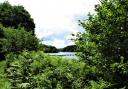
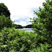
Some walks are just so lovely you don’t want them to end, and this was one of those. Stitched together by enticing footpaths, the tiny settlements of Black Dog and Washford Pyne sit well off the beaten track. Lying on the Two Moors Way, they inhabit an elevated area between Dartmoor and Exmoor, so the views are glorious. Basking in summer sunshine, with blowsy hedgerows, small streams and lush woodland, it’s hard to imagine a more idyllic route for a walk – I hope I’m not tempting fate for this summer!
Sadly, the Black Dog Inn closed after Christmas, so take a summer picnic and enjoy lunch alfresco – we gratefully made use of Peter Craske’s memorial bench in Washford Pyne churchyard, surrounded by bees and birdsong. Does it get any better?

1. From the crossroads in the centre of Black Dog, follow the road towards Thelbridge and Witheridge, passing the slumbering inn on your right; you’re heading towards the area known as Lower Black Dog. In 350m, just past The Old Post Office on the right, you’ll reach a telegraph pole on the left of the road bearing a prominent footpath sign pointing right.

2. Turn right here along a narrow path between garden fences; this soon leads through a footpath gate into a field. Bear diagonally right across the corner, to reach a metal gate in 70m. Beyond this, a tree-covered path brings you to a broad crossing track. Turn left along this, ignoring a footpath going right almost immediately.
This track leads to Pyne Farm and is part of the Two Moors Way (TMW) – the logo is an ‘M’ above a ‘W’. Soon the track descends and bends, crossing a damp area, near a pond on the right, then climbing to reach the buildings of Pyne Farm. Keep ahead on the track, with the buildings on your left. The way soon starts to gently climb again beneath trees, and reaches a gate into a field 120m from the farm.
3. Follow the right-hand hedge for a short distance to reach a four-way fingerpost. From here, keep ahead on the footpath across the field, still on the TMW, aiming towards the distant buildings of Wonham Farm. The path descends to a gate at the bottom, beyond which the field drops more steeply. Veer right to the footbridge spanning the stream, then follow the right-hand hedge up the field.
You reach another TMW-marked gate; beyond it walk through the field heading towards an obvious gate at the right-hand end of the barns at Wonham Farm. When you reach it don’t go through, but instead go round the side of it to reach another TMW-marked, footpath-field-gate combo in the corner.
4. Beyond this, walk alongside a barn on your left for a few metres, then cross the track, bearing slightly left to a gate with a TMW post near it, which also has a blue bridleway arrow. Once in the field, walk downhill, alongside the right-hand hedge. This hedge-line bends right and soon reaches another gate with various arrows. Go through the gate and continue alongside the right-hand hedge, still following the TMW, which is now a bridleway. It soon passes through another gate, keep going alongside the right-hand boundary; the trees of Washford Wood are a few fields ahead, with lovely rolling farmland views to the left.
When the right-hand fence ends, keep ahead down the steeply sloping field bearing slightly right to reach a footbridge in the corner.

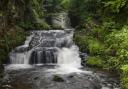
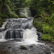
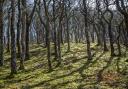
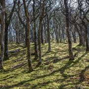
5. This carries you over the stream and into the trees of Washford Wood. Follow the path ahead (ignoring one to the left), which climbs and bends and ambles delightfully through this tranquil place of dappled light. In spring the bluebells are a haze. The path passes occasional TMW markers or blue bridleway blobs, to reassure. Relish the sylvan loveliness of this woodland for a third-of-a-mile. Near the end of the wood you pass the mouldering remains of a long-gone vehicle – bashes to bashes, rust to rust – and after this a long-abandoned caravan amongst the trees. There’s no doubt a story here.
Soon after this the TMW emerges from the trees and follows a hedged track for 130m, out to the lane.

6. To return to Black Dog the walk goes right here, but before doing that turn left and follow the lane for just over 300m into lovely Washford Pyne, named for the Pyne family who owned the manor in the 14th century.
Just beyond the beautiful Old Rectory, the enchanting little Church of St Peter welcomes visitors: drinking water is available to top up our bottles and a sunny bench offers a breather. Coincidentally, St Peter’s has the same number of bells as there are houses in this village: six. The list of incumbents goes back to 1280 – although the earlier church was destroyed by fire in 1880, and everything, apart from the base of the 15th century tower, was lost. The rebuild, a faithful replica of the original, was completed between 1883 and 1887 and cost £1,246 – the church is now Grade ll*-listed and is described by Historic England as an ‘unusually complete and well-designed and quite original late C19 church of national importance’. The place is full of gems: a superb studded plank door, the ornate lectern, decorative organ pipes and tall brass oil lamps, to name but a handful. And there’s a tiny stained-glass trefoil window in the porch. The whole place is just lovely!
7. Leave through the main gates, dedicated to Phyllis May Lee, and turn right along the lane to retrace your steps to the track from which you emerged earlier. Stay on the lane beyond it, now no longer the TMW, keeping an awareness of the distance you’ve walked from this point. In a third-of-a-mile the road bends gently right – keep going. In another 250m, 70m after a driveway on the right (I think the sign on the gate says Harbour-something!), the lane bends more firmly right, with a gate ahead of you, on the left of the lane.

8. Unhelpfully, there’s no fingerpost here (I’ve asked the council if they could remedy this), but a footpath starts at this gate. Leave the lane and walk across the field, bearing slightly right towards the distant roof of Lower Gatehouse, 500m away – as you cross the field glance back to make sure that you can see the lane you’ve just walked along stretching away beyond the gate, and you’ll know you’re on the correct line! We waded through a sea of flowering grasses and wildflowers, though this may well have been mown by the time you’re here.
In 230m the path passes a yellow-arrowed telegraph pole with a footpath gate just beyond. After this head downhill to the footbridge. Cross, and continue steeply uphill along the left-hand hedge – it’s easier to zig-zag up.
Lower Gatehouse comes into view and near the end of the field you find an arrowed post by the hedge. Turn right here, as directed, walking across the field for about 50m (the house is over to the left). You reach the boundary surrounding the environs of Lower Gatehouse and a yellow-arrowed gate leads onto a narrow path, fenced from the field. Follow this path (I’ve asked the council to clear some of the overgrowth) and at the end pass through a gate and turn left. Walk through the bottom of a damp meadow, lush with wildflowers, cross a small plank bridge and go through another arrowed gate. An obvious path leads out to a surfaced driveway; turn right along it, walking away from Lower Gatehouse.
9. The drive leads to the road within 200m. Turn left for about 50m, and as you reach the Black Dog sign look for the footpath going right off the road. Take this, following the right-hand hedge through the field. At the end turn right through a metal gate (the bull warning on the other side came as a surprise as we hadn’t encountered one – and you wouldn’t have seen me for dust if there had been one!), then turn immediately left and cross a plank bridge. A gate leads to a path under trees, which soon reaches yet another gate.
Walk along the left-hand boundary through the next field and at the end you reach a broad crossing track – this is the track to Pyne Farm. Turn left along the track and follow it to the road in Lower Black Dog. Turn left, and before long you’re back at the start.

4 things to do while you’re in the area
1 The Mount Pleasant Inn is a lovely old pub at Nomansland, about four miles from Black Dog.
2 Thornes Farm Shop near Cheriton Fitzpaine, is just over seven miles away and is my favourite place for picking strawberries (and other soft fruit). It also has an excellent café.
3 Withleigh Nursery, home to masses of unusual plants and Café Banana, is just over eight miles away, towards Tiverton
4 Waterbridge Golf Course is just over seven miles away, near Down St Mary, for those who fancy slotting in a quick round.
Look out for:
Occasional wind turbines
Rolling farmland views, some to Dartmoor
Bijou historic church
Wild flowers
Compass points:
Start point: Black Dog, Postcode EX17 4QS; grid ref: SS805097
Parking: On-road - there is usually somewhere to park near the shelter by the crossroads
Map: OS Explorer 114, Exeter & the Exe Valley, 1:25 000
Distance: 4 miles
Terrain: Farmland and woodland paths and tracks. Some very quiet lanes. Sloshy after wet weather so be well-booted
Exertion: Easy-moderate with one short and strenuous uphill section
Dog data: Animals grazing; some quiet roads
Refreshments: Nothing en route, take a summer picnic – and please leave no litter
Walking 1000 miles
During 2023 Simone is walking 1000 miles to raise funds for the Devon Wildlife Trust. If you’d like to help support this charity and the Big Walk, please visit: