This circular walk around Bradford Peverell and Stratton takes in the remnants of a Roman aqueduct that once supplied Durnovaria, now known as the county town of Dorchester, and includes the lovely country pub The Saxon Arms. So let's join Dorset magazine's walks writer Edward Griffiths for this delightful summer ramble
Bradford Peverell stands on the Roman road from Ilchester to Dorchester (known as Durnovaria by the Romans), south of the River Frome, the parallel A37 and the main railway line between Yeovil and Dorchester. ‘Peverell’ was added to the original pre-Domesday ‘Bradford’ when Richard I granted the manor to Robert Peverel around 1190 AD.
For a small Dorset village, it managed a tenuous link to major national events when William Howley, Rector of Bradford Peverell (1811-1813), was appointed Archbishop of Canterbury in 1828. It was Howley who told the 18-year-old Victoria she had acceded to the throne when William IV died in 1837. He crowned Queen Victoria at her Coronation in 1838 and conducted her marriage to Prince Albert in 1840.

The Roman aqueduct which supplied water to Dorchester from its starting point near Notton Mill runs through the parishes of Maiden Newton, Frampton and Bradford Peverell following the contours south of the River Frome. It has been dated to the late-1st or early-2nd century AD. Along its winding course of over 11 miles, it only falls 25ft from 275ft above sea-level at source to 250ft at Durnovaria’s west gate. Immediately south of Stratton and west of Bradford Peverell, it performed a sharp V-shaped diversion (called a re-entrant) to maintain its contour around the valley below Penn Hill. It performed another diversion south of Bradford Peverell itself, also below Penn Hill, around the Strap Bottom valley where this varied walk leaves the village.
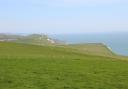
Our route follows some pleasant field paths and tracks, beginning by ascending to Penn Hill for views over the Frome valley to the north downs crammed with Bronze Age settlement sites and barrows. It crosses the aqueduct’s route and the River Frome, wanders through Grimstone village along the A37, and follows a pre-By-Pass section of the Dorchester Road through the ancient village of Stratton.

The Walk
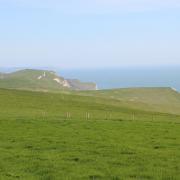
1 Church of the Assumption, where this walk starts from, was rebuilt in 1850 in the early English style incorporating fragments of 13th and 15th-century stonework and stained glass from the earlier St Mary’s which Rev. John Hutchins had recorded in his 1774 book History and Antiquities of Dorset. Walk up Church Lane past left Manor Farm and cottages. Passing the left footpath, follow the concrete track bridleway through the yard, becoming gravel with ‘New Barn Field Centre’ ahead. Through a storage yard, pass opposing field-gates. Take the bridleway-signed right-fork. Follow the rising path under trees, between fields. Through the end bridleway-gate into a high field, follow the right hedge up to twin-gates. Through, follow the left fence over Penn Hill to facing 1½ bridleway gates. The valley below-right with Stratton beyond is where the Roman aqueduct performs a V-shaped ‘re-entrant’ diversion to maintain its contour.

2 Through the gates, follow the left-fenced grass path downhill with the vast right field’s re-wilded edge and long views over farms, fields and woods. Continue under the electricity stanchion to the half-gate onto a banked flint/grass track. Turn right, with right wood and left fields. In ¾ mile, around the steel cantilever-barrier, fork left down to the road. Cross, signed ‘Frome Valley Trail’. Through the fence-gap, cross the field diagonally to the top corner. Join the hedged grass path, then track, down to the Roman road, signed back ‘Frome Valley Trail’ with Lower Muckleford House opposite. Turn left. Past cottages and left ‘Old Chapel’, take the right signed-footpath opposite ‘1 Higher Muckleford’.

3 Down to the footpath-gate with Permissive Path arrow, go through and turn half-right across to the footpath-arrowed twin-stiles under trees. Over, follow the old left hedge across the field, cutting across the left V-shaped corner, continue round to the left footpath-stile. Over, go right.

Over the River Frome footbridge to Wrackleford Estate’s Seven Hatches Beat, continue along the path to the footpath-stile onto Grimstone A37. Turn left, cross over and walk through the village, passing ‘Grassby Stonemasons. Established 1861’, a red rusty-roofed barn, a right flint barn, and the lay-by. Turn right for ‘Sydling St Nicholas’ and ‘Greyhound Inn’. Under the stone railway bridge, take ‘Grimstone Dairy’ concrete bridleway past the thatched cottage.

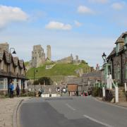
4 Rising and sunken under trees, continue straight past Grimstone Dairy Farm’s cottages, barns and dairy sheds. Over the top, continue down the wide track with super views. See the aqueduct ‘shelf’ half-right. Rising to a left bend, take the right footpath-stile/steps down to the railway line. Cross quickly and carefully and go up the path/steps to the A37 verge, signed back ‘Footpath’. Equally quickly and carefully, cross to the cycle route on the opposite verge. Go left. Turn into the ‘No Entry’ road, joining Dorchester Road at the ‘Stratton’ sign. Past The Rise, continue down to the right green on The Square and past the 1898 Chapel left. The Saxon Arms pub is behind the green.


5 Past left Sawyer’s Lane. Right St Mary’s Church dates from the 12th century. The nave is 12th century but largely rebuilt when the tower was added in the 15th century. 17th-century Manor Farm is just south of St Mary’s. Continue along Dorchester Road passing many interesting cottages including the converted Old Chapel and the group of three cottages dated ‘1900’ opposite Wrackle Close, with the water-pump. Reaching the A37, join the cycle-way above right thatched cottage No. 1.

6 Keep straight on. Before the roadside railings, take the right footpath-signed kissing-gate. Over Wrackle Stream footbridge, cross the water meadows with the left hedgerow and hand-railed sleeper-bridges to the corner footpath gate/kissing-gate. Through, over the River Frome brick-arched bridge, continue to the Frome mill-stream and the facing house with the stepped garden. Over the sluice-gate bridge, continue along the path and over the stream’s flat bridge to Roman road. Go left, passing a variety of charming cottages, to the crossroads. Turn right into Church Lane where you started.

Compass Points
Distance: 4 miles/6.5km
Time: 2½ hours
Exertion: Fairly easy. Several stiles but gentle ascents
Start: Church of the Assumption, Bradford Peverell (Grid Ref: SY658930)
Map: OS Landranger Sheet 194
Public Transport: First Wessex B2 Dorchester to Grimstone for alternative start at Point 3
Dogs: On leads along roads and in villages, abide by The Countryside Code
Refreshments: The Saxon Arms, Stratton for real ales, lunches and evening meals
Click here for a walk through Bronze Age Dorset at Winfrith Heath