This circular walk, around Fifehead Neville and Haydon Lane, follows the River Divelish and takes in remnants of some of Dorset's medieval drove roads and tracks. Along the way Edward Griffiths introduces us to some of the pretty bridges and sun dappled fords that criss-cross this river
In her 1964 book Inside Dorset, Monica Hutchings said of Fifehead Neville: ‘Most of the time, this is just a very quiet, pretty, unspoiled corner of Dorset with a continuity of habitation running from Roman times to the present day’. Throughout intervening medieval times, travel between Dorset villages, market towns and churches was either on foot, by saddle-horse, pack-horse, or horse-drawn cart for heavier goods. Many of Dorset’s medieval drove roads and tracks are recognisable by old stone bridges and fords across rivers.
This walk follows the River Divelish taking in many of its crossing points and bridges, from 18th-century Rolls Bridge on the old A357 near the start (responsibility for the earlier bridge was taken over by Dorset Council in 1635) to the ancient ford at Puxey Farm, Salkeld Bridge (dedicated to Lieutenant Philip Salkeld), Plumber Manor’s 18th-century bridge and the medieval pack-horse bridge at Fifehead Neville. The return route uses surviving sections of medieval drove roads and paths around Holebrook Green and Haydon, including Fifehead to Lydlinch road and Kings Stag to Sturminster Newton drove via Haydon Corner and Puxey.

Philip Salkeld was born in the rectory at Fontmell Magna in 1830. Working in India with the Bengal Engineers in 1856, and trapped in the Delhi Mutiny Siege, the 26-year-old officer led British people, wives and daughters to safety across the Ganges Canal and River Jumna. He organised sappers to build artillery batteries on the Delhi Ridge and was mortally wounded in a massive explosion during an attack on Kashmir Gate. His left arm was amputated in the field hospital but he died October 1857. He was awarded a posthumous Victoria Cross.

The Walk
1 Out onto the A357, turn right. Past the building suppliers, cross over. Pass Rolls Mill Farmhouse. Just before three-arched 18th-century Rolls Mill Bridge over the River Divelish, turn into Riverside Farm’s drive, signed ‘Glue Hill ½’. Go through the two-way footpath half-gate. Into the field, turn right past the barns. Continue along the right barns, Riverside Farm and paddock to the hedge-gate with three-way signpost. Take the ‘Puxey Farm ½’ footpath straight up the field, passing right of the first electricity-post, to the hedge’s footpath-stile. Over, cross the track from your left. Walk half-right down the field, signed ‘Puxey Farm ¼’, aiming 50 yards left of the solitary ash tree below you. Through the footpath-gateway, walk down the track towards Puxey Farm but go over the footpath-gated footbridge left of the Divelish ford.


2 Over the bridge, go through the left hedge’s nearby gate. Then cross the long field, aiming right of the far trees, to the hedge’s un-arrowed half-gate. Through, cross to the un-arrowed gateway. Through, follow the grass track straight to the half-gate into the road, bridleway-signed both ways. Visit Salkeld Bridge below left, then cross into ‘Plumber Manor’ bridleway-drive. Continue to the left white-railed fork. Fork right into the bridleway-arrowed hedged track with left trees. Bend left across the Divelish bridge with Plumber Manor left. This fine Jacobean country house is now an award-winning luxury hotel. Up past the left barn and two rows of cottages, go through the right parking area’s beech-hedge gap. Cross the lawn to the fence’s footpath-gap into a field with River Divelish right.


3 Follow the field path to the hedge-gap. Through into the next field, continue to another hedge-gap. Into this field, follow right trees and river to the Hardy Way gate onto the concrete ford road. Go right over the medieval packhorse bridge, then continue up the lane.

Pass first right Mill Cottage, then more right cottages and The Old Rectory. At Church Farm House on the left bend, fork right under huge yew, beech and a chestnut to visit medieval All Saints Church which dates from the 14th century.

The chancel arch and nave’s south wall are of this date. The Salkeld monument is on this south wall. Robert Salkeld, Philip’s father and Rector at Fontmell Magna 1795-1841, was born here. The north aisle is c.1500 and the south porch was added in 1736. Outside, the Brune family’s immense fenced ‘mausoleum’ with a blocked arch entrance, dates from 1707.

4 Leaving, continue along the lane, around the right bend with left halter path. Past left Home Farm, Home Farm cottages and The Old Chapel, take the right bridleway-signed track, the start of the Fifehead to Lydlinch road, with glimpses right of the late 17th-century Manor House, much altered in the 19th century. The track becomes narrower at a right bungalow before descending between banks of coppiced hazel to the Divelish tributary bridleway-bridge. Over into the ascending field with left footpath, follow the bridleway-path straight up and over to 1½ gates onto the road. Cross into unsigned Haydon Lane bridleway-track, still the Fifehead to Lydlinch road. Past left Haydon Farm, continue down the hedged track, bending left, then with long views left. Past two left barnyards, ascend past a right footpath-gate.

5 At the right bend and drive, fork left down to the steel-barrier and wooded green track. Reaching a T-junction, where the Fifehead to Lydlinch road and Kings Stag to Sturminster drove road meet, take the right wide and hedged grass track, part of the Sturminster drove, not the lesser path straight on. Continue for ¼ mile to another steel-barrier. Through to Haydon Corner, take the right ‘Puxey ¾’ bridleway, signed back ‘Haydon Lane ¼’. Follow the bridleway-path through trees and old coppice to a T-junction with right corner barnyard. Take the right ‘Puxey ½’ bridleway, signed back ‘Haydon Corner ¼’. Follow the bridleway-path under trees, bending left then straight on to a grassy ‘ride’. Past left and right barns, continue on the concrete track to the lane with reverse-fork bridleway signed ‘Brickyard Lane ¾’. Follow Puxey Lane straight on for ¾ mile, passing right Hile Farm and bridleway, right ‘Puxey Farm’ bridleway-track and left Badger Farm. Around the last bend, continue up to the A357. Turn right and walk back to North Dorset Business Park where you started.

Compass Points
Distance: 5 miles/8km
Time: 3½ hours
Exertion: Not too strenuous, some mud on bridleways to Puxey
Start: North Dorset Business Park, Rolls Mill on A357, park thoughtfully on estate road (Grid Ref: SYT776134)
Map: OS Landranger Sheet 194
Public Transport: First Bus X10 Yeovil and Blandford to Sturminster car park
Dogs: On leads where there is livestock, abide by The Countryside Code
Refreshments: Olives Et Al at Rolls Mill for picnic lunch ingredients (closed Sundays)
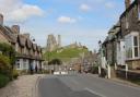
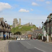
Looking for another Dorset walk - try this spring stroll on the Dorset/Somerset border