This three-and-a-half-mile walk follows the tributaries of the River Britt, promising stunning views around every corner

Distance: 3½ miles/5.75 km
Time: 3¼ hours
Exertion: Fairly strenuous. Ascending a total 464 ft
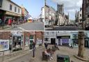
Start: Julia Memorial in Beaminster Square (Grid Ref: ST481013). Park in Yarn Barton car park in Fleet Street - very reasonable
Map: OS Landranger Sheet 193
Public Transport: First Wessex 6 Yeovil to Bridport
Dogs: On leads where livestock is and in accordance with specific notices encountered on the walk and The Countryside Code
Refreshments: The New Inn, Stoke Abbott for good lunches (only if booked on Sundays)

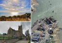
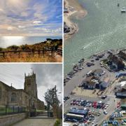
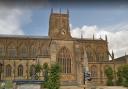
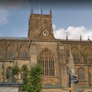
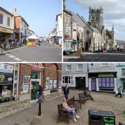
After leaving Beaminster, this fine walk frequently meets some of the River Brit's tributaries so, to enjoy this walk's wonderful views, we're going up and down several hills either side of the tributary valleys. Near the end, the views from Gerrard's Hill to Beaminster and over the archetypal 'rolling countryside' are spectacular. On the way, divert into Stoke Abbott, a lovely village with stone-built cottages, a church dating from the 12th century, and a good pub.
THE WALK
1. From The Square, walk south-west into Church Street. Past left Bell House, turn left into St Mary Well Street with lovely old stone cottages. Past the left footpath along the River Brit, continue up the cul-de-sac and down into the tree-shaded track. At a cattle-grid, go through the bridleway-arrowed gate/kissing-gate and follow the left wood up the field with the high right wood. Through another gate/kissing-gate, the bridleway goes straight on and a footpath goes right to the wood. Continue down by the left wood to another bridleway and footpath-arrowed gate/kissing-gate. Through, follow the grass path, bisecting the field, to the far left corner bridleway-gate.
2. Through, follow the hedged path to another bridleway-gate/kissing-gate. Through, continue up the fenced path with the right field and left private wood. Beginning to descend, go through the right footpath kissing-gate and turn half-left up the field to the hedge gate/kissing-gate. Through, cross the farm track. Through the opposite footpath half-gate, walk ¼-right down the sloping field to the footpath half-gate into a wood. Ignore the right stream's bend and walk straight on. Pass a left footbridge over a stream. Cross the next one, go over the footpath-stile and out of the trees and turn half-left up the hill, brushing against the left side of the solitary oak. At the footpath signpost by the top hedge, turn left to the corner footpath-gate.

3. Through onto a grass track, bend right at a two-way footpath arrow-post and follow the track up alongside the left wood with Gerrard's Hill ahead. Then, descending and hedged both sides, pass a staggered footpath crossing. At the end, join the track, signed back 'Footpath', and walk up to the lane. Turn left. Follow the lane down, past the Horsehill Farm turning and up under trees into 'Stoke Abbott'. At the top of the hill divert straight down, but only to visit charming Stoke Abbott and St Mary's Church. To continue the walk, turn right onto bridleway-signed Mason's Lane for 'Chart Knolle'. It's a long climb. Past right 'Chartvale' continue up the deeply sunken lane, becoming gorge-like further up. Through twin stone gateposts, take the left 'Chart Knolle ¼' bridleway/footpath up into a hanging wood above the lane. There are fine views through the beeches. Through the end bridleway half-gate, go down the short field with Chart Knolle house right.
4. Through the stone-wall's half-gate, go straight to the four-way signed bridleway/footpath crossing. Take the 'Beaminster 1' footpath half-gate and follow the right fence down and up above the pond valley to the right footpath-stile. Over, up the bank and over the top stile, walk up the field to the footpath gate/stile. Over, follow the grass path up towards Gerrard's Hill beech clump. Through the gateway and through the cross-bank gap, go right to the O.S. trig point. After enjoying the views, rejoin the grass track and start descending with Beaminster ahead. Over the corner stile, cross a track to the gate/stile. Over, bear ¼-right down the field to the fence footpath-signed stile. Over, go ¼-right down the steep hill to the next fence footpath-signed stile, then half-right across the paddock to another fence footpath-signed stile.
5. Over, go left to the footpath half-gated footbridge into the Woodland Trust's woodland. Go right of the bench and up the woodland path. Pass a three-way footpath-pointer for 'Beaminster ¼'. Out of the woods, follow the left fence up steeply to the footpath half-gate into an enclosed path. Go right/left between fields. Over and down behind stone barns, go right to 1½ gates with a three-way footpath-pointer. Through for 'Beaminster', go half-left down the field path to the corner footpath-stile into a short path. Into Half Acre Lane, turn right to Stoke Road T-junction. Turn left. Over the stream bridge, take the right half-gated footpath into the long field with the stream on your right. Through the end 1½ gates, cross Knapp House drive. Continue along the track and into Shorts Lane and into Church Street. Past St Mary's Church, walk back up to The Square where you started.