This walk offers a peek into Dorset’s fascinating history books, with a route that takes in a Neolithic ceremonial monument that is shrouded in mystery

On this exhilarating walk, we explore two small villages, both with historic churches, a unique Roman road hairpin bend, the enigmatic Dorset Cursus, an Iron Age and Romano-British settlement, several Neolithic barrows and Ackling Dyke Roman Road.
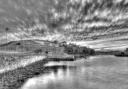
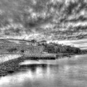
Running for miles across the rolling hills of Cranborne Chase, the Royal Commission on Historical Monuments says that Dorset Cursus, a Neolithic ceremonial monument, is 'the largest known of its kind'. In 1821, when Sir Richard Colt Hoare produced his plan, it was relatively undamaged after 5000 - 6000 years but, today, little remains due to plough damage. The Cursus comprised a 6¼ miles long parallel-sided enclosure about 300 - 400 ft wide with a bank and external ditch both sides. And the long views are pretty spectacular, too.

Distance: 6¼ miles/10 km
Time: 4 hours
Exertion: Not too strenuous. Some long slow ascents
Map: OS Landranger Sheet 195
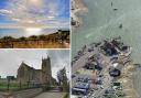
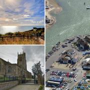
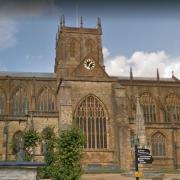
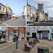
Start: Gussage All Saints' Church (Grid Ref ST998107)
Public Transport: None

Dogs: On leads where livestock is and in accordance with specific notices encountered on the walk and The Countryside Code
Refreshments: Drovers Inn, Gussage All Saints, for lunches and bar meals

THE WALK
1. From the War Memorial triangle, walk down the road and over the Gussage Stream bridge. Turn right along the lane for 1/3 mile to the Ackling Dyke Roman Road crossing and plinth. Take the left hedged bridleway-track, rising into trees at Sovell Down Nature Reserve. Fork right onto the arrowed footpath. Through facing 1½ gates, continue up the Nature Reserve's path to the half-gate into a huge sloping field. To preserve any hard-earned crops, choose Route A or B as follows:
Route A: If a path has been cut through, continuing the Nature Reserve footpath's direction, walk half-left up the field to the wide gap into a second field. Continue the same line up to the roadside hedge. Follow this for 200 yards then go half-right down the field to the footpath-stile, about 200 yards from the bottom left corner, into the wood.
Route B: If no path has been cut, turn right along the field's right hedge, meandering for ¼ mile and passing around a right wood to the wide gap into a second field. Through, turn right down to the wood, then left along its edge to find the footpath-stile into the wood.
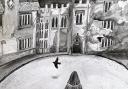
2. Down the woodland path, emerge into Gussage St Michael at a backward footpath-signpost. Turn right to visit the church, but left for 'Long Crichel' to continue. At the left bend, continue into Manor Road, footpath-signed 'Cashmoor 1½'. In 300 yards, go over the right wooden fence opposite House 12. Follow the used path into the field corner and along the hedged Gussage Stream into the adjacent field. Through the gate into the next field, keep following the stream to gated Manor Farm drive. Through the opposite stile/gate follow the level track for ½ mile. Before a left bend, take the right footpath-stiled bridge. Into the field, turn left to the footpath-signpost at the electricity stanchion. Don't cross another footpath-bridge into the garden. Turn right along the fenced path, around the garages and out onto Ryalls drive beyond their gate. At the road, turn left.
3. Along the lane for 100 yards, take the right bridleway-signed 'North Farm Cursus Herd' Tarmac track, rising slowly with vast skies, between the hedge and a huge field. At the top, pass left barns and rejoin the track. Round the left bend, which crosses the south-east edge of the Dorset Cursus, 130 yards brings you to a right bend which crosses its north-west edge. However, into the facing field, ignore the blue-painted arrow. Turn right on the right-hedged track, becoming grass half way up. After ½ mile, meet a row of younger trees. The long-barrow right is 155ft long, 65ft across and 10ft high at its highest point. At your field's end, go through bushes to the fenced bridleway.
4. See the Salisbury road ahead and Penbury Knoll hill-fort half-right ahead. Just over your facing fence is the site of the Iron Age and Romano-British Gussage Hill settlement, one of the largest native occupation sites in Dorset. Turn right. Keep straight on for ¼ mile. Past two concrete barriers, follow settlement boundary banks and ditches through the wide grass area with round barrows right. Bend right, then left at the bridleway fence¬post into the fenced path passing multiple banks and ditches left. In 400 yards, cross a 'Private' farm-track. Continue along the bridleway-track.
5. Looking left, the long line of trees mark the line of Ackling Dyke. At its bottom end, the south-east edge of the Dorset Cursus touches it on its way north-east. Into Harley Wood with Ackling Dyke inside with John Ironmonger's memorial stone. Turn right. Follow Ackling Dyke's raised track, straight as an arrow or a marching legion, for 2 miles. The last half-mile, you're actually on it. Around the end cantilever barrier, meet the lane opposite Sovell Down's bridleway-track. Turn left and retrace your steps back to Gussage All Saints where you started.