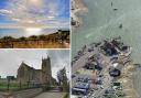
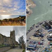
This walking route around Dewlish and West Bagber Copse features a village which will intrigue archaeology enthusiasts

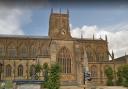
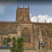
There was a major fire in Dewlish in 1859, but the new Wesleyan Methodist Chapel was built the same year and many of the farmsteads were rebuilt by 1860. In Church Street, Model Farm was also built in 1860, using banded flint and brick and incorporating the original round-headed archway moved from Manor Farm House's driveway entrance opposite. In 1872, the 12th-century All Saints' Church next door was much modified by T. H. Wyatt. More intriguing for archaeology enthusiasts are the 17 acres of Court Close medieval settlement in fields below and around All Saints'. Only the banks and ditches of the embanked enclosure remain visible above ground, subdivided by banks and scarps, together with indications of closes, a hollow-way and a small moat which probably enclosed a former manor site.
The Walk
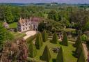
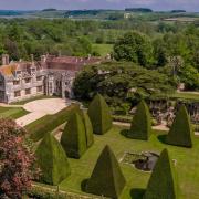
1 From All Saint's, walk down the road. At the left bend, go through Manor Farm field's footpath-arrowed gate. Turn right along the churchyard wall to the two-way footpath-stile. Over, follow the clearly-used path straight on, under overhead wires and 10 yards right of the post. Continue across Dewlish deserted medieval village earthworks to the footpath-stile into the facing trees. Over 2nd and 3rd stiles, notice the stately stable-block and follow the path across the park field, crossing the drive at the junction, to the fenced tree clump. Over the footpath-stile, walk through the trees. Over the exit stile, notice Dewlish House in the distant trees and bear ¼-left to the fence gate and footpath-stiled Devil's Brook footbridge (probably dry in August).

2 Over, bear right, rising along the field's slope to the corner footpath-stile into Park Hill Woods. Up to the nearby T-junction, turn left and ascend slowly for ¼ mile through the woods before seeing a high right field. Soon, take the right footpath half-gate into this field. Follow the left hedge's grass path up and over, with super long views, to the gap in facing trees. Through, turn right to the corner, then left down towards Dennet's Bottom hedge's wide gap. Don't go through. Turn right into the unsigned, hedged, bridleway path. In 100 yards, cross an arrowed footpath. Into the shady section, instantly, turn left into the rising field. At the nearby footpath-post, bear right and follow the faint path rising along the slope to the facing hedged wood, then bend left to follow the hedge up.
3 As the field opens wider, follow the wood's edge right. Just before a small oak with a two-way arrow-post beyond it, turn sharp left onto the long path between open fields. Reaching the 'look-out', pass right, still on the path, alongside the left hedge. In 100 yards, fork left into Milborne Woods, instantly passing two footpath posts. Keep straight on through the woods. Around the end gate onto the hedged lane, turn right for a ½ mile stroll. Pass left Coles Farm. Descending under trees, take the unsigned left reverse-fork grass track, ascending slowly into a field. Follow the meandering left hedge (Coles Farm is left again) and under electricity wires to a half-gate onto a hedged fenced track. Turn right.
4 Continue for ¼ mile before bending right, between top fields, still fenced. In another ¼ mile, turn left at the bridleway-arrowed T-junction. Past the left barn, continue up the track. Past a right barn, fork right at a bridleway-gate, now, with left fence and right trees, notice the left field's sunken water tank. Descend to a house and barns and pass a bridleway-post. Through into an open field, turn ½-right, slightly clear of the right fence, up and over to the far left corner bridleway-gate under trees. Through, follow left West Bagber Copse's edge to the three-way bridleway-signed corner gate. Through onto the farm track, with cob-walled West Bagber barns opposite, turn left.
5 Up to the top fork, veer into the right field and follow the left hedge, through into the second field, and on to the corner bridleway half-gate. Through the hedge and another half-gate, turn left onto the arrowed bridleway along the left hedge and above right Devil's Brook valley. See Dewlish ahead and right. Through the off-set corner bridleway half-gate, walk to and follow the hedge across the field. At a left gate, continue into the rutted track, sweeping right at a left gate. Just keep descending. Through 1½ bridleway and footpath gates, continue along Pound Lane with a hanging wood left. Pass Brook Farm and several houses. Before meeting the road, take the right path across the brick-arched footbridge. Then meet Middle Street before Old Parsonage Farmhouse. Follow the road up and into Church Street where you started.
WALK
Distance: 4¾ miles/7.5 km
Time: 3½ hours
Exertion: Not too strenuous. A few ascents
Start: All Saints' Church, Church Street, Dewlish (Grid Ref: SY775982)
Map: OS Landranger Sheet 194
Public Transport: Damory 311 from Blandford
Dogs: On leads where livestock is and in accordance with specific notices encountered on the walk and The Countryside Code
Refreshments: The Oak at Dewlish for local beer and food