Enjoy early spring blooms on this circular ramble around Winterborne Stickland
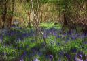
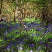
This invigorating early spring walk in north Dorset explores the high chalk downs, ancient woodland, pretty cob and thatch cottages and elegant manorial buildings either side of the River Winterborne’s upper reaches.

The Walk
1. St Mary’s is a homely pretty church which has served the village since the 13th century. Masses of primroses and daffodils scatter themselves freely about the churchyard in spring. The 13th-century chancel and nave both have wagon roofs, the nave has white plaster between the ribs, its intersections are masked with floral painted bosses resembling tea-plates. In the 16th-century porch, there’s a reset 15th-century semi-circular stone panel depicting the crucifixion and two flanking figures.

From St Mary’s Church, walk west along West Street, the Winterborne Houghton lane, with the ancient lime tree on the junction. Many of the thatched cottages, strung out along West Street, are 18th century and built mostly with rubble-stone, flint, brick and cob. Pass a right signed footpath at Mulberry House. After the left four-cottage terrace, take the left signed footpath between gardens, through the footpath kissing-gate and up the valley side through trees (housing many rooks), with views up the valley towards Delcombe Wood. Through the top footpath-signed kissing-gate, turn right up the road and take left ‘Valley View Farm’ bridleway-signed track/drive.

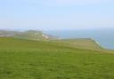
2. Through 1½ gates follow the fir-tree edged track up and over, past the right barn-yard and straight down to the facing fence’s bridleway-gate. Through, bear ¾-right down the green track into the valley. At the bottom, continue on the track up to the top left corner bridleway half-gate. Through, follow the right hedge up the steep field and into the corner. Through the bridleway half-gate, ignore the left/right track and go ¼-right across the high field’s bridleway-arrowed path to the far side’s hedge and bridleway arrow post. Go right to the left bridleway gate. Through, follow the path through Charity Wood, mostly beech trees. In about 250 yards, at a two-way bridleway-post, keep straight on, descending gently with scattered holly bushes.

3. Into a group of ancient beeches, take the first left, doubling back hairpin bend, track. It’s a bridleway although the arrow-post may be missing. Rising (track may be muddy) and swinging right and left to a cantilever-gate, exit Charity Wood into a ¾ mile long field. Follow the green track descending along left trees with long views ahead and passing a right tree-clump. Through the bottom gate to Clenston Road, bridleway-signed back, turn right. Past left Higher Clenston Cottage, continue along the hedged road. In ¼ mile, after a left brick cottage, arrive at left Old Rectory drive’s tree-planted lawn. Then, opposite the old stone/brick/flint thatched barn, the right bridleway leads to Oatclose Wood.

4. Past the Manor House’s pillared gateway, turn left at the buttressed stone/brick/flint barn. Follow the bridleway-signed track and fork left past left barns, not right to the cottages. Cross the River Winterborne which flows into fields towards Winterborne Clenston. Continue up to the facing bridleway and footpath-gate at the cottages’ end. Around the gate, continue up the drive, then through assorted barns, becoming a farm track, still rising with left trees, between fields. In half-mile, when the left trees finish opposite a bridleway and footpath-post, take the left field track to the first right hedge with bridleway and footpath-arrows.

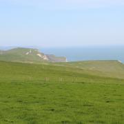
5. Take the right-hedged grass track on the other side of the hedge and continue rising gently for another 1/3 mile to the end gateway’s footpath and bridleway-arrowed sleeper. Through, keep following the grass track with right trees over the huge field. Past a right cattle trough, continue under the electricity cables and down to the gap through the dense hedge to the three-way bridleway-signpost. Turn left on the grass track against the left hedge, with super long-distance views, rising gently again, to a hedge gap. Through into the next field, follow the meandering left hedge to the corner gap into The Plantation - of formerly coppiced hazel. Follow the path inside the left edge through to a narrowing strip between fields. Keep straight on to meet a grass track with left fence and right hedge. This in turn meets a Tarmac drive (Lady Caroline’s Drive) coming up left from Quarleston Farm. With Canada Farm solar panel installation right, continue around the facing gate and to Fair Mile Road from Blandford St Mary to the right, signed back ‘Canada Farm’ and bridleway.

6. Turn left. With hedge and several properties left, hurry to the chevron right bend where you take the bridleway-signed left half-gate into a high field. Follow the right hedge grass track with super long views, including Highwood Tower in the Drax Estate’s Charborough Park. Forward-right over the hedge is the communications mast you’ve been sighting at various intervals throughout this walk. Through the facing hedge-gap, continue along the large field’s right hedge grass track, under the electricity cables again and on to the facing 1½ gates. Through, continue through another large field along the right hedge grass track, rising gently to 1½ bridleway-gates. Through, cross the communications mast’s lane and, round the Canada Farm gate, continue down the tree-lined lane, called Chalky Path, past right Beech Tree Farm.

7. Continue down the sunken lane, with rooks overhead and edged with harts-tongue ferns, past left Sycamore Down Farm and between a group of cottages. Emerging from Chalky Path, cross Clenston Road into the green space with Stickleberries Day Nursery left over the River Winterborne and the ‘Stikellane’ name-board right.

Over Clenston Road beyond this, the brick and flint house with the stone porch is the 1685 Rectory, built by the rector Robert Clavering who had married Honor, daughter of Richard West of Shillingstone, in 1683. Robert was rector for over 50 years from 1682 to 1735. Leave through the barrier-gap into Dunbury Lane, signed ‘Milton Abbas’. Cross into West Street, signed ‘Houghton’ and go straight on past the left ‘Old Reading Room’ to the lime-tree and St Mary’s Church where you started.

Compass Points
Distance: 4¾ miles/7.5 km
Time: 3½ hours
Exertion: Mild with gentle ascents
Start: St Mary’s Church, West Street, Winterborne Stickland (Grid Ref: ST835046)
Map: OS Landranger Sheet 194
Public Transport: None
Dogs: On leads when requested, abide by The Countryside Code
Refreshments: The Crown Inn, Winterborne Stickland, cosy dog-friendly bar, excellent food and ales. Closed Tuesdays.