Early records of the Hundred (an ancient division of the county) of Culliford Tree show that the name derives from ‘Culvardestre’. Culvarde was probably a Saxon landowner and ‘tre’ is an abbreviation for ‘terrae’ meaning land. Culliford Tree barrow is the most westerly of a string of eight and, as it was the meeting place for the Hundred courts; it was enclosed in 1740 with a bank of shrubs to distinguish it from the others. The barrow was opened in 1858 by Captain Damer the landowner and Reverend William Barnes, rector of nearby Came and Whitcombe (the latter is the famous Dorset dialect poet). They discovered several bodies aligned east-west.
![Medieval strip-lynchets seen from Bincombe Hill track. (Photo: Edward Griffiths)]() Medieval strip-lynchets seen from Bincombe Hill track. (Photo: Edward Griffiths) The South Dorset Ridgeway, which forms the centre point of this fine walk, is crowded with skyline Bronze Age barrows. Around Green Hill and Chalbury hillfort, there are distinctive remains of medieval strip-lynchets, constructed to provide level ground for growing crops on the hillsides. Bincombe, in Saxon English ‘binnan-comb’ meaning ‘the inside dell’, stands in a small dell (valley) - amid a much larger one. In his book History and Antiquities of the County of Dorset, published in 1774, the Reverend John Hutchins writes: ‘From the summit of Bincombe Barrows, there is one of the most extensive and beautiful views of the county’. On the path around Bincombe Hill, we will pass the concrete target wall of Bincombe Rifle Range, ordered by the War Department on June 6, 1915. The range’s area was 1200 yards long and 700 yards wide, all approaches and paths were closed to the public during firing exercises.
The Walk
1. From the lay-by, walk west to the golf course corner. Turn right down the slowly descending road alongside right Came Wood. At the wood’s end, go through the hedge’s bridleway-arrowed half-gate onto the path inside the wood. Follow the path, fenced left and descending. When the wood ends at a right field, continue down inside the narrow strip-wood with coppiced hazel. Past a bridleway-post, the facing gate opens into Warren Barn but follow the path above the barnyard and past another bridleway-post to the ‘Jubilee Trail’ (J/Tr) signpost. Go right through the hedge gateway and cross the track into the field. Ascend the field, with the right thicket and hedge, over and down into the valley with a three-way J/Tr-signpost. Go straight across and ascend alongside the right wood.
![Culliford Tree Barrow. (Photo: Edward Griffiths)]() Culliford Tree Barrow. (Photo: Edward Griffiths) 2. At the top corner hedge-gap, go through and turn right on the path between left-fenced ‘Gallops’ and right wood. Continue to the new wire-fence and bridleway half-gate. Through into the recently cleared area, follow the path half-left across to the bridleway-post on the fence’s outer corner. Here, follow the used path across the field, between the two tree-topped barrows, to the roadside fence’s bridleway-posted half-gate. The right of these two barrows is Culliford Tree barrow. Onto the road, go right, signed ‘West Hill ¾’. At the ‘Culliford Tree’ signpost crossing, turn left for ‘Broadmayne 2¼’ along the road with a good verge right. In ¼ mile, fork right onto the bridleway-track between fenced fields with extensive views. Continue for 1¼ miles, passing beneath overhead cables and along White Horse Hill.
![Green Hill and White Horse Hill from the zig-zag path. (Photo: Edward Griffiths)]() Green Hill and White Horse Hill from the zig-zag path. (Photo: Edward Griffiths) 3. Reaching a left clump of young beech trees opposite a right gate and ruined stone barns, take the right bridleway half-gate, signed ‘South Dorset Ridgeway Bincombe 1¾’. Follow the right fence past the barn walls. At the fence corner, turn right along the green path with fine seaward views left. Through the facing bridleway half-gate, continue above the left spring-water catchment area for Sutton Poyntz waterworks. Continue along the gorse-clad slopes, through 1½ bridleway-gates and along the green hill to the fence bridleway half-gate. Through, follow the green track slowly downhill alongside the right camping-field’s bank. Down to 2½ sign-posted gates, go through onto the roadside bank. Turn left. In 30 yards, cross right to the signposted footpath gate/stile. Over, cross to the nearby footpath-stile. Over this, follow the grass path around Green Hill’s flanks, noticing the strip lynchets and Iron-Age Chalbury Hill-fort over to your left.
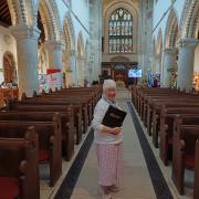
![Gateway onto Bincombe Hill. (Photo: Edward Griffiths)]() Gateway onto Bincombe Hill. (Photo: Edward Griffiths) 4. Continue clockwise around Green Hill and descend to the footpath-stile onto the road in Coombe Bottom, signposted back ‘Osmington 3’. Cross to the opposite footpath-signed fence-stile. Over, follow the zig-zag path up the steep slopes to the bridleway-gate in the fence/wall corner. Through, keep straight up along the left wall to the facing half-gate below cables. Through, go straight on for 30 yards to join the track along the hillside with long views left. Past the WW1 Rifle Range’s concrete target-wall below, continue to the partially concrete track and meander down to the tracks’ triangle. Turn right, signed ‘Bincombe ½’, down the mossy walled track and through the bridleway-gate. Visit Holy Trinity Church, which Hutchins described as ‘a small ancient edifice, all tiled, and contains nothing remarkable’. However, inside this perfectly charming building, the circular font is Purbeck marble with a rough stone stem which is believed to be Norman.
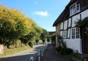
![Holy Trinity Church, Bincombe. (Photo: Edward Griffiths)]() Holy Trinity Church, Bincombe. (Photo: Edward Griffiths) 5. Then continue past the left barnyard and right listed stone barn with date-stone ‘C C 1856’. At the lane-junction, keep straight on up the raised pavement passing right Hillside and Dairy House, left Lower Dairy and Middle Farm. At the top of the hill, turn right, bridleway signed ‘Came Down ½’. Pass right Granary House and bend left at the right barns. Through the bridleway-gate, continue up the sunken lane. When the lane bends right towards the aerial-mast, keep straight on. Through the bridleway-gate, continue along the track with left hedge and right trees. Over again, continue into a small valley with far reaching views beyond Upwey to the coast, and go through another bridleway-gate. Keep ascending, with left hedge and high right field, back to the Golf Course and Came Wood corner where you started.
![Came Down Bridleway track. (Photo: Edward Griffiths)]() Came Down Bridleway track. (Photo: Edward Griffiths) Compass Points
Distance: 5 miles/8 km
Time: 3 hours
Start: Lay-by on west corner of Came Wood opposite Came Down Golf Course, on Broadmayne to Herringston road (Grid Ref: SY686857)
Exertion: Not too strenuous. A few hills and two stiles
Map: OS Landranger Sheet 194
Public Transport: None
Dogs: On leads when requested, abide by The Countryside Code
Refreshments: The Old Ship Inn, Upwey for home-cooked meals and real ales
Pq
‘The South Dorset Ridgeway'is crowded with skyline Bronze Age barrows’
‘From the summit of Bincombe Barrows, there is one of the most extensive and beautiful views of the county’






















Share