


Solstice, from the Latin Solstitium meaning ‘sun stands still’, is a biannual celestial event which marks the turning point when the Sun’s path halts in its journey across the sky before turning on its course. In the Northern Hemisphere, the 2025 Winter Solstice falls on December 21. It brings the shortest day, almost eight hours of daylight, and the longest shadows. The Sun rises late, sets early, and, for a moment, lingers at its lowest point in the sky. In Dorset sunrise is between 08:06 to 08:11, and sunset between 16:03 to 16:08.
Acknowledged as the first day of winter in the astronomical calendar, the Winter Solstice was a crucial time of year in many ancient cultures. Since Neolithic times, people have honoured this moment as the death and rebirth of the Sun God. Some prehistoric monuments, such as the stone circle of Stonehenge, Neolithic causeways and Bronze Age burial mounds are aligned to catch the solstice light, a testament to its mystical power. For early farming societies, it marked a time when animals were culled to save feeding during the colder months, food stores were assessed and plans for next year's planting set into motion.
For the Romans it was the birthday of the Sun, celebrated as part of their riotous seven-day festival of Saturnalia. The Anglo-Saxons observed Mōdraniht,‘Night of the Mothers’, revering both goddesses and female ancestors. Later, the Christian church placed Christmas within its pagan glow, layering new meaning upon older rites.
Spiritually, the Winter Solstice is the triumph of darkness before the light return, an invitation to stillness, reflection and renewal. Hills, barrows, and headlands across Dorset offer striking places to watch the solstice, be it winter or summer, blending sky, stone and myth as well as connecting us with an ancient rhythm observed for millennia.
Here are 10 easily accessible locations to watch the Winter Solstice. Fold it into a pre-dawn or pre-dusk walk, or from the comfort of your car.

HENGISTBURY HEAD
Sunrise over the Needles of the Isle of Wight; sunset towards the cliffs of the Isle of Purbeck.
Sunrise 08:06/Sunset 16:03
Jutting eastwards into the English Channel, Hengistbury Head has been a sacred site for over 10,000 years. Traces from the Palaeolithic, Bronze Age barrows, and an Iron Age hillfort can be found on this coastal site which guards the entrance to Christchurch Harbour. An ancient forest still stands on its northern shore, surviving as part of the protected Nature Reserve here.
Access: From the car park at Hengistbury either walk along the beach to enjoy views from the shore or climb the small hill to the coastguard lookout post.
PENBURY KNOLL
Sunrise looks over the woodland of the New Forest. Sunset aligns with the southern section of the Dorset Cursus, a Neolithic ceremonial route stretching 7 miles across Cranborne Chase National Landscape.
Sunrise 08:08/Sunset 16:03
Once a royal hunting ground, Cranborne Chase has Neolithic long barrows, Bronze Age barrows, raised earthworks and early settlements. Its lack of modern encroachment makes it an ideal location for stargazing; it’s a designated International Dark Sky Reserve, one of only 22 in the world. Penbury Knoll, half-hidden amongst pines, may never have been completed as an Iron Age hillfort, nevertheless, from its peak, the Winter Solstice aligns with one of the most mysterious prehistoric monuments in Britain, echoing the route of ancient travellers who may have walked the great Cursus to greet the setting Sun.
Access: Either park in the village of Pentridge or at the Martin Down Nature Reserve to walk about a mile up to Penbury Knoll
FONTMELL DOWN
The sunset sinks into the Blackmore Vale, falling behind the ramparts of Hambledon Hill and slopes of Okeford Hill.
Sunset 16:04
This chalk downland dips away, and the Blackmore Vale stretches out beyond the spurs. Fontmell Down is rich with wildflowers, but also rich in archaeology. Bronze Age barrows and cross dykes mark it as intensively used land. Compton Abbas and its ruined church sit in the valley, and planes from the little hilltop airport can often be seen in the skies above. The slopes mark the divide between the high spiritual landscape of Cranborne Chase to the wild lowland of the Vale.
Access: View the sunset from the comfort of the car park at the top of Spread Eagle Hill or walk onto the open access area of Fontmell Down. Alternatively climb to the peak of Melbury Beacon.
SWYRE HEAD
The Isle of Purbeck’s highest point offers sunrise over the ‘Golden Bowl’ of Encombe and St Aldhelm’s Head, while sunset spills over the Isle of Portland.
Sunrise 08:07/ Sunset 16:05
Topped with an isolated Bronze Age burial mound, Swyre Head towers above the fertile valley of the Golden Bowl below, which has been farmed for centuries. Encombe House, built in 1770 by John Pitt (cousin of the Prime Minister William Pitt), sits at its heart, while ancient trackways and carriageways criss-cross the surrounding woodland and crumble into the sea.
Access: From the small car park at the end of Kingston Road, cut through the woodland and climb the hill to reach the peak of Swyre Head.
RAWLSBURY
Sunset spills over the Blackmore Vale into the Somerset hills in the distance.
Sunset 16:05
This pear-shaped Iron Age hillfort, with banks nearly 6m high, sits on the western peak of Bulbarrow Hill (the third highest in the county). It later served as a beacon site during the Spanish Armada in 1588, and then as a Napoleonic telegraph station in the early 19th century, passing messages over large distances using the power of fire.
Access: Park carefully in the small layby to then wander straight onto the hillfort.
RINGSTEAD
Sunset over the Isle of Portland and Weymouth Bay with its colourful Georgian facade.
Sunset 16:06
Weymouth Bay’s shifting sands and dangerous reefs were once the domain of smugglers, who then transported their contraband inland. When plague first arrived in England, during the summer of 1348, through the neighbouring port of Melcombe Regis (now part of Weymouth), this fishing community suffered greatly. The remains of the village are hidden in the woods. Without the local knowledge ships often foundered here. Watching the solstice from this coastline spare a thought for the seafarers and smugglers who once depended on moonlight and shadows to survive.
Access: Two car park options at Ringstead: free National Trust one at top of hill (above Southdown Farm) with views over the bay – long walk down to the beach, or the beach car park with short walk to the shore.
HARDY MONUMENT
Sunrise glows over the hills beyond Dorchester and the Isle of Portland, lining up with barrows on the South Dorset Ridgeway, while sunset paints Chesil Beach, and the curve of Devon’s coastline.
Sunrise 08:09/Sunset 16:07
The monument was built in 1844 to honour the Naval Officer Admiral Sir Thomas Hardy (1769 – 1839) of Trafalgar fame. Hardy lived in the village of Portesham as a boy, and later at Portesham House. Shaped like a spyglass with its corners aligned to compass points, the 21m high tower is visible over half the county. Its position was deliberately chosen as a navigational aid to shipping and has been on navigational charts since 1846. Take the 120 steps to the top, on days when the monument is open to the public, to enjoy some of the best views in the county.
Located by the car park is Dorset’s newest stone circle. Created by artist-architect Amanda Moore in 2016, the Black Down Stone Circle consists of five stone ‘totems’; one is aligned with true north, the other four with the midwinter and midsummer solstice sunrises and sunsets. If conditions are clear, the sun’s full disc shines through an opening in one of the totems, lighting up a central rock of Portland stone.
Access: Enjoy views from the National Trust car park, or from the Black Down Stone Circle.
EGGARDON
Winter sunsets fall across the Marshwood Vale, with Golden Cap glowing on the coast.
Sunset 16:07
A vast Iron Age hillfort carved into the chalk, Eggardon also contains Bronze Age barrows and earthworks. The ridge commands views east over the Marshwood Vale to the hillforts of Coney's Castle, Lamberts Castle, Pilsdon Pen and Lewesdon Hill, suggesting its role as both sacred and strategic. Birds of prey soar in the skies above this vast landscape, with its patches of woodland dotted over the slopes.
Access: Park in the layby to the west of the hillfort to walk onto the site. The northern side is private, but the southern section is managed by the National Trust.
EYPE
From Eype Beach the winter sun rises and sets over the water between West Cliff and Thorncombe Beacon. From the beacon itself, the sun sets beyond Golden Cap.
Sunrise 08:10/Sunset 16:07
Eype (meaning ‘steep place’ in Old English) is linked to legends of Greek traders from Epirus who set up a temple on its shores. Barrows on the hills date from the Neolithic to Bronze Age, while Thorncombe Beacon, at 157m, formed part of the Armada Beacon chain in 1588. Local legend tells of the ‘Devil’s Jumps’ - ancient mounds said to be left as the Devil bounced around before being driven into the sea by the Abbot of Forde Abbey.
Access: Admire the view from the car park, or head down to the shingle beach. For the more adventurous, scale the slope to Thorncombe Beacon.
PILSDON PEN
Sunrise over the Hardy Monument in the east; sunset beyond Golden Cap on the western horizon. The patchwork fields of the Marshwood Vale fills the southern foreground.
Sunrise 08:11/Sunset 16:07
At 277m, this is Dorset’s second-highest point, neighbouring Dorset’s highest – Lewesdon which is covered in trees. In contrast Pilsdon is bare, exposing the monumental earthworks and allowing you to appreciate the same views of its former residents. Flint tools found here reveals evidence of humans living here at least 10,000 years. Its plateau contains Bronze Age barrows, and it is enclosed by Iron Age ramparts built by the Durotrigian.
Access: Enjoy views from either the car park at Lobb Gate or venture up onto the hillfort.

Tess of the Vale: Walks & Rides
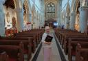
Dorset-bred Catherine Speakman, also known as Tess of the Vale (pictured), is a landscape archaeologist and cartographer. Through her website tessofthevale.com she combines expertise with storytelling to explore the county, providing access and information about Dorset’s most secret spots through self-guided walks and rides, a new adventure is published each week. And there’s also a free Walk of the Month – for December this is Tadnoll – taking in the nature reserve, the railway, the river, and the tallest obelisk in the county. Membership to Tess of the Vale, monthly (£7) or annual (£70), provides access to over 350 varied adventures across Dorset and beyond, for a range of abilities. It would make a great Dorset Christmas gift for a keen walker, cyclist or horse rider. More at tessofthevale.com or scan the QR code. Follow @tessofthevale on Facebook, Instagram & Threads


















Share