It is quite possible to walk the entire perimeter of Canvey Island but at a total distance of 14 miles it is perhaps more accessible if divided into two. This western half passes much marshland.
1. From the corner of Station Approach and Church Parade a small slope leads to a path entrance with a concrete bollard; the path leads to Somnes Avenue. With due care, cross the road and take the path through a gap in the railings signposted as ‘public footpath 10’. Pass the golf driving range on the right, then continue between a hedgerow and some water works before crossing the golf course to access the sea-wall. Be aware of golfers while crossing the course. At the sea-wall turn left; after 450 metres, just before a mobile phone mast and with allotments to the left, fork left along the grassy top of an old sea-wall, which leads to a road: Canvey Road.
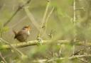
2. Cross the road and ascend the sea-wall opposite, where the route continues via a metal kissing gate. Off to the left is Canvey Way, the A130 while, looking north to the right, Benfleet can be seen across the marshes, with the railway line running in front of it. After just over a kilometre the sea-wall path bends sharp right, then sharp left after another 300 metres. Marshland birds abound, the species varying depending on the time of year, though the stark white Little Egrets are present all year round, as are the Cetti’s Warblers with their manic-sounding calls. The path now loops round to the left before passing under Canvey Way.
3. From here the path continues south, still on the sea-wall with East Haven Creek to the right. The land is grazed so there are several metal kissing gates along the way, in fences dividing up areas of pasture. After 1200 metres a path leads off left into Canvey Wick nature reserve but continue on the sea-wall, through another kissing gate. Loop right and left; glimpses of machinery and flocks of gulls across the creek indicate the presence of a large landfill site, as may the aroma, depending on the direction of the wind.

4. After a further two bends, pass a causeway off to the right which leads to a flood barrier. A similar structure can be seen in the distance behind it (the Fobbing Creek barrier, passed on the Fobbing walk published in the July 2023 issue). Here the sea-wall bends left beside the much wider Holehaven Creek, the horizon now dominated by the cranes of the London Gateway port and the multiple tanks at the Coryton oil facility. A long straight, interrupted only by a kissing gate, is followed by a gradual bend left. The path soon kinks slightly inland, around a derelict jetty, before resuming the sea-wall and passing under the massive structure of an old pier, well over a mile long, known as the Occidental Jetty. Continue through a squeeze beside a metal gate and after 800 metres descend from the sea-wall to the Lobster Smack pub (an historic inn, mentioned by Charles Dickens in ‘Great Expectations’).
5. From the pub, head inland up the lane (Haven Road), past the oil storage facility and keep straight on past various junctions. Towards the end of the road, on the left, is one of the old Dutch-style octagonal thatched cottages, dated 1621. You are now in the heart of Canvey ‘village’; opposite is the Co-op, occupying a building which used to be the King Canute pub, next to which is an interesting information sign.
6 From Haven Road turn right along Long Road, past some shops, then turn left just beyond the traffic lights, onto New Road. When this joins Link Road keep straight on, before turning left onto Dinant Road, right onto Central Avenue and then left onto Thomas Drive, at the end of which a right turn finds you heading back along Church Parade to the starting point.

COMPASS POINTS
DISTANCE: 8.5 miles (13.7km)
START POINT: Corner of Station Approach and Church Parade, Canvey Island, postcode SS8 9RB, grid reference TQ786846
ACCESS: On street parking is available on both Church Parade and Station Approach. The Lekoe Road bus stop, very close by on Somnes Avenue (B1014), is well served by routes 22 and 27 (www.essexbus.info)
MAP: OS Explorer 175 Southend-on-Sea & Basildon
REFRESHMENT: The Lobster Smack pub is passed on the walk. For pre-walk supplies there is a small supermarket opposite the entrance to Steli Avenue (grid reference TQ790844; postcode SS8 9UB) or a garage with a convenience store on Somnes Avenue (grid reference TQ787846; postcode SS8 9QB).
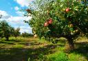
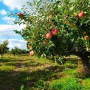
PLACES OF INTEREST: Despite evidence of occupation since pre-Roman times, one could almost call Canvey an artificial island. Although earlier defences exist, it was during the 1600s that Dutch engineers and workers were engaged to construct extensive sea-walls and dykes to prevent regular flooding. Many workers remained, as does their influence to this day (such as in many of the road names). Two of their octagonal thatched cottages still stand: one, on Haven Road, is passed on the walk while the other, on Canvey Road (grid reference TQ774837) is run as a public museum (open Wednesday afternoons in the winter and also Sunday afternoons from April-September). The Occidental Jetty was constructed to serve an oil refinery being built on the island in the early 1970s, so that oil tankers could pump crude oil ashore while moored in deeper water. Construction was halted due to an international oil crisis, and never resumed. The refinery also had a 450ft chimney (where Morrisons supermarket is now) which was demolished in 1997 by celebrity steeplejack Fred Dibnah. It was made of concrete rather than brick and actually collapsed a day early, while Fred and colleagues were preparing the ‘controlled’ demolition. Fortunately, it still landed in the planned position. Part of the old refinery site has rewilded and now forms Canvey Wick nature reserve, a Site of Special Scientific Interest and recognised as one of the most biodiverse sites in Britain, particularly important for rare invertebrates. It is passed on the walk but can also be accessed separately, with a free car park and entrance off Northwick Road (grid reference TQ766837). There is another excellent nature reserve nearby, also with free car parking, at West Canvey Marsh, off the roundabout at TQ775841.