Even a relatively short walk in this quirky parish, nestled between Chelmsford and the A12, includes heathland, pubs, beautiful arable farmland, an unusual church and an old horse-racing track!
The Walk
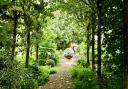
1. Cross the greensward from the car park towards a wooden footbridge over the road side ditch, beside a wooden fingerpost. Cross the road and proceed along the tarmacked driveway opposite, leading to Glebe Farm. Keep left and then turn left just past a pond. Go through a wooden kissing gate and continue beside a long bramble patch before turning sharp right. Pass a corrugated iron fence then on to a footbridge, after which turn left and keep to the field edge. Follow this path for the best part of a kilometre, ignoring two path on the left.

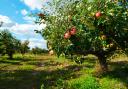
2. At a little spinney in the corner of the field the path descends some steps leading to a pair of footbridges with metal handrails; after crossing the second, turn left along the field edge. Ignore a gap on the left but turn left over a wooden footbridge in the corner of the field. On the other side of the bridge turn right along a wide path with a small woodland across the stream on the right. There is a vineyard ahead in the distance, with the tall radar tower beyond that.
3. Upon reaching the vineyard, just before a gap with a piece of rusting machinery sat in it, bear left up the hill, with the vineyard on your right. Keeping to the edge, cross another footbridge to the next field. The path runs beside a mature hedgerow and kinks around a pond, to emerge through a gate onto Rignals Lane. Cross the road to access a path between fences, indicated by a concrete fingerpost. The well-defined path continues in more or less a straight line between buildings for 500 metres to reach Barnards Road, opposite a school and beside a rather splendid oak tree.
4. Turn right and at the T-junction with Watchouse Road turn left. The White Bear pub is just along this road, as is the chip shop on the right in a small shopping area beside the public library. Follow the road all the way to the traffic lights at the crossroads by an Indian restaurant (which used to be The Eagle pub). Using the pelican crossing, cross to Margaretting Road but just beyond the railings turn right into Church Lane which, funnily enough, leads to the church.
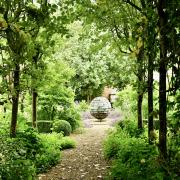
5. Roughly opposite the church entrance a path leads past an information sign, heading into the heathland part of Galleywood Common. Bear right, passing a lone mature silver birch with multiple trunks, then an area of mature gorse, leading out onto a greensward beside Horse and Groom Lane. The pub is just off to the right. To continue the walk, turn left and follow the greensward (part of the old racecourse) as it becomes increasingly wooded, leading back to Margaretting Road via a gap in some railings. Cross, through another gap, and the greensward returns all the way back to the car park.

COMPASS POINTS
Distance: 4.0 miles (6.4km).
Starting point: Galleywood Common ‘Wood Farm’ car park, just off Stock Road (B1007): grid reference TL703021; postcode CM2 8JU.
Access: Parking is free at the site but there is a 2 metre height restriction. There is a bus stop at the car park entrance, well served by multiple routes in and out of Chelmsford (www.essexbus.info).
Map: OS Explorer 183 Chelmsford & the Rodings.
Refreshment: There are two pubs in the latter half of the walk: The White Bear, on the corner of Watchouse Road and Well Lane; and the Horse and Groom, on the edge of the Common. There is also a fish and chip shop on Watchouse Road.
Places of interest: Galleywood Common was mentioned in the Domesday Book and is largely managed nowadays as a nature reserve. Historically, though, it was principally famous as the home of the original Chelmsford horse-racing course, parts of which can still be discerned in the landscape today (indeed this walk follows a section of it). Laid out from at least 1750 it was a significant course with royal patronage, George III having instituted two prizes of 100 guineas which were raced for annually for more than 100 years. The course was losing popularity in the early part of the 20th century however, and was never reopened after WW2. The area is still well served by pubs though in the past there were even more, to serve the racegoers. In 1899 Samuel Crozier, landlord of the Admiral Rous pub (now Rous Cottage, near the start/end of the walk) was the last man to be hanged at Chelmsford Gaol, having been convicted of murdering his wife, Ann, on the premises. She was a former barmaid at The Fleece in Duke Street, Chelmsford, and they had only married earlier that year.

The church, dedicated to St. Michael & All Angels, is a relatively new addition, having been constructed on land inside the racecourse in 1872/3. It was paid for entirely by Arthur Pryor, then owner and resident of Hylands House, 1½ miles to the north-west. It was designed in the gothic revival style by Piers St. Aubyn, a famous Victorian church architect often accused of unsympathetic restoration of older churches, though also feted by many for his work on St Michael’s Mount, Cornwall, where he is buried. More recent still, the large (358ft) radar tower to the east is a rare example of its type and is Grade-II listed. It was actually first built and sited at RAF Canewdon beside the River Crouch but was moved to the Marconi research facility at Great Baddow in 1956 and has loomed large over the surrounding landscape ever since.