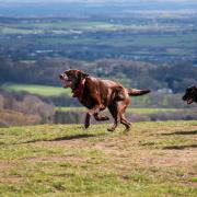
It’s faint, but it’s still there. You can hear it in the echoing fall of the heavy latch as you step down into a country church, or in the gentle clack of billiard balls in an old pub. It’s there in the tick of a robin’s call from an autumnal hedgerow, like the winding of an antique clock in a dusty hallway. Or in the brush of boots against the brittle rows of November stubble.
It’s in the wingbeats of the wild geese as they fly high against a frosty sky. It was here before we came, and it will continue when we’re gone. You won’t hear it unless you listen, but if you can blot out the roar of the new, you can still pick it up: it’s the insistent, slow heartbeat of old Cheshire.
You hear it most clearly in places like Shotwick, where the tides of time are felt less forcefully. This is an apt metaphor, as it happens, since the village was once the embarkation point for an old crossing of the Dee, and the red sandstone walls of the churchyard looked upon reedbeds and mudflats.
The green lane below the church led down to the ferry-cum-ford and Greyhound Farmhouse was an inn where travellers could await the arrival of the boatmen or fortify themselves in advance of the dangerous crossing. Even the Cheshire volume of the Buildings of England series, the antiquarian’s bible and not given to emotion, describes Shotwick as 'Wirral before the Fall', with a pang of prelapsarian regret.

Nearby Shotwick Castle was a riverside fortress – and no mere outpost either, but an important stronghold, its towers gaunt on a massive earthwork, guarding this strategic crossing point from Wales. Henry II, Henry III and Edward I all visited the castle on their various campaigns against the Welsh, and even after the site lost its garrison and was turned into a deer park, with ornamental ponds and gardens, Edward the Black Prince was another royal guest.
The path to the castle is still called the Welsh Road, as an old footpath sign in a Saughall garden attests.
Now, robbed of its stone and its pomp, the castle site is just a grassy mound grazed by cattle and Shotwick village a quiet cluster of weathered-brick cottages with an old church at the end of long country lane to nowhere.
Apart from the distant hum of traffic, and glimpses of modern industry at Deeside, life is peaceful and slow in this rural backwater, and all the better for it. The lucky residents wouldn’t have it any other way.
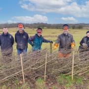
We feel the rhythms of the land keenly at this time of year, when we’re most conscious of the seasons turning. Our footpaths are capillaries, and a country walk is a stethoscope. Listen to the pulse of the old county this autumn. It’s still beating, and it’ll do your own heart good too.
1. From the front door of the pub, turn left past the entrance to the car park, and then immediately left into a driveway with a red-brick wall to the right. Follow the drive as far as the gates to Shotwick House, where you take the footpath on the left, which continues parallel to the drive with views of the house. Shotwick House was built in 1872 by the famous Chester architect John Douglas.
2. Turn left across a field to a strip of woodland, where you turn left, inside the fence. At the end of the field, follow the path through the trees beyond, with a stream and gully on your right. At the end of the wood, you meet another path at a T-junction; turn right and drop down steps to a long footbridge. Climb the steps on the other side, and follow the footpath ahead, still leading through the trees. When the path emerges at the end of the wood, turn left to a kissing gate, then right along the top of the field above the earthworks of Shotwick Castle.
3. Beneath an oak tree at the far end of the site, turn right through a kissing gate and follow the left-hand edge of a series of fields, ignoring a footpath that crosses at the end of the second field. Carry straight on north-eastwards until you reach a lane.

4. Turn left and follow the road down into a dip and up again, with views to Moel Famau and the Clwydian Hills beyond the Dee. At Shotwick Lodge Farm, keep to the right of the old farm buildings. Bear left as you approach the busy A5117 trunk road, then cross the bridge over the dual carriageway. Another driveway joins from the right; carry straight on until you reach the public road.
5. Turn left and walk down to a busy junction, where you cross the A550 at a combined cyclist/walkers’ crossing. Turn right along the grass verge, then very shortly turn left through a kissing gate into a field, with a farm to your right. Walk down to a fence corner where you go right through a hand-gate and left through a kissing gate. Descend to the Shotwick Brook, which you cross via a footbridge, and climb the opposite bank to a narrow gap in the bramble that leads out to a country lane. Turn left and walk into Shotwick village.
6. A short detour along Hall Lane on the right is worthwhile, to view Shotwick Hall (built in 1662 for the Hockenhull family) and its impressive gateposts. Returning to the main village street, continue between the old houses to the church, whose box-pewed interior is well worth a look if the Norman door is unlocked. Take the byway through a gate below the churchyard wall. This green lane bears left across an old bridge, then turns right and continues over the border into Wales, before reaching some houses. Swing right in front of a road embankment and pass under a subway to emerge on the edge of the Deeside Industrial Estate. Cross Drome Road and turn left along the pavement.
7. Keep right at the roundabout, crossing a slip road onto the bridge over the dual carriageway. On the far side, cross the southbound slip and follow the next exit to the right, passing a sign for MOD Sealand. Cross the road carefully into Green Lane East on the left, again following the MOD sign. At the entrance to the camp, where a retired Tornado jet stands guard, take the service road opposite that swings left and runs below the bank of the dual carriageway.
8. After 450 metres, turn right onto a footpath alongside a reed-filled ditch. This path leads along the top of a series of fields reclaimed from the estuary and separated by stiles.

9. After a mile, another footpath following an embankment joins from the right; turn left here over a footbridge and bear right into a field. Walk to the left of a ditch across the middle of the field and when it bends right carry on to meet a farm track. Turn right then, just short of a gate, turn left onto a footpath. This leads to a field which you cross diagonally to a hedge. Cross the next field corner-to-corner in the same direction, leading to the end of a path that emerges between houses onto the main street in Saughall (notice the Grade-II-listed footpath sign in the garden on your left). Turn left, passing half-timbered Bridge Farmhouse on your way back to the Greyhound.

The Greyhound
The Greyhound is a popular village pub with a comfortable, many-roomed interior. Landlady Nicky Edmunds, three and a half years into her second stint in charge, describes the Greyhound as a traditional village pub with a warm, friendly welcome for everyone. The menu is traditional too, though everything is home-prepared and there is a specials board that changes weekly. Morland’s Old Speckled Hen is a permanent fixture, with four or five other cask ales rotating as guests on the adjacent hand pumps.
There’s a quiz on Thursday nights. More unusually, the pub boasts a rare bagatelle table and on Wednesday nights the pub’s resident team can be seen in competitive action.
This historic game, played on a baize table with one semicircular end, dates from the 18th century, and the Chester and District Bagatelle League, thought to be the last surviving bagatelle league in the UK and the oldest in the world, has been in existence since the Victorian era at least.
The league website describes it as a game that can be learnt in five minutes, but which takes a lifetime to master.
The Greyhound is open from 3pm on Mondays and Tuesdays, and from noon the rest of the week. Dogs and muddy boots are welcome away from the carpeted areas, and there is a large beer garden at the rear. Parking for customers is available in the adjacent car park, and there is also parking in the Vernon Institute opposite.
Compass Points
Area of walk: Saughall and Shotwick
Start point: Saughall village, near the Greyhound
Distance: 6 miles/9.5 km
Time to allow: 3 hours
Map: OS Explorer 266: Chester and Wirral
Refreshments: Greyhound Inn, Saughall, facebook.com/SaughallGreyhoundInn 01244 881122
Practicalities: Mostly level, with a couple of flights of steps and several stiles. Cattle may still be present in fields, and paths may be muddy. Saughall is on the number 15 bus route from Chester.