This glorious Ribble Valley route starts and finishes in beautiful Waddington, a village seemingly designed with walkers and cyclists in mind.
Waddington is a beautiful village on the outskirts of Clitheroe that certainly caters for visitors. It must be one of the only villages in the Ribble Valley that can boast three pubs and a café and having tried them all – my dedication to research on your behalf knows no bounds – I am pleased to report that they are all excellent and always busy.

The surrounding countryside and quiet roads make for good walking and cycling and it’s rare not to see cyclists passing through or stopping for food and drink on any day of the week. A short drive out of the village takes you up to Waddington Fell and a car park that offers a starting point for some great moorland walks and some fantastic views of the Ribble Valley and the Bowland Fells.
Some of my recent walks have been on moorland so this month we’re heading out on a short circular walk that takes in the lovely countryside around the village and along the banks of the River Ribble.

THE WALK
1. Walk up to the Higher Buck and then turn right and follow the road to West Bradford and Grindleton. Keep following the road until it reaches the school on the left.
2. Almost opposite the school on the other side of the road is a stile but do not cross this as further on there is a green public footpath sign pointing down a ginnel between two houses. Follow the ginnel to a stile and cross this then bear diagonally right across the field to another stile in a wire fence and cross this then the two more further on still bearing right towards the distant Clitheroe Cement Works.
The path drops into a valley then enters some trees and then reaches some steps. Climb the steps and then keep bearing diagonally right crossing a series of stiles, eventually reaching a field corner and a gate stile. Cross this and follow the path down towards the river then turn left and head towards Bradford Bridge, then take the stile and steps to reach the road and cross the bridge.
Note: The cement works dominate the skyline and impinge on a fine view of Pendle Hill. Some people may find this distracting but I quite like the shape of the huge tower and at night it can look quite spectacular.

3. Once over the bridge, cross the stile on the right over a wall then follow the path with the river on the right. Keep on the path, crossing a couple of stiles, to enter Crosshill Quarry Local Nature Reserve and follow the path through the woods as it becomes part of the Sculpture Trail with some lovely carved artworks.
Pass a four-sided bench that looks like a type of compass with North, South, East, and West carved on the legs, then climb some steps with a metal handrail. There are various tracks going uphill but ignore these and keep right at each junction going downhill and, keeping the river on the right, follow yellow signs saying ‘Ribble Way’.
Note: Cross Hill Quarry Local Nature Reserve is part of The Wildlife Trust for Lancashire, Manchester, and Merseyside. It is a haven for birdwatchers, botanists and geologists and it seems hard to believe that this beautiful place once resounded to the sound of explosions and machinery digging limestone.

4. Exit the woods at a metal gate then turn right and cross over Brungerley Bridge and keep on the road to reach the entrance of Waddow Hall on the left.
There is a sign saying ‘Private Property’ that could be off-putting to walkers but this should be ignored as you are on a public footpath although there is no ‘Public Footpath’ sign. Keep on the main track and pass a blue sign saying ‘Welcome to Waddow Hall’ and, just beyond this, a yellow footpath arrow. Stay on the main track to reach track junction with a second blue sign saying ‘Waddow Hall location F6’.
Keep straight on towards a 10mph sign and beyond that a yellow footpath arrow. Reach a cattle grid and keep right, following the yellow footpath arrows on a path that leads behind Waddow Hall and eventually joins a wide track that leads to the main road. Turn right and follow the road into Waddington. Turn right at Twitter Lane and pass by the Lower Buck into the village centre.
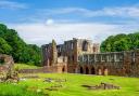
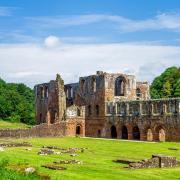
Note: Waddow Hall, a 17th century building, is the Conference and Activity Centre for Girlguiding UK. It is supposed to be haunted by the ghost of Peg O’Nell who was drowned in a well having been pushed in by the lady of the house. Apparently, Nell was pregnant with the master of the house’s child.

COMPASS POINTS
START AND FINISH: Waddington village centre
DISTANCE: 3.8 miles/6.1 km TIME: 2 hours
TERRAIN: Footpaths across fields, tracks and road. Walking shoes will be fine in good weather
MAP: OS Map OL41 Forest of Bowland and Ribblesdale
FACILITIES: The Lower Buck is part of the Ribble Valley Community Toilet Scheme