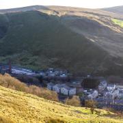
This relatively easy circular walk from Downham passes through some glorious Ribble Valley countryside.
If there was a chart of picturesque villages in Lancashire, it would take something special to keep Downham off top spot. It nestles below the steep flanks of Pendle Hill which dominates the southern skyline of the village. The village was mentioned in the trials of the infamous Pendle Witches in the 1600s and one could easily feel transported back to those times when walking around the ancient cottages and St Leonards Church.
The Downham estate is owned by the Assheton family and has been since 1558 and members of the family still manage this, and the Second Lord Clitheroe did not allow overhead electricity lines, TV aerials or satellite dishes in the village, so there is a lovely unspoilt feeling about the village.
The 1961 film Whistle Down the Wind starring Hayley Mills and Alan Bates was filmed in Downham and fans of the film still visit to see the locations that were used. Visitors are also attracted by the good walking available, both high level on Pendle Hill and low level to the surrounding villages of Chatburn, Worston and Rimington.

1. Leave the car park and turn left and cross the bridge over the river then turn left and walk uphill passing the Assheton Arms on the right and carry on towards Chatburn. Reach the road on the right to Rimington and there is a footpath on the corner that runs parallel to the road to Chatburn, go through the gate and take the path and follow this down to and then cross the bridge over the bypass and then, at the fork in the road, keep left and go downhill.
Note: Chatburn sits close to the huge Ribblesdale quarry of Hanson Cement, still called Castle Cement by locals. The village had textile mills at one time but now are all gone and replaced by housing. Chatburn Post Office was bombed during World War Two.
2. Turn left into Kayley Lane. Follow the lane until it reaches a footbridge crossing left to right. To the right is a private drive and to the right of that is a footpath, follow this and then cross a step stile over a wall on the left and then follow the path as it goes between some houses and eventually leads uphill to the bypass.

3. Cross the bypass and enter the footpath opposite, then cross the stile into an open field and carry straight on to a step stile in a wall corner then follow the path as it climbs steeply uphill and is a bit rocky at times to reach a gate stile. Cross the stile and carry straight on and then start to drop downhill.
Keep on the path as it passes a farm on the right then climbs uphill to reach a stile and cross this and, with a wire fence on the right, carry on to and cross another stile. The wire fence is now on the left. Follow the path until the fence turns left, then keep straight on across the field to pick up a wall on the left. Follow the path to a stile, cross this and carry on, with a wire fence on the left.
Reach two wooden gates, one slightly before the other, and take the right-hand gate and carry on to enter a short track and at the end head across the field to a gate between some houses. Go through the gate and drop down to the road, then turn left and then left into the car park.
Note: It seems hard to comprehend that the route of this walk was the seabed millions of years ago. The underlying geology of the area is mainly limestone, hence the Ribblesdale Quarry and because it is formed from ancient sea creatures, there is quite an abundance of fossils, some of which are quite easy to find. Worsaw Hill stands at 725 feet/221 metres high, and it is thought there was a Bronze age burial site on it.

COMPASS POINTS
Start and finish: Car park in Downham.
Distance: 2.9 miles/4.6km
Time: 1¾ hours
Map: OS Map OL41 Forest of Bowland and Ribblesdale.
Terrain: A bit of road but mainly footpaths and could be muddy in wet weather. Boots would be ideal.
Facilities: Public toilets in Downham.


