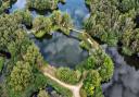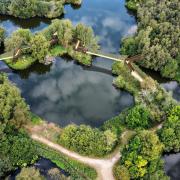


Caistor St Edmund and Venta Icenorum Roman town
Full walk:5.8 miles 9.3km
Short walk: 4.3 miles 6.8km
A walk on permissive and public footpaths to Arminghall Church.
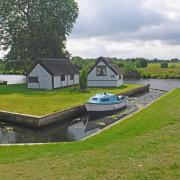
Parking at Venta Icenorum
NR14 8QL TG231 032
what3words /// basis.tailwind.hothouse
You can choose to visit the Roman town at the beginning or end of your walk.

1 From the rear of the car park, pass through the covered area with the main information board. Pass through the gate; here you have a choice of walking below the embankment or climbing the steps to walk on top of the embankment. Whichever you do, you will end up at the church; then follow the path back to the car park.
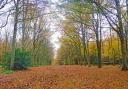
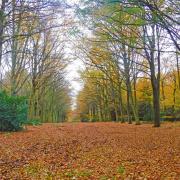
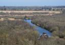
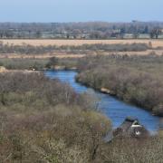
2 Leaving the main car park entrance, cross the road with care, following a permissive path at High Ash Farm to pass through Gravel Pit Plantation. You then cross a road taking the path down to the left down to Foxes Grove; turn right at the end of the woods, turn left then right to a marker post at the oak tree. Turn left up the field. Just before the road turn right, following the field edge path to a gap down to the road.
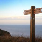
3 Turn right for a short distance along the road and take the footpath to your left. This path goes uphill. Part way up the hill there is seat with pleasant views back over the meadows. When you come to the finger post go down the small slope turning right up Hallback Lane. At this point you join the Boudicca Way; you turn right, following the track uphill to a gap on your left where the Boudicca Way comes up from your right.
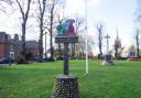
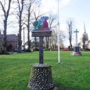
4 Follow the path on your left between the fences. Turn right then left to the drive; turn right at a road where you turn right towards Arminghall church which appears on your left. Go through the gate to the far end and out of another gate into a lane; turn right to the road and turn right. On your left are the village sign and the wooden village hall. At the fingerpost, as the road bends to the right, turn left following this path.

5 Re-join the Boudicca way by turning left. There is a seat made from a tree in memory of a horse. After following the field edge path, you will come to another well-placed seat part way down, giving pleasant views of the valley. At the bottom of the hill turn left over a bridge and follow the path to the hedge. The official path should run beside the ditch, but the path has been cut away. High Ash Farm has kindly put a path through to the fence instead. Turn right uphill bringing you to the road; turn left along the road then right on to a bridge, then follow field edges to cross another bridge and go straight on to the road.
(If doing the short walk turn right follow the path to the road cross the road through the gate and follow the path to where you came up from the Roman Fort follow back to car park.)
6 turn left and follow the road to the T-junction, then turn right. Follow the road for about 800 metres to a gap in the hedge. Follow the path which follows the road to a parking area where you may be lucky and the coffee cart will be there. Carry straight on, following the road to just before the main road. Turn right, follow the path to the gate to take you back to the car park.
High Ash Farm has kept the old permissive paths open with some help from the public and organisations including Norfolk Ramblers as we believe countryside access, especially so close to the city, is important. In the spring and summer, you have the wildflower meadows.

Caistor Roman Town
Caistor Roman Town also known as Venta Icenorum, was the largest Roman town in East Anglia. When it was first established in the AD70s, the town was unenclosed. The banks and walls visible today were not built until the 3rd century AD. The town was laid around a grid of streets, and in true Roman fashion, there is evidence of an amphitheatre to the south of the walled area, and a temple to the north-east; this temple was in addition to those in the centre of the town. The town also boasted running water, baths, a town hall (basilica), and a central public place (forum).
The site is operated by Norfolk Archaeological Trust; there are County Monument sites scattered around the walk and information boards all around the Roman town and High Ash Farm.

The Railway Tavern, Poringland
This is a traditional pub, serving classics and pizzas. They also do a small portion menu, ideal if you don’t want to fill up after (or before) your walk.
therailwaytavernframinghamearl.co.uk

The Fish Inn, Poringland
If you fancy a fish and chip lunch instead, you can call in at Poringland’s Fish Inn and pick up a tasty wrap of your favourites. The village also has a number of convenience stores if you need to pick up some supplies for the walk or a snack afterwards.