
This month we’re with the Norfolk Ramblers for a walk from the Roman Camp at West Runton

Compass points
Start/finish: National Trust car park off Sandy Lane on Camp Lane
Distance: Six miles or 9.5 kilometres
Grid reference: TG1836 4138
Post code: NR27 9NE
Ordnance Survey maps are available from all good booksellers and outdoor stores or visit the online shop www.ordnancesurvey.co.uk/al
")
Directions
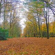
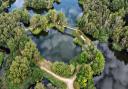
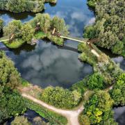
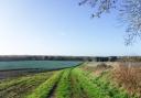
1) From the car park return along Camp Lane to the road and cross to the woods in front of you; the path goes off slightly to the left through Edward’s Plantation. At the end of the woods, pass through the kissing gate, then cross the field to the next kissing gate. After a few metres you will come to a junction of paths – take the one straight on. At the junction of paths below Incleborough Hill turn right, follow to the road, then follow to the pond. On the corner turn left, passing under the impressive viaduct. Go straight on to the main road.
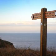
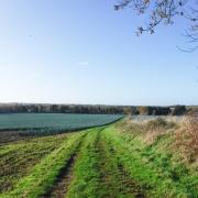
2) Cross the road, turn left. Following the road, passing the first finger post on the left, keep on the pavement up the hill to a gate. At a fingerpost into Wood Hill Caravan Park turn left, following the waymarker post. Follow the tarmac track to the end and turn right, which will take you past the reception building. Turn left then right on the main track to a waymarker that takes you diagonally across the grass towards the cliffs. Follow the path along the cliff top to Water Lane; cross the road and take the steps up to the cliffs. Follow the waymarked path along the cliffs, through the caravan park. At the finger post turn left.
3) If you are feeling extra energetic you can go straight on and climb the steps up to the top of Beeston Bump, returning the same way to re-join the path. Cross the railway with care and follow the lane ahead, again taking care as you may meet cars on this narrow lane. At the main road cross taking the marked path towards Beeston Hall School. At the end turn right along the track beside the school, then beside the horse paddocks at the top of the track at the woods turn right, passing the attractive partially-thatched cottage on your left. Follow the path along the field edge below Beeston Regis Heath. At the track in front of the house take the path; turning back on yourself climb up to the top where there is a welcome seat. There are many paths on the heath; from the seat follow the wide grass path to a marker post, turn left which will bring you to a barrier. Bear left here with the quarry to your right. Towards the end of the woods you come to a track turning left – follow this to a junction. Take the path to the left. At the end of this path turn right then left; this will bring you to a track. Turn right, follow this track passing the start of the caravan park on your right and you will come to the car park on the left.
A) The Roman Camp, Beacon Hill
Beacon Hill is the highest point in Norfolk. At its summit the hill is 103 metres (338 ft) above sea level. The hill is also known as the Roman Camp. The summit and surrounding woodlands are now in the care of the National Trust. The car park, which is maintained by donations, has benches which makes Beacon Hill an ideal location for picnics.
On the summit of Beacon Hill there is an earthwork enclosure known as Roman Camp, a name believed to be coined around the turn of the 19th century by local cab drivers to make this place more appealing to tourists.
There are reports of a watch being kept at this site in 1324, so it’s very probable that Beacon existed around this time. Historians believe there would have been a beacon here around the time of the Spanish Armada in 1588.
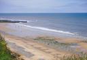
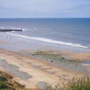
B) West Runton
In 1990, around 600,000 years after it died, the remains of the West Runton mammoth was discovered after winter seas had eroded the cliffs at West Runton, The huge pelvis was the first bone to be revealed in the base of the cliff and a year later many more bones were found. By 1992, some 25% of the skeleton had been recovered and the remainder was recovered in 1995 u
Get rambling
Norfolk Ramblers welcomes new members. If you are interested in walking in the company of like-minded people, visit norfolkra.org.uk or call 07505 426750. For queries about this walk, phone 07905 565740.
Norfolk Ramblers has established a footpath working group to do some path cutting and general maintenance. We try to make sure that all the paths in these walks are fit to walk, but if you encounter a problem please tell us.
Contact Peter James at pdjames.ramb@ntlworld.com; 07905 565740