
A six mile circular walk from the centre of Earsham
THE WALK
1. From the layby, walk towards Bungay over the Roaring Arch Bridge. Cross the road and take the public footpath beside the river. Pass through the metal gate and follow the path until you come to a narrow bridge on your right. Cross then follow the track going over the bridge. The Angles Way goes off to the left, but you carry straight on passing St Mary's Church, Ellingham, on the left. Follow the road to a marker post for the Angles Way, which takes you on a path through the village to the village hall.
2. Take Station Road opposite beside the pub - this brings you to the bypass. Cross the road with care, turn right and walk along the verge to a gap in the hedge that takes you onto Marsh Lane. Follow this until you reach Bath Hills Road. Turn right and follow the road passing the gravel pits. When the road ends take the bridleway straight on, which takes you through Bath Hills. Follow to the road then take the footpath straight on. With some views through the trees of Outney Common and the river, follow this path which goes down hill, crossing the drive to the hall through the gate.
3. Turn left, following the path around the lakes to the road. Cross the road, turn right and cross the bypass. Turn right then left to follow the path beside the old maltings development, then cross the road and go straight on along Ditchingham Dam.

4. If doing the short walk, go over the bridge and follow the road to the roundabout. Go past the shops - the Butter Cross is on the left where you join the main walk.
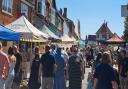
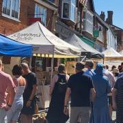
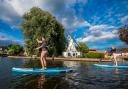
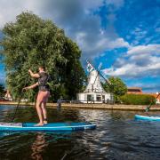
The main walk bears left into Falcon Lane, then straight on through the kissing gate onto Falcon Meadow. Follow the path beside the river. At the sluice turn right over the bridge, bear left and follow the path passing the rowing club then straight on under the old mill. This brings you to Staithe Road. Follow round to the right, then at Trinity Street go right passing Trinity Church on your right. A short way further there is a crossing place into the grounds of St Mary's Church. Follow this path to the High Street. Turn right. Just around the corner is the Butter Cross. There are refreshments available in the square and the entrance to the castle.
5. Cross the road and take the path behind the bus shelter and beside the old pub. At the entrance to the café take the path to the right - you will have good views of Bungay Castle. Then follow the path down to the pub car park which will bring you onto Earsham Street. Turn left and follow the road over the bridge, then take the pavement which will bring you to the Roaring Arch Bridge and back to the layby.

COMPASS POINTS
STARTS AT: Park in the layby on the old Bungay Road at Earsham
NEAREST POST CODE: NR35 2TA
MAIN WALK: 6.25 miles, 10.5km
SHORTER WALK: 5.25 miles, 8.5km
GRID REFERENCE: TM3292 8964
WHAT3WORDS: shifting.feast.thumb
POINT OF INTEREST

St Mary's Church, Bungay
The distinctive, lofty tower of this grand church is a landmark for miles along the Waveney Valley, which divides the counties of Suffolk and Norfolk and is the focal point of the market town of Bungay. The present church of St Mary is the parochial nave, aisles, and tower of the Priory Church of the Blessed Virgin Mary and the Holy Cross, built for an order of Benedictine nuns. It replaced an earlier Saxon church on the same site which was one of five churches in Bungay mentioned in the Domesday Survey of 1086.

Bungay Castle
This Norman castle was built around 1100 by Roger Bignold of Norfolk, and took advantage of the protection given by the curve of the River Waveney. Roger's son, Hugh Bigod, was a prominent player in the civil war years of The Anarchy and his loyalty was called into question during the early years of the reign of Henry II. Henry confiscated Bungay, returning it in 1164. Hugh went on to build a large square Norman keep on the site in 1165. It is not recorded how much it cost to build the keep, but Hugh Braun, who led the excavations at the castle in the 1930s, estimated that it would have cost around £1,400. Hugh ended up on the losing side in the revolt of 1173 -1174. Bungay was besieged, mined, and ultimately destroyed by royal forces. The site was subsequently restored yet again to the Bigods and was further developed in 1294 by Roger Bigod, 5th Earl of Norfolk, who probably built the massive gate towers on the site. Roger fell out with Edward I and after his death the castle reverted to the crown, falling into disrepair and ruin. From 1483, it was primarily owned by the Dukes of Norfolk until the 20th century.

Falcon Meadow
The historic 4.2 acre Falcon Meadow lies between Bungay and Ditchingham. It is accessed at the Ditchingham end from the junction of Bridge Street and Ditchingham Dam, and from Bungay by bridge from the Staithe.
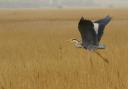
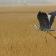
This beautiful water meadow currently provides the only remaining riverside green area in Bungay with a public right of way. It has one of the oldest public footpaths and is a valued and unique place to go to sit, fish, canoe, wildlife watch and hold riverside events.
It is owned and managed by the Falcon Meadow Community Trust, which aims to develop it as recreational space and to improve its potential as a wildlife habitat.
FOOD AND DRINK
Earsham Street Cafe in Bungay is a fabulous spot to stop off at and refuel. Set in a characterful 17th century building with a gorgeous hidden courtyard, tuck into gourmet sandwiches, soup, platter boards and all sorts of freshly baked sweet and savoury goodies - it's particularly well-known for its veggie fare.