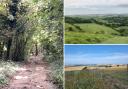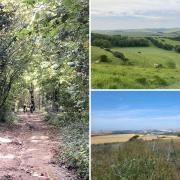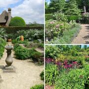


Nestling at the foot of the South Downs, Slindon is one of the most beautiful villages in Sussex steeped in culture and history.
This charming rural idyll was home to saints and smugglers and claims to be the birthplace of cricket after a 14th century mural depicted shepherds holding ‘cricks’ which looked like hockey sticks and complaints in 1622 of men breaking church windows playing cricket in a nearby yard.
Home to a population of just 500, the ‘official’ local cricket club is still playing after 250 years, while much of the land and houses here are in the care of the National Trust.
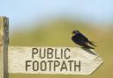
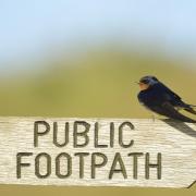
There is plenty to see here on a circular walk created by the National Trust around the village and through Slindon’s medieval deer park and its largest traditional estate on the South Downs.

THE WALK
1 Starting at the village car park (grid ref: SU960077) take the middle track away from the road. After around 275yd (250m) turn through the first gate to your left. Continue for 545yd (500m) through the woodland, until you reach the pale – a bank slanting in from the left. This was once topped with a solid fence to keep in livestock.
2 Continue along the track for around 490yd (450m) until it goes through a gap in the pale, then turn right. In around 380yd (350m) the pale bears right again. Look out for enormous white tree trunks which are relics of the Great Storm of 1987 that are now home to owls, bats, woodpeckers, and kestrels.
3 To your left, just before the pale bends right, you can see Druid's Grove which is a great picnic spot in the summer. Archaeological finds of stone tools here show that half a million years ago people worked in the village by the seaside though the sea is now miles away.
4. Within the next 275yd (250m) you pass through a stile, then the track joins a tarmac lane from your right. There’s a sheltered bench which is built into remaining fragment of wall of the village’s Regency tea room, which burnt down in the early 1940s.
5 In another 275yd (250m) the lane meets Top Road. Go right and follow the path that winds through the trees. Step over a low wall, then follow Top Road beside Slindon House, now used by Slindon College. At the next turning, go right down Church Hill.
6. Continue down until it bears left at the bottom. There is a pond to your right that is fed by a spring, and immediately after that turn right, go through the gate, fork left and follow the cobbled path through the woods until you return to the car park.
Trail Notes
Difficulty: Easy
Distance: 1.8miles, 2.88km
Duration: 1 hour
Dog Friendly but keep under control as there is livestock in surrounding fields.