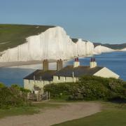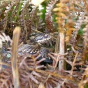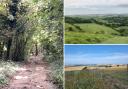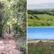

From the rolling hills of the High Weald to stunning coastal scenery where the South Downs meet the English Channel, Sussex is a county of striking contrasts, featuring countryside dotted with picturesque towns and villages, beaches and cliff-top coastlines.
But for dog owners, taking a scenic stroll in rolling countryside isn’t always a walk in the park. There’s steep terrain to consider, stiles too difficult for the larger dog, busy roads, and the chances of encountering horse riders and grazing livestock.
After a bracing hike up hill and down dale, you’ll want a hearty meal and no doubt some liquid refreshment at a traditional pub. But which ones are dog friendly? Veteran dog walkers David and Hilary Staines, and David Weller, have solved all these problems with these carefully-curated canine-friendly walks in the county

ASHDOWN FOREST, EAST SUSSEX
3 miles (4.8km)
By David and Hilary Staines
Start & Finish: Kings Standing Clump car park.
Sat Nav: TN22 3JB.
Parking: There is a free car park at Kings Standing Clump, at the start of the walk.
OS Map: Explorer 135 Ashdown Forest. Grid ref: TQ473301.
Refreshments: Although dogs are not allowed in the restaurant area, The Crown & Gate is very dog-friendly with a large garden with water bowls and a big jar of dog treats on the bar.
DOG FACTORS
Livestock: Potential to encounter livestock grazing and horse riders at any point.

The Walk
1. Walk out of the car park taking the path on the far side, opposite the car park entrance. Keep to the left of the clump of trees known as Kings Standing Clump.
Follow the path as it drops gently downhill and then slowly bears right as views of the valley open up on the left-hand side. Where three paths divert on the right-hand side in quick succession, keep going ahead.
2. When you get to the bottom of the valley keep straight ahead and climb up the other side until you finally go through a livestock gate and out onto the main road. Turn left. Be careful as there is no pavement and only a very shallow grass verge to walk on. Very soon there is a grass verge on your right-hand side and then later a pavement on the left. On the left-hand side you will soon see the pub.
3. On leaving the pub, retrace your steps to point 2. Now take the broad grassy path on the left-hand side as it climbs steadily up the hill. At the top, keep right around another clump of trees, Crows Nest clump. Follow the path straight ahead, continuing in the same direction when another path merges in from the left.
4. Initially there will be some security fencing on the left-hand side. The uninspiring-looking land on the other side of the fence has a curious history as it was chosen during the Second World War to house the world’s most powerful radio transmitter. Named ‘Aspidistra’ after a song popular at the time; the location was ideally suited to transmit messages to occupied Europe. Once the site had no further use as a wireless station, it later housed a Cold War bunker and then a police training ground. You now follow this path straight ahead in the same direction and it will bring you back to the car park.

SELSEY AND PAGHAM HARBOUR, WEST SUSSEX
3.5 miles (5.6km)
By David Weller
Parking: East Beach pay and display car park in Selsey.
OS map: Explorer 120, Chichester, South Harting and Selsey. Grid Ref: SZ 866 934).
Nearest refreshments: Beside the car park is a seasonal café while further along the seafront behind the lifeboat station in Albion Road is the dog-friendly Lifeboat Inn.

The Walk
1. From the far end of the car park, go up to the promenade and turn leftwards along it for a short distance. Turn left here; now go ahead and follow Drift Road until it bends sharply left.
2. At this sharp bend, turn right and continue along a farm track to meet a junction of tracks by Park Farm. Go ahead on a public footpath between a house and farm buildings and press on along a concrete track between fields. When it
finally bends left, maintain direction ahead along a cart track between fields.
3. At the end of the field on your right, pass by a gate and go leftwards on a signed footpath, with a large arable field to your right. At the field end, ignore a footpath signed rightwards and press on ahead to meet a farm drive.
Continue ahead, passing Greenlease Farm, and remain on this drive until it ends at a country lane.
4. Turn right along this lane that ends at the car park of St Wilfrid’s Chapel. Turn right in the car park; pass by a gate and the earthworks of an 11th-century castle to soon reach the shore of Pagham Harbour Nature Reserve.
5. Turn right along the shore to reach the shingle banks of the Inner Owers where
dogs have the freedom to enjoy themselves at the water’s edge. Continuing along the shingle or along an unmade track lined with eclectic seaside houses will bring you back to East Beach and dog restrictions.

DITCHLING BEACON, EAST SUSSEX
4.5 miles (7.2km)
By David and Hilary Staines
Start & Finish: Ditchling Beacon car park. Sat Nav: BN6 9XE.
Parking: The car park at the Beacon is pay and display but free for National Trust members.
OS Map: Explorer 122 Brighton and Hove. Grid ref: TQ331130.
THE BULL welcomes dogs in the main bar but they must be kept on a lead in the garden and are not to go into the kitchen garden area.
DOG FACTORS
Livestock: Chances of sheep along most of the route so you may want to have a lead ready. Potential for cattle between points 4 and 5.

The Walk
1. Take the broad chalk path that leads away from the car park, then go through the gate marked nature reserve with the National Trust sign on the left-hand side. Keep going ahead up the gentle slope. You are on the South Downs Way. Keep to the broad path. Very shortly you’ll reach the top of a hill which is 814 feet above sea level at its highest point. The height of the hill made it an ideal site for a warning beacon which would be lit in times of imminent invasion – hence the origin of the name.
Don’t take the path that leads downhill to the right-hand side but keep ahead on the chalk and gravel path with the fence line on the left-hand side. Pass a circular dew pond on your left. At top of the ridge, take the next path on the left-hand side.
2. Just after you have gone through another gate, turn left at the signpost reading ‘public bridleway to Chattri Memorial’. Go through the gate and take the path as it drops gently downhill. At the next gate, go through and cross the next field.
3. Just before the gate at the end of the following field, turn left down the broad track which is signposted as a public bridleway.
4. Just before farm buildings, take the path that veers left and go through the gate as the path curves up the hillside, through yet another gate at the top, and then down the other side. You will soon find yourself at the bottom of the often deserted valley known as North Bottom. Keep ahead along the track. After a short distance, go through the gate in the right-hand fence line and follow the path left, keeping the woods on your right. (If you have reached the gates where the track finishes you have gone too far, retrace your steps and you will find the correct gate shortly on your left.) At the far end of this field, go through another gate and a small grove of trees on the other side. The path will now climb quite steeply up hill. When you get near to the top of the incline, go through another gate.
5. Go ahead and at the end turn right when you come to the South Downs Way. Then there is just a short uphill climb which will return you to the car park.

WISTON AND CHANCTONBURY RING, WEST SUSSEX
6.4 miles (10.3km)
By David Weller
Where to park: Chanctonbury Ring car park. OS map: Explorer 121 Arundel and Pulborough. Grid reference: TQ 146 124)
Nearest refreshments: The Frankland Arms in Washington village where dogs on leads can join you in the bar or sleep off the walk in the garden.
DOG FACTORS
Livestock: Fenced off livestock for ¼ mile, sheep on open downland for ¼ mile (see point 6) and maybe the occasional horse rider.
Stiles: 4, easy for all but the very largest dogs.
The Walk
1. From the car park entrance, go left along the lane to soon reach a junction of tracks by Malthouse Cottage. Turn left on a signed footpath along a stony track and pass between the buildings of Great Barn Farm. The farmer requests that dogs be kept on leads here as there is livestock, albeit in well-fenced fields. Press on and maintain direction along a shady cart track.
2. Pass under an ornate footbridge and 90 yards later the track bends left. Here, fork right on a stony footpath and maintain direction. Soon the path becomes grassy with views of the downs on your right. Cross a stile and follow the path rightwards before it soon swings left to another stile.
3. Cross the stile and pass through a strip of woodland to reach an open field. Turn left along the field edge and soon follow it rightwards. Keep to the field edge as it remains parallel to a country lane on the other side of the hedgerow.
4. At the field end, go down steps to meet a crossing bridleway. Turn right on the
bridleway, which later narrows and brings you to woodland. Go ahead along a broad track between trees for 35 yards before forking left on the signed bridleway. At a second directional post, go left and ignore a kissing gate to your left. Keep to this uphill bridleway as it climbs to the top of the downs.
5. When the bridleway exits woodland it is met by another from the left; go
right. The narrow path follows a fenced field and, after swinging left, ends at
the South Downs Way long distance path.
6. Turn right now along the well-signed South Downs Way. As you near Chanctonbury Ring – which takes its name from the ring of trees on top of the hill, go through a gate beside a cattle grid. Pass the ancient hill fort and go by a second cattle grid.
7. At a fork in the track, follow the long-distance path right, where it soon begins its descent on a chalky track. When the track begins to level and with a field to your right, look out for a directional post opposite a pedestrian gate on your right. Turn sharp right here through the field, going almost back on yourself, to reach another gate at the edge of woodland.
8. Follow a wide, shady track and at a fork by tall pine trees with a field to your left, keep left. Soon follow the track leftwards to meet a junction of paths in 50 yards by field gates. Turn right through a gate and continue on a bridleway alongside woodland. Along the way pass tumbledown Owlscroft Barn.
9. Press on ahead on a footpath that runs alongside a forestry track and maintain direction to reach Malthouse Cottage. Turn left here to soon rejoin the car park.
Edited extracts taken from East Sussex Dog-Friendly Pub Walks by David and Hilary Staines and West Sussex: A Dog Walker’s Guide by David Weller (both Countryside Books, £8.99).