This delightful walk takes you through a West Dorset village that was shaped by a thriving flax and hemp spinning industry

Pymore Mill began life as a flour and hemp-balling mill, but was spinning flax by 1800. Employing 87 people in 1838, later expansion added a large mill pond, two three-storey warehouses, another mill, a dye and bleaching house, a ropewalk, a school, a manager's house, a lodging house for some female staff, and Pymore village with 27 cottages. At its peak, the mill employed 300 people producing twine for nets, yarns for fishing lines and other goods from spinning hemp and flax.
Prominent in Pymore was the Suttill family, from John Pickard Suttill in the early days to Captain Kenneth Suttill when the mill closed in 1955. Many of the old buildings have since been converted into delightful homes.
The Walk
1 Over Morbae Grove bridge, follow the road right. Crossing the River Brit on the footbridge to the converted four-storey mill by the weir, bear left into the drive with Mill Cottage left. Emerge at 'Pymore Island' sign at Thread Mill Lane bend. Turn right. Past old mill buildings and Captain Suttill's white Pymore House, seeing Morbae Grove bridge right. Turn left, with the Old School on the corner, into Suttill Crescent. Follow it round, bending left and passing Pymore House again, to the bollarded area with three-storey 'Old Twisting Rooms' facing. Turn right. Pass the left long low building, the three-storey building and several business units. Cross the yard and continue into Pymore Road.

2 Turn left. Follow the hedged lane, past Pymore Inn right, to the T-junction. Turn right/left to the footpath-stile/gate beyond the cottage. Over, follow the right hedge up the field with River Brit down to your left. Continue into the tree-lined track. Through the footpath-gateway into another field, cross to the footpath-stile. Over, cross the long meadow, keeping 50 yards from the right hedge, to the ditch-bridge gateway. Through, cross the long field nearing the right hedge. Before a half-gate into woods, turn left down to the corner gate/stile onto the Brit bridge. Over, turn right, as footpath-signed, along the field with the river right. Pass two more footpath signposts.
3 Through the corner half-gate, follow the meandering River Brit to a right stile into 'Sheep Field'. Over, bend left to the fence footpath-stile. Over, cross the field to the stiled-bridge into another field. Continue to another footpath-stile. Over, cross the long field with right barns to the footbridge and kissing-gate into another long field. Continue to the fence kissing-gate, footbridge and footpath-stile. Through the trees, follow the path left up the field, along the top trees and down to the footpath-stile/gate into a sunken lane, signed back 'Pymore 1¾'. Turn left, slowly ascending under trees for ¼ mile to the 'Melplash' T-junction.
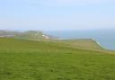
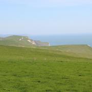
4 Waytown's Hare and Hounds is 200 yards right, but turn left to continue. Continue to Pineapple Lane junction. Fork right for 'Salway Ash'. Up the tree-shaded lane, continue over the top with views to Langdon Woods. Round the left bend, descend past Dorset Nectar Cider Farm. Down the sunken lane, take the left bridleway-track opposite Marles Farm. Rising under trees to a paths' junction, go through the facing bridleway half-gate into a high field above the Brit tributary valley. Follow the left hedge, then continue to the bridleway-stile/gate left of some huge leylandii. Through, walk down the drive past Higher Ford Cottage to the complicated junction.
5 Go slightly left to the right hedge's bridleway-gate into the top of a field. Walk down to the bridleway-gate at the stone barn's left end. Through, walk down the drive but only to the left fence's bridleway half-gate. Through, follow the field's left hedge down to the bridleway-gated bridge into a steep field. With long views, ascend against the right hedge to the gateway. Into the next field, climb to the bridleway-post at the top hedge corner. Past, follow the hedge to the corner gate onto sunken Ash Lane, signed back 'Bridleway'. Turn left. In 30 yards, take right 'Higher Ash Farm' bridleway-track. Past Ash Lane Farmhouse, continue along the concrete track and through the farmyard into the hedged track, meandering to the bridleway-gate.
6 Through, follow the right hedge down through three fields. Into the fourth, in 100 yards, take the right bridleway-gate onto a farm track. Turn left up the enclosed track. On a right bend, take the corner bridleway-gate into the hedged path to a lane, signed back 'Bridleway'. Turn left. In 100 yards, take right 'Middle Pymore Farm' drive. Reaching the windsock-post, veer left onto the bridleway-arrowed path cut across grassland. Across the landing strip, continue along the cut path and past the hedge-corner bridleway-arrows to 1½ bridleway-signed gates. Through into a field above Pymore, follow the left hedge down to the bridleway-gate left of brick barns. Through, walk down the concrete track past Pymore Terrace of 12 workers' cottages to Morbae Grove bridge where you started.
Details
Distance: 4¾ miles (7.5 km)
Time: 4 hours
Exertion: Several ascending fields
Start: On River Brit bridge, Morbae Grove, Pymore (Grid Ref: SY469945)
Map: OS Landranger Sheet 193
Public Transport: None currently
Dogs: On leads where there is livestock and in accordance with specific notices encountered on the walk and The Countryside Code
Refreshments: Hare and Hounds, Waytown. Daily lunches 12 - 2pm