This walk is a dance with the county border as Sally Mosley saunters from Staffordshire over the Dove and dabbles into Derbyshire, exploring a quartet of pretty villages in quintessential middle England along the way
Distance: 7 miles
Parking: Public car park, Church Lane, Ellastone DE6 2HB
Terrain: There are 10 stiles and 10+ gates as well as uneven terrain. Riverside meadows are prone to mud and occasional flooding. Some sections of road and lane walking are without pavements. There may be livestock in fields.
Refreshments: No refreshments available on route. Rucksack snack advisable and drinks.

Toilets: No public toilets on route
Map: OS Explorer 259
Walk highlight: Quiet leafy lanes between ancient hedgerows

Description
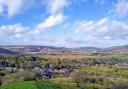
The topography of South Derbyshire is so different to that of the north of the County. Ancient hedgerows replace drystone walls encompassing a patchwork of rolling pasture and arable crops instead of wild open moors and dramatic Edges. As well as sleepy little villages, ornate red brick residences and mansions lie hidden away amid a maze of quiet country lanes and fabulous footpaths. 1 Leave the car park to follow a footpath through the churchyard, passing Ellastone Church, dedicated to St Peter. From a gate to the rear, the path leads down to a stile beside a junction on the main road. WITH EXTREME CARE turn left and walk beside the main road to cross over the narrow bridge then turn immediately right through a gate by the side of a lodge cottage.
2 Follow a grassy path along the former drive leading to the ruins of Calwich Abbey. Along the way you will pass a deep pond said to be where monks from the Abbey fished for their tea. The first building on this site was a priory built in 1148 for a cell of Augustinian canons but replaced by an abbey in 1734 and re-constructed as a large Hall in 1848. This was then demolished in 1935 leaving only the derelict stable block. Handel was a frequent visitor to Calwich, reputedly obtaining inspiration here to compose his ‘Messiah’ and ‘Water Music’. Down by the river is a fishing temple and 18th century Portobello Bridge. All are on private land and not accessible to the public.
3 Continue along the track beyond a cattle grid to Calwich Home Farm with its unusual circular building alongside. To the right of a lone sycamore in a tiny triangular junction of tracks are three gates. Head through the middle gate along a fenced drive, then go over a stile on the left which is just before a cattle grid at the entrance to a private garden. Descend the grassy bank and cross a footbridge in the hedge with stiles either side before heading across a vast meadow, aiming for Toadhole Bridge as a waymarker in the distance. This is the River Dove and county border between Staffordshire and Derbyshire.
4 Follow the bridlepath beyond leading to the road and then proceed up Littlefields Lane into Snelston with its quaint cottages, fabulous country houses and quirky village hall. In August 1971, 81.8 hectares of land around Snelston were designated as a conservation area including 55 buildings of which 20 are listed. This was at one time the model village belonging to Snelston Hall, a vast stately home demolished in 1953. The large estate is said to have contained a plantation of 80 monkey puzzle trees.
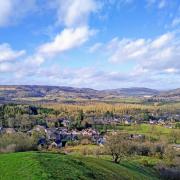
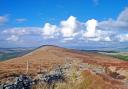
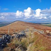
5 Head up Cackle Hill, a quiet lane between ancient hedgerows, hollowed away by the passage of time, your reward for the climb being far-reaching views toward the Weaver Hills and Staffordshire Moorlands. Continue along this quiet and peaceful road for almost a mile, until you arrive at Chapel House. Go through a gate opposite and cross fields aiming for the rear of a white painted property and a stile near to the newly built wooden garage. Be guided by arrows indicating the way around Shepherdswood leading to the drive up to Green Lane on the top of the hill.
6 Carefully cross the road and follow the footpath down to Roston, passing through a succession of fields. If planted with crops, please walk around the edge. The little hamlet of Roston was mentioned in the Domesday Book as Roschintun. On its tiny village green where The Hollow meets Bag Lane is a stone bearing a commemorative plaque for the Golden Jubilee of Her Majesty, Queen Elizabeth II and the thanksgiving for the life of Queen Elizabeth the Queen Mother.
7 At the top of the green is a fingerpost and stile. Follow the footpath in virtually a straight line over landscaped grounds set with plantations of young trees, emerging at a junction. Proceed down Bowlingalley Lane which is signposted Norbury ¾-mile. This quiet road leads between manicured parkland and fields, dotted with magnificent trees like centurial stalwarts. In summer they enhance the landscape with muted shades of green, whilst in autumn there is a golden glow from these fabulous arboreal gems.
8 Little exists of the medieval village of Norbury apart from the church dedicated to St Mary & St Barlok, Norbury Hall, Norbury Manor and a scattering of cottages (the primary school, village hall and other cottages are situated down a lane to the east). The Old Manor is well worth a visit with parts dating back to medieval times and is considered to be of exceptional architectural interest. It is owned by the National Trust with limited opening between April and October. Norbury was the principal seat of the FitzHerbert family from at least 1125, other notable Derbyshire properties associated with this family being Tissington Hall and Padley Manor.
9 Carefully descend the road to Norbury Hollow where the red brick building on the right was Norbury and Ellastone station opened in 1852 as part of the North Staffordshire Railway, originally on a branch line from Rocester to Ashbourne. The line was closed to passengers in 1954 and freight in 1956.
10 Cross over the Dove to return to Staffordshire as confirmed by the old boundary post. This bridge has long since been an important crossing of the River Dove. Just before the white painted house on your right you will see what looks like an old farm building in the field. This was in fact one of two pill boxes erected either side of the bridge during the Second World War to guard it from attack. Walk up Dove Street and turn right at the junction to return to the centre of Ellastone and the car park.
www.sallymosley.co.uk