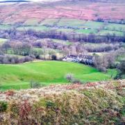
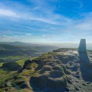
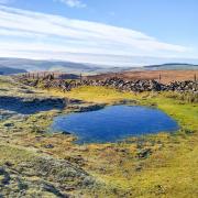
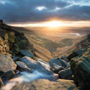
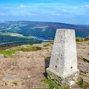
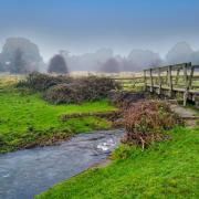
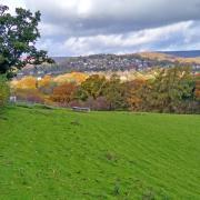
Helen Moat explores the boundary of the Peak District National Park
On the April 17 1951, Britain’s first national park was born. As the park approached its significant anniversary, Friends of the Peak District launched an ambitious project – to devise a walk that would take in the entire park boundary.
This new and exciting long-distance hike, now up and running, weaves 190 odd-miles along the boundary, just inside the national park or on its outside fringes. The hike extends across Derbyshire, Cheshire, Staffordshire, Greater Manchester, West and South Yorkshire.
For the long-distance rambler, it’s truly satisfying to come full circle almost 200 miles later in the handsome spa town of Buxton.
You can complete the entire boundary walk in one go over a couple of weeks or tackle the twenty stages one at a time over months.
The latter requires careful planning to take advantage of local transport (or two cars parked at either end of each linear route. Alternatively, you can devise your own route to create a circular walk, picking out highlights of the boundary.
My chosen route follows the first part of Stage Twelve, starting in Beeley. It takes in atmospheric woodlands and a historic quarry before looping back along the Derwent Valley Heritage Way.
READ MORE: 3 places to explore on the Peak District Boundary Walk
Beeley to the Nine Ladies
1. The walk starts from the Chatsworth estate village of Beeley, its bucolic charms echoed in street names such as Church, Pig and School Lane. Keeping the Devonshire Arms on your right, head up Brookside with its babbling stream until you reach a sharp bend in the road.
2. Turn right and cross the narrow stone footbridge. Climb two fields until you meet a country lane. Cross over the road and go through a gate, continuing in the same direction.
3. At the signposted junction turn left to climb steeply through meadows towards woodland, then diagonally right to enter Smeltingmill Wood.
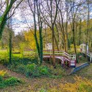
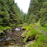
4. Inside the wood take the right fork, climbing up to pass between two high drystone walls, the site of an old mining rail or tramway of Burnwood Quarry, its Ashover gritstone used in the construction of Chatsworth House. The forest path drops down to a wooden footbridge where Smeltingmill Brook tumbles off the steep forested slopes. It’s a serene spot. Pause and feel the peace of this lovely woodland before continuing across the slope through Rowsley Wood, keeping left. Head along the forest track until it meets Chesterfield Road.
5. Turn left onto the road and almost immediately right to follow a narrow path between a hedge and dry-stone wall. The path drops down to Rowsley, passing, surreally, through a decorative wrought-iron gate beneath an arched leylandii hedge. You would be forgiven for thinking you’re entering a garden.

6. Emerging at the A6, turn right and walk through the village along the pavement. Pause on the bridge spanning the Derwent River; you’ll see the overgrown raised track of the old railway, broken by the A6 that now slices through it. There are plenty of lunch option in Rowsley from the shopping outlet of Peak Village to the upmarket Peacock hotel, the 17th Century manor house now owned by Lord and Lady Manners. If you have time, explore the Caudwell’s Mill museum and the craft shops. Here we diverge from the Peak District Boundary Walk to return to Beeley.

7. Head up Church Lane next to the Peacock. It’s worth continuing up the road to St Katherine’s, climbing the steps through the covered lychgate to the Grade II listed church constructed under the tenure of John Manners, the 7th Duke of Rutland. He laid the foundation stone in 1854 along with coins of every value from a sovereign to half a farthing.
8. Retrace your steps down Church Lane until you come to a stone-built house at the end of a car park on the left. Follow the fingerpost to pass through farm buildings and under the old railway bridge. The churned-up farm track gives to way to grassy paths that lead through fields and woodland along the banks of the River Derwent. This section of the walk follows the Derwent Valley Heritage Way before rounding a hill to meet a lane at Calton Lees.
READ MORE: Exploring the Chatsworth Estate villages of Beeley, Calton Lees, Edensor and Pilsley
9. Drop down through the Chatsworth estate hamlet to the B6012. If you have the time and inclination, Chatsworth Garden Centre stocks everything from garden plants to craft wares, and you can enjoy a cuppa at the Vines Restaurant.
10. Cross the bridge, pausing to admire the imposing ruins of the old water mill by the River Derwent, used to grind corn, with the parkland of Chatsworth House, the edge and moorland above the estate all proffering heart-soaring vistas.

11. Go through the kissing gate on the right at the end of the bridge and follow the broad grassy path between trees. The floodplain pathway emerges at Beeley. Cross the road to the village and put your feet up (metaphorically speaking) at the Old Smithy or the Devonshire Arms.
READ MORE: Short break - The Devonshire Arms at Beeley
AT A GLANCE
Start point: The Devonshire Arms, Beeley; Grid ref: SK 2609 6844
Parking: There is some parking in the village; please park considerately.
Map: OS Leisure – LO24 – the Peak District, White Peak.
Terrain: Easy with a short, sharp rise up to Smeltingmill Wood and the occasional incline in the woodlands.
Distance: Just over 6 miles
Refreshments: Lots of choice: café and pub at Beeley, fine dining and good-value pub fare in Rowsley alongside café options at Peak Village and Caudwell’s Mill.
Calton Lees offers breakfast, brunch or lunch at the garden centre. I recommend the mill café at Rowsley with its delicious homemade food and lovely views overlooking the mill leat and tree-topped hill.
Useful information: The Peak District Boundary Walk guidebook, published by Friends of the Peak District, gives invaluable information on the long-distance walk along with detailed maps.


