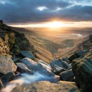
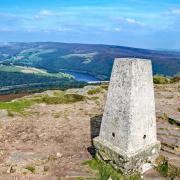
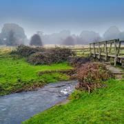
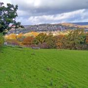
A fascinating ramble starting in Cromford and ascending to Bonsall, famous for hen racing, UFO sightings, magical open gardens and much more!
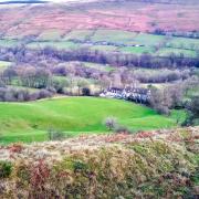
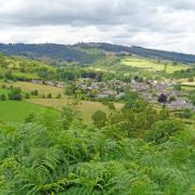
Description: Starting at the UNESCO World Heritage Site at Cromford, this moderately challenging walk passes mills, mines and marvellous buildings on an ascent to the hilltops for far-reaching views. Leave behind the hustle and bustle in the valley below to enjoy the peace and tranquillity of traditional hill farming countryside and ancient woodland with a wander around Bonsall, famous for hen racing, UFO sightings and much more!
Distance: 7 miles
Parking: Various car parks at Cromford Mill (pay & display)
Terrain: Eight gates, six stiles and numerous sets of steps. Some roadway without pavement. Fields with livestock. Narrow woodland paths with trip hazards and steep slopes. Close proximity to watercourse and deep water in mill ponds. Steep ascents and descents on good paths or roadways.

Refreshments: Fountain Café and The Barley Mow, Bonsall
Toilets: Public toilets at Cromford and Fountain Square, Bonsall
Map: O.S. Explorer OL24 – White Peak
Walk highlight: Bonsall’s old market cross
1 Walk up Mill Lane to the traffic lights and cross into Cromford village. Turn right in the Market Place and walk up Scarthin with promenade walk overlooking the mill pond, passing Scarthin bookshop with its labyrinth of rooms containing more than 100,000 books.
2 For a relatively small village, Cromford once had a number of chapels, most have now been converted into dwellings or are used for business purposes rather than prayer. Continue to the main road passing the red brick former Primitive Methodist Chapel of 1853 and Cromford Garage beyond. At one time the Scarthin Mission Room, now a car ramp and tool chests have replaced pews and pulpit. Use a footway to reach Chapel Hill where the derelict building was once a Methodist Training School.
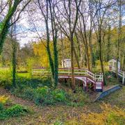
3 At the top of Chapel Hill carefully follow a narrow footpath as it climbs through woodland which in spring and summer is carpeted with wild flowers. Leave behind the noisy Via Gellia road as you scale the steep slope beneath Harp Edge. Ignore paths leading off to the right.
4 Follow the perimeter fence of Ball Eye Mine and Quarry which produced dark blue fluorite, barite, malachite, cerussite, smithsonite and anglesite. The footpath will merge with a bridlepath and then become a gated track across fields as you descend to Bonsall, entering the village at Town End and passing Herbert Lodge which looks more like a French château than an English country house.
5 Follow Church Street into the centre of the village passing the primary school and Church dedicated to St James. Standing elevated from most of its congregation, the church is reputed to have the highest chancel in England. Dating from the 13th century, much of the existing structure was rebuilt in 1862 when a medieval stone carving of a lead miner known as T’Owd Man of Bonsall was sent away for safe keeping. By the time work was completed the carving had been incorporated into a wall of Wirksworth Church who refused to send it back! A copy of the carving can be seen by the information board in Bonsall’s Market place.
6 You will arrive at Bonsall Cross which sits atop 13 circular steps, dominating the former Market Place and junction of roads. Take a few minutes to look around. Notice an old building with a long row of windows, situated above the seated area. This old workshop is a survivor from the days of cottage industry and framework knitting. From the 17th century, stocking frames would have been rented from a hosier who also supplied the raw materials and then bought back the finished products. Records from 1844 show that 143 frames were still being worked in Bonsall.
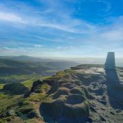
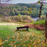
7 Head to the right of the King’s Head car park and follow the footpath sign to a narrow walled path known as Stepping Lane which is said to have been resurfaced by German prisoners of war in the 1940s. Ascend several flights of shallow steps and then cross a couple of fields and stiles to Uppertown at the top of the village. Conveniently placed seats on the crest of the hill provide far-reaching views over to Black Rocks and Crich Stand. In fields on either side are the scars of lead mining, an industry that once exploited these limestone hills. Gentlewoman’s Pipe, Perseverance Mine, Godbehere Mine, Tailor’s Venture Vein and Tearbreeches Mine are just a few of the amusing names to be found in the area.
8 Emerging from Bell Lane, turn left to Bankside as the road zigzags steeply downhill. You are now walking on the boundary of the Peak District National Park, but will leave this behind as you follow the road down Bonsall Dale where there are ‘character’ properties including another frameworkers building dated 1737. Beyond is the Barley Mow pub, home to the World Championship Hen Racing. Also notice pigeon lofts dotted around – Bonsall pigeons have been raced from as far away as the Pyrenees, clocking up speeds of some 70 mph!
9 Arriving at Fountain Square notice the interesting plaque on the water fountain which was erected to the memory of Henry Forth of Manchester in 1870. With the recreation ground on your left follow the steeply descending Clatterway road to Via Gellia Mill. Use the footway where possible. From Uppertown at the top of Bonsall to the former Pig of Lead pub at the bottom is a drop of some 400 feet.
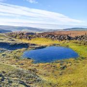
10 Carefully cross the main road and follow the footpath opposite between the mill building and deep pond where dragonflies dart about in summer sunshine. Head up a flight of steps at the start of an old path where miners from Bonsall once walked to work underground and millworkers from Middleton came down from the hilltop to work at their machines creating the fabric Viyella, a mix of wool and cotton, which was first created here.
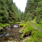
11 After the first gate turn left on a concessionary path passing the shell of a field barn and cross Dunsley Meadows Nature Reserve to enter Slinter Wood. Follow the path down to Slinter Cottage which was for a time a bobbin mill. Continue along ‘The Goat Path’ beside Bonsall Brook as it trips and tumbles over a succession of little weirs to Cromford, resting every so often at mill ponds where its energy was once harnessed by waterwheels.
12 Arriving back at the village, carefully walk down a flight of steep steps and head past the former corn mill of around 1780 which was built by Richard Arkwright to serve the village. Turn right and follow Water Lane to the junction with Cromford Hill where you can see Arkwright’s Store with original shop front and terraces of millworker’s cottages lining the road. Head back to the traffic lights to end your walk at Cromford Mill.
Bonsall Magical Open Gardens can be viewed on Saturday 27th and Sunday 28th June.


