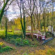
On the border between Derbyshire and Staffordshire, Sally Mosley takes a fabulous rural ramble which passes a succession of historic houses, crosses a ‘double-decker’ bridge and ends in an eerie tunnel
DISTANCE: 7 miles
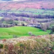
DESCRIPTION: Ashbourne may be a treasure trove of Georgian architecture but this walk through stunning countryside of rich pastures and riverside meadows, and along ancient tracks heads back even further in time. Middle Mayfield and Upper Mayfield contain a wealth of 17th century properties with even older parts. Look for blocked-up windows from long ago tax avoidance, see wild flowers in abundance and enjoy a stroll along Piccadilly Lane!
WALK HIGHLIGHT: The charming properties of Middle Mayfield. Well Dressings 25th June to 1st July
PARKING: Mapleton Lane Car Park, Ashbourne, DE6 2AA (pay & display) Grid Ref: 176469

TERRAIN: Eight gates. Eleven stiles. Roadway without pavement. Areas prone to mud. Livestock grazing. Eroded holloway with stream. Close proximity to river. Steps and trip hazards
REFRESHMENTS: Kiosk café at Mapleton Lane car park; The Royal Oak, Hanging Bridge; Rose & Crown, Middle Mayfield
TOILETS: Mapleton Lane car park
MAP: OS Explorer 259 – Derby

1 Exiting the car park turn left and walk uphill approximately 100 yards. Go up steps on the right opposite the speed restriction sign and follow a footpath initially between hedgerows and then along the top of fields where there may well be horses, donkeys and alpaca grazing. After the sixth field (seventh stile), descend the next field diagonally keeping to the top side of a telegraph pole in the middle of the field to avoid mud. Follow a short stretch of wall heading right to a stile by Bentley Brook which is on its way to unite with the Dove.
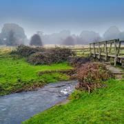
2 Cross the following field with the brook to your right, ignoring a footbridge and proceed to the far corner to pass through a gate. Walk to a raised embankment and turn right to follow this elevated path as far as the River Dove. At the river turn left and go over a stile along a footpath to the main A52 road, emerging at the side of The Royal Oak.
3 Cross the main road with care then head right over Hanging Bridge taking you into Staffordshire. On 7th December 1745 the retreating army of Bonnie Price Charlie rode through here on its return north. The rebels shot an innkeeper and a local man named Humphrey Brown who refused to hand over his horse. Many of the villagers locked themselves in the church for safety. It is said that some of the soldiers were caught, tried for their actions and then hanged from gibbets erected by the bridge. Along with Gallowstree Lane these are grisly reminders of their fate. Having crossed the bridge look back to see that when it was rebuilt and widened in 1937 the arches of the 500-year-old bridge were left beneath. The large cream-painted building at the junction, now apartments, was at one time the impressive Queen’s Arms Hotel.
4 Turn left and walk approximately 100 yards along the B5032 to see Rock Cottage opposite. This was a cellar built into the bank to the rear of a much larger house, one of a terrace that was demolished in 1922 when the road was widened. Cross over where safe and return to the junction to head up Old Bank.
5 Walk up this steep and narrow old road to Upper Mayfield which is an assembly of feature properties offering photographic opportunities every few yards. After passing Gallowstree Lane on your left you will come to the old Methodist chapel on your right, now a private house.
6 At a crossroads with the impressive and elevated 18th century Corner House facing you, turn left to walk along Piccadilly Lane with cottages dating back to the 17th century as well as more modern housing. Old Hall Farm on the left dates back to 1680 and was at one time the manor house. It has several blocked- up windows, probably to avoid the Window Tax introduced in 1696 but repealed in 1851 when campaigners argued that it was in fact a tax on health, light and air.
7 After Old Hall Farm take a footpath on the left by a fingerpost sign. Walk past the pond and descend fields and stiles, emerging at the side of the water pumping station which was erected in 1912.
8 Turn right and follow Slack Lane which soon becomes a grassy track and holloway.
9 At the end of Slack Lane turn right and follow Hall Lane to yet more historic houses. On the corner are Holme Farm on the right, which dates in part to 1440, followed by the impressive Mayfield Hall. Although Georgian in appearance, it is on the site of a much older property built on land granted to Henry de Ferrers by William I. Beneath the hall are cellars and passageways thought to date back to the 12th century. A little further along the lane on the left are Brook Farm, c.1580, a stone-mullioned late Elizabethan hall, and Mayfield Cottage, c.1720, built for John Barr, an ironmaster who incorporated a lot of ornate metalwork into his home. On the right is Old Hall Farm, c.1620, a beautiful Jacobean house.
10 Opposite Old Hall Farm is a short footpath which crosses a field to the B5032. (The Rose & Crown is at the end of the lane on the opposite side of the main road.) Turn left and follow the main road a short distance to the junction with Church Lane. Cross carefully and follow the lane to Church Mayfield.
11 St John the Baptist Church is Saxon in origin. The first house of worship on the site was erected in 1125 but was replaced by a Norman structure. The tower was added in 1515 and its door still has bullet holes dating back to the raid by the Young Pretender’s troops in 1745 mentioned earlier.
12 Continue walking through Church Mayfield and, shortly before the sign for Coneygreve Lane on the wall of Mayfield House, turn right down a footpath on the right by an information board. Walk past houses on your left and descend to the old Mayfield Mill complex. After crossing the mill stream turn left and walk through The Terrace of 1849 which comprises 40 houses in five terraced rows built by mill owners Joseph and George Simpson for their employees.
13 After the houses, bear right along The Line, a track bed which eventually leads to the former Clifton Railway Station, crossing back over the Dove into Derbyshire along the way and passing Dove Cottage which is thought to have been the home of the mill manager.
14 At the junction cross to a grassy area where you will find a plaque on the site of the old Clifton corn mill which from 1798 has been used as one of the goals for the Ashbourne Royal Shrovetide Football match. After the mill was demolished in 1967 a stone was erected as the Down’ards goal.
15 Cross the footbridge over Henmore Brook and follow the footpath across meadows with the meandering watercourse to your right. Reaching Doles Farm, the waymarked path leads you between the farmhouse and a large new cattle shed. Continue on the footpath with Henmore Brook still to your right, crossing stiles and a field, eventually emerging from a stile in the hedge by a small roundabout.
16 Cross the road with care and walk past the burial ground to enter Ashbourne along Mayfield Road. Walk to St Oswald’s Church with its needle-like spire. Inside is the renowned Carrara marble monument to Penelope Boothby in the form of a sleeping child, said to be the work of Thomas Banks. Note also the unusual gate piers on the main entrance – the pointed tops are held in place by carved stone skulls.
17 Continue along Church Street which contains some of the best properties in this fascinating market town, such as the Mansion House, Grammar School and almshouses.
18 Arriving at the first of the antique shops for which Ashbourne is renowned, turn right down Station Road. At the traffic lights turn right onto a track and head through the tunnel to end your walk. Do not be surprised to hear the sound of steam engines but fear not because it is only a recording played through speakers! w
NB: My thanks to Mayfield Heritage Group www.mayfieldheritage.org.uk for providing many of the snippets of interest in this article by means of an information leaflet and the series of beautifully illustrated boards placed throughout the village.


