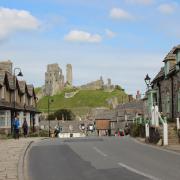
Edward Griffths follows the trail of the mighty Stour as it reaches the sea at Christchurch

On previous Dorset magazine walks we have seen the River Stour, at various stages along its 64 mile journey, grow from a gentle stream to a substantial river powering several mills. On this walk, we will see the Stour as a wide highway with anchorage for five lanes of pleasure craft and two lanes for moving boats and rowing club activities. During this walk we cross Wick Fields to see the Stour, wide enough for the ancient Wick Ferry to still operate, upriver from Christchurch Priory. Then, after exploring Hengistbury Head, where people from Stone Age to Romans lived and worked, we walk to Mudeford Spit to watch the river racing out into the sea through the narrow harbour entrance. We finish by strolling along the harbour edge with its reed-beds, creeks and important wildlife reserve. *If you wish this walk can be split into 3½ miles by returning to the start after visiting Wick, or 4½ miles by only doing Hengistbury Head to Mudeford Spit and back, just follow the instructions in the text.

--------------------------------------------------
Distance: 6 miles (9.5km) *Shorter versions of walk 3 miles or 4 miles (see intro text).
Time: 4 hours.
Exertion: Not too strenuous. Short ascent of Hengistbury Head. Some beach walking. No stiles.
Start: Hiker Café, Hengistbury Head Pay and Display Car Park (Grid Ref: SZ163912).
Map: OS Landranger Sheet 195.
Public Transport: In school summer holidays, Yellow Buses number 12 runs between Christchurch and Sandbanks via Hengistbury Head
Dogs: On leads at all times.
Refreshments: Hiker Café in the car park for breakfast, lunch and cakes. Mudeford Spit Café for breakfast, lunch and dinner.
--------------------------------------------------
The Walk
1 For the 4½ mile walk, walk to the cliff edge and start at Point 3. All others, from the café, walk down the Land Train’s tarmac lane. Immediately past the Outdoor Education Centre’s drive, take the left ‘Holdenhurst 4½’ signed grass path through gorse, soon crossing that drive to the kissing-gate onto ‘Wick Fields’ gravel path. After ½ mile through bushes and wildflowers, pass a left turning and cross a boardwalk signed ‘Holdenhurst 4’. Continue along the path above reed-beds. Through the end half-gate, cross the field to the right corner signpost. Bend right. Through another half-gate, follow the fenced path to the half-gate onto the River Stour riverside path. In 100 yards, go through the facing hedge-gap. Past a little creek and slipway onto the stone-edged green, turn right to see Wick Ferry plying its centuries-old trade. Now, turn around and walk to the road, Wick Lane, with Wick House opposite.
2 Turn left along the road. At the fork, keep Wick Green on your left, then ignore turnings off. Around the right bend, continue into ‘Cycleway 2’ path with the left school fence. Around the end gate and into Thornbury Road, turn left. Take the ‘Hengistbury Head 1½’ cycleway, passing St Katherine’s School, into Rolls Drive. Passing Selfridge Avenue right, continue along meandering Rolls Drive, with left Solent Meads Golf Course, to Broadway. Turn right and cross left into Southbourne Coast Road, with Saint Nicholas’ church on the corner. In 100 yards, turn left into Solent Beach Car Park. Beyond the barrier, go around the right gate onto the sandy path to the low cliff edge. Carefully, descend to the beach and turn left. Follow the shoreline, passing two wood-groynes and a rock-groyne. Reaching a second rock-groyne, go back up the low cliff, before the gabions (rock cages). Return to the car park to end the 3½ mile walk.
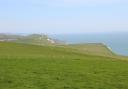
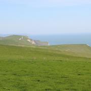
3 For the 4½ and 6 miles walks, join the cliff-top tarmac path passing ‘Double Dykes’ and ‘Barn Field’. Ignore any left turns. Stay on the main path, passing ‘Natterjack Toad’ enclosure. Climb Warren Hill steps to the OS trig point and Rotary Club’s viewpoint map. After the old Coastguard Station, continue along the tarmac track and keep right at the next fork. Pass ‘Quarry Pond’ and go through bracken and heather areas to the fenced viewpoint overlooking Mudeford Spit. Go down the wide steps to the beach huts. Take the sand ‘track’ right of the huts, or follow the shoreline and scramble over the rock-groynes. Whichever you choose, in ¼ mile, pass the gap to Beach Café. Continue, past more huts behind sea defence walls, onto a firmer and easier track.
4 After the last beach-hut, on legs, continue past fenced dune areas to the end of Mudeford Spit with Mudeford Quay opposite. The ‘Stour Valley Way’ begins here, so you can now make a start, but rest awhile first. Eventually, turn around and follow Christchurch Harbour’s edge, passing the Black House and conveniences. Stay on the track past the beach huts and Beach Café with Hengistbury Head facing you. Past two more WC blocks, with Mudeford Lagoon SSSI right, the track becomes tarmac at the Land Train terminal. Catch it, or continue walking, bending right when the beach huts end, into shady trees. Stay on the lane, ignoring all side turnings, then along the harbour’s reed beds with creeks and grazing cattle and Christchurch Priory far beyond. After the new Visitor Centre, continue along the lane back to the car park and Hiker Café.