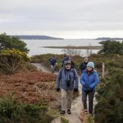

Edward Griffiths enjoys some of Bournemouth’s glorious green spaces including a nature reserve named after a smuggler and a fine country park created from a common
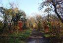
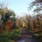
When the trees are decked out in their glorious autumn colours this is an especially fine ramble. Looking at this walk’s highlights in order of discovery, Central Gardens were acquired by Bournemouth Council between 1871 and 1921, before which they were known as Decoy Meadow with a large pond used for wildfowling. The pond was re-instated further upstream at Coy Pond in 1888.
Pug’s Hole Nature Reserve, in a densely wooded valley, is believed to be named after Captain Pug, a local smuggler who hid his ill-gotten gains here. The area was planted with pines around 1816.
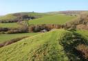
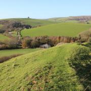
Talbot Heath, part of the Bourne Valley Nature Reserve, is a rare survivor of the ancient heath which once ran between Christchurch and Dorchester. The landscape is dominated by gorse, heather and silver birch and there are Bronze Age barrows here dating from 2200-800BC.
The land for Meyrick Park, previously known as Poors Common, was given to Bournemouth by Sir George Meyrick, together with four other parks, in return for common land which was enclosed. Through here, we follow Tapps Trail, named after Sir George Ivison Tapps and his son Sir George William Tapps-Gervis who were instrumental in creating ‘a marine village and watering place for the genteel elderly’ and developing ‘a select seaside resort as famous as Brighton and Weymouth’.
Information
• Distance: 3 miles (4.75km)
• Time: 2½ hours
• Exertion: Not strenuous. No stiles. Some mud after rain.
• Start: Bournemouth’s War Memorial, Central Gardens (Grid Ref: SZ085913)
• Map: OS Landranger Sheet 195
• Public Transport: Untold numbers of Bournemouth’s Yellow Buses run from The Square
• Dogs: On leads in nature reserves, golf course and roads
• Refreshments: Restaurants and cafés galore around The Square nearby.
The walk
1. From the War Memorial, with the Town Hall up to your right, take the Tarmac path upstream. At the fork, go right. Pass the tennis courts on your left. Up and over, below the Wessex Way flyover, continue into Upper Gardens. Ignore all side paths. Across Queen’s Road, keep straight on for ‘Coy Pond’, instantly leaving the main track to follow the low level arrowed path nearest Bourne Stream. Again, ignore paths off. Pass the 1885 Victorian-gothic Water Tower which provided power for a sprinkler system and large fountain. It is now a favoured roost for bats.
2. Join the main track below right gardens and continue to Prince of Wales Road. Cross into Upper Gardens for ‘Coy Pond’. Stay on the Tarmac track with the stream, bog and boardwalks below. Continue past a left fork before leaving at the junction of Branksome Wood Road in Bournemouth and Coy Pond Road in Poole. Cross carefully and follow the shale path through Coy Pond Gardens to the bow-shaped steps. Up these, cross the road. Walk left of Coy Pond to the road’s left bend. Here, take the gravel path under trees with the stream right. Go up the facing steps into Wren Crescent. Turn right. On the bend into Thwaite Road, take left Wren Crescent cul-de-sac and walk up the steps between two garages.
3. At the top, turn left for ‘BR No 36 Talbot Heath, Bourne Valley’. Over the railway bridge and through the gateway, meet a paths’ T-junction signed ‘Bourne Valley Local Nature Reserve’. Cross right/left. Follow the heath path, past a right fenced enclosure and aerial mast, to a staggered junction. Turn sharp right, doubling back. But, first, turn left and walk straight to the viewpoint for a better appreciation of the extent of Talbot Heath. Having doubled back at the junction, walk towards the mast you just passed. In 25 yards, turn sharp left. Through gorse and bracken into trees, cross another path and leave through the barrier/gap into East Avenue, back into Bournemouth.
4. Walk along East Avenue. Take first right Rothesay Road. Over the railway bridge, turn right towards Talbot Heath School. Take the left signed ‘FP No A17 Pugs Hole’ narrow path alongside No 27’s fence. Follow the tree-rooted path down under pines, and turn left at the first T-junction into Pug’s Hole valley path, soft with pine needles. In 300 yards, with vehicle noise ahead, take the left fork. Past the Pug’s Hole Information Board, leave through the gateway into Glenferness Avenue. Cross over and turn left. At the top, turn right into Leven Avenue.
5. Reaching right Walsford Avenue, cross left to the footpath opening into Meyrick Park Golf Course. Turn instantly right to follow the arrowed ‘Tapps Trail’ footpath through trees alongside the road. Meandering and undulating, passing two more footpath-posts, walk alongside right garden walls and fences, left fairways and more right walls. Finally, with increasing traffic noise, descend steps by Wessex Way onto the ‘B13 Braidley Road’ Tarmac path. Down under the flyover supports to Braidley Road, turn right. Under 1921 St Stephen’s Bridge with St Stephen’s church above, pass the right Town Hall. Reaching Bourne Avenue, cross to the steps back down to the War Memorial where you started.
More…
- The ultimate Dorset walking guide - our complete guide of amazing walks all around the county
- The best autumn walks in Dorset - great walks to enjoy the falling leaves and changing colours