
Edward Griffiths traces the boundaries of an airfield which hosted some magnificent men in their flying machines at the 1910 International Aviation Meeting
Without Dr Thomas Armetriding Compton, there wouldn’t be any Southbourne. Dr Compton started to practice in Bournemouth in 1866, so successfully he was able to buy vast areas of land east of Bournemouth including a mile of heathland fronting the cliffs and reaching ¼ mile inland. In 1875, he bought farmland with an oak wood called Foxholes. Here, in 1876, Henry Reeve, Registrar to the Privy Council built Foxlands House. More detached and semi-detached properties were subsequently built and Dr Compton called his developing ‘village’ Southbourne.
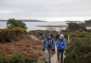
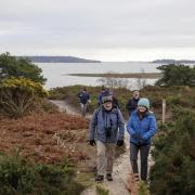
Southbourne had its own aerodrome, now replaced by residential properties, and this walk traces its boundaries. There wasn’t a specific runway but pylons on four corners of a trapezium-shaped flying circuit for the 1910 International Aviation Meeting held between 11 and 16 July 1910. There were speed competitions over eight circuits of the trapezium-shaped course, totalling five miles, and flights to the Needles. Tragically, aviation pioneer the Right Hon Charles Rolls of Rolls-Royce fame was killed when his plane crashed in what is now the playing field of St Peter’s School, the first Briton to die in powered flight.
Information
• Distance: 4¼ miles (6.75km)
• Time: 3¼ hours
• Exertion: Easy. Level roads and seafront promenade
• Start: Solent Beach Car Park, Southbourne Coast Road (Grid Ref: SZ157912)
• Map: OS Landranger Sheet 195
• Public Transport: Yellow Bus 33
• Dogs: On leads at all times on this urban walk
• Refreshments: Five or six cafés and coffee shops in Southbourne Grove
The walk
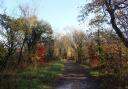
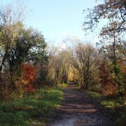
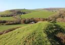
1. Take the north-east corner path over the embankment and turn left along the diagonal path to the Broadway’s pedestrian ‘refuge’. Turn left. You’re now walking practically up the centre of Southbourne Aerodrome arena. Past right Rolls Drive, named in honour of Charles Rolls, cross the junction of Southbourne Coast Road and pass left St Nicholas’ Church. Pass Clowes Avenue left and Selfridge Avenue right, named after Gordon Selfridge who had grandiose plans to build endlessly on the vast open ground, and a mansion for himself on Hengistbury Head. Turn left into Harbour Road. Take third right into Hengistbury Road.
2. You’re now following the Aerodrome’s south-west boundary. Rising gently, pass Cellars Farm Road. Notice the higher ground to your left, ideal for the main grandstands which overlooked the Aerodrome’s flying arena down to your right. Cross Willsdown Road. After right Nugent Road, continue into the blue-gated ‘Public Highway’ path, still following the Aerodrome’s boundary, with St Peter’s School left and the playing field right. Sweeping round to the north in an arc, grandstands and motor enclosures filled all of the left areas, with prices ranging from 2/6d to 10/- (12½p to 50p) per motor including uniformed chauffeur. In the playing field’s far corner there is a memorial plaque marking the spot where Charles Rolls died.
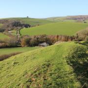
3. Emerging into Sunnylands Avenue, walk past the fourth left house. Take the narrow Tarmac path between houses into Southlands Avenue. After the first left house, take another fenced Tarmac path into Belle Vue Road. Cross the pedestrian crossing. This mile-long road was laid out for access to the Winter Garden built in 1874 near Bolton Road on the cliff top. Turn left. Take first right Foxholes Road. Rising and bending left, there are good views to the New Forest. Continue to second right Guildhill Road. Crossing Ken Road continue up to the signed ‘Seafield Gardens’, laid out in 1929 on existing Turbary Common. Walk straight on through and turn left after the impressive water tower. Dr Compton first arranged to share the area’s water supply from Tuckton to Boscombe’s water-tower before building Southbourne’s own water tower here in 1898. Continue past the tennis courts into Seafield Road. Turn right then left up Tuckton Road.
4. Meander to the Belle Vue Road and Southbourne Road junction. Keep straight on, passing right Immanuel Church, Carbery Avenue and Irving Road, and left Carbery Row parade of shops. Continue along Southbourne Grove with a second parade of shops left and more shops right. At the left parade’s end, turn left into Portman Terrace. Past left Fisherman’s Avenue, take the Tarmac path through wooded Fisherman’s Walk, passing the Victorian Bandstand. Reaching the sunken garden and fountain, go through to Southbourne Coast Road. Over the pedestrian crossing, walk down to Fisherman’s Cliff Lift with views right to the Purbeck hills and left to the Isle of Wight.
5. Go down the left Tarmac path. At the first bend, take the steps down to Southbourne Promenade. Follow it, passing Gordon’s Zig-Zag, St Catherine’s Path and Warren Edge with Hengistbury Head coming ever closer. A 1/3 mile Esplanade was built in 1885 with a terrace of six large houses, and an 880ft iron pier was opened in 1888. The promenade and pier were badly damaged in winter storms in 1900. The Esplanade was abandoned and the houses demolished in 1902. The pier was demolished in 1907. Continue along the narrowing Promenade and past a left fork. At the end, walk up the steps to Southbourne Coast Road and the car park where you started.
More…
• The ultimate Dorset walking guide - With Durdle Door, Brownsea Island, Jurassic Coast and a whole host of other stunning sights, Dorset is an amazing place for a stroll