Derbyshire is home to an embarrassment of riches when it comes to walking destinations. In this inaugural County walks: the extra mile feature, we explore why Chrome Hill, Crich as well as Linacre and Old Bramton provide perfect inspiration for plotting your own walking itineraries.

CHROME HILL
Location: Peak District
Map: (O.S. Explorer Map OL24 – Grid Ref: 071672)
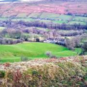
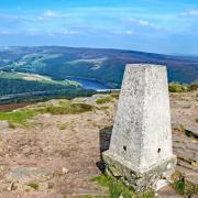
Affectionately known as the Dragon’s Back or Sleeping Dragon, this ‘Cornish Pasty’ shaped hill with a summit at almost 1,400 feet sits on the Derbyshire side of the upper River Dove not far from the quaint little village of Hollinsclough.
It is surrounded by footpaths, bridleways and old hollowed-away routes amid a chain of other strange shaped hills. There is a concessionary footpath over the spine of Chrome with dangerous sheer drops, not suitable for anyone with a fear of heights! However, to the rear of the hill is an alternative and easier path.

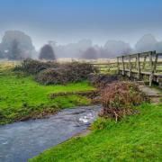
Nearby is an ancient track, now rough and badly eroded, that lies between Tenderhill and Booth Farm. It crosses the Dove and county border at Washgate Bridge, which still retains its original cobbled surface and low sides.
This area of the Peak District National Park abounds with a maze of footpaths and rights of way offering a permutation of routes.
Hollinsclough comprises a historic chapel, village hall, primary school, hill farms and a little cluster of quaint cottages. Reputedly the village had a small silk weaving industry during the 18th century with silk being transported to mills in Macclesfield by pack ponies using old ways that can still be seen to this day as there have been few changes to the landscape hereabouts.
The road along Hollinsclough Rake provides sweeping views across the valley toward other dramatic reef knoll hills including Parkhouse, Hitter and High Wheeldon.

CRICH
Location: Amber Valley
Map: O.S. (Explorer Map 269)
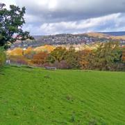
Perched on a rise above the Derwent Valley, Crich is a fascinating village offering a variety of walks into nearby countryside.
Crich featured as Cardale in several series of Peak Practice in the 1990s before filming was transferred to Hartington. At the top of the village is an old cross in the middle of the road. Evidently, this is the site of the medieval market place where an annual fair was once held with people selling cattle, poultry, eggs, butter, pigs and pedlars wares.
The Church of St Mary’s has a 14th century tower and spire. Within is said to be a memorial to John Clay whose first wife was the daughter of William Calton, reputedly the chief Cock Matcher and Servant of the Hawks to Henry VIII.
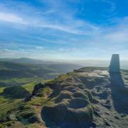
Crich Stand is a Regimental Memorial Tower. From the top of the Stand at 1,000 feet it is reputedly possible to see into five counties and with a telescope make out Lincoln Cathedral – on a clear day!
Crich Tramway Village is a famous local attraction first opened in 1959 as a museum following the purchase of its first tram from Southampton Corporation in 1948 for the princely sum of £10.
Cromford Canal was built by railway pioneers Jessop and Outram, and opened in 1793. Parts of the canal are now a nature reserve where some 250 species of plants have been recorded along with 80 species of hoverfly, butterfly, dragonfly and damselfly as well as over 50 types of birds. That’s a lot of fluttering wings!
LINACRE AND OLD BRAMPTON
Location: North East Derbyshire
Map: (Explorer Map 269)
As Derbyshire is landlocked with no seaside to saunter beside we can console ourselves that the county has a raft of reservoirs and stunning dales for some waterside wanders.
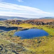
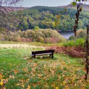
Only a couple of miles as the crow flies from the famous Crooked Spire, Linacre Reservoirs are sited on the outskirts of Chesterfield, nestling in rural tranquillity close to the pretty little village of Old Brampton.
An on-site information board states that permission was granted by an Act of Parliament for the Lower Reservoir to be constructed in 1855 (holding capacity 140 million litres) followed by Upper Reservoir in 1885 (575 million litres) and Middle Reservoir in 1904 (410 million litres). Prior to 1909 the water was unfiltered before being pumped to customers, resulting in complaints about its taste and odour. Quote: ‘The appearance of the public water supply was such that the poor used it as soup, the middle class for washing their clothes and the elite for watering their gardens’.
Old Brampton is a picturesque linear village lining the route of an old road. The church, dedicated to St Peter and St Paul is well known for its clock face curiosity which has 63 minutes to the hour. Installed in 1897 to commemorate Queen Victoria’s Diamond Jubilee, it is thought that the painter may have over indulged whilst visiting the George and Dragon pub which until 2010 was located nearby, resulting in a few too many brush strokes on his return!


