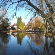
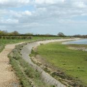
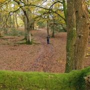
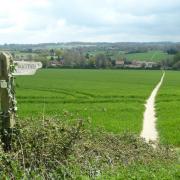
Steve Davison heads to Fleet Pond in the northeastern corner of Hampshire for a breath of fresh air.
The history of Fleet Pond – Hampshire’s largest freshwater lake covering 52 acres – stretches back several hundred years to the 12th century when artificial embankments were made to form two large fish ponds in an area that was known as ‘La Flete’, meaning stream of shallow water. Jump forward to the 16th century and one of the fish ponds was lost following a severe storm that breached an embankment, and the land was converted to pasture. Following the arrival of the railway line from London to Southampton, Fleet Pond was promoted as a destination for day visits and ice skating in winter.
During WWII, the pond was drained and planted with willow so that enemy planes could not use it for navigation. Following the end of hostilities the pond was refilled and now forms a site of special scientific interest and a local nature reserve cared for by the dedicated members of the Fleet Pond Society. Today the reserve provides a range of wildlife habitats from reed beds and marshes, to woodland and open heath.
From the car park the walk circles counter-clockwise around the pond, passing Brookly Stream – one of the two streams that feed the pond. The longer walk then continues southwards to cross the Basingstoke Canal and take in open woodland, with an optional pub visit, before re-crossing the canal. The canal, which opened in 1794, connected Basingstoke with the River Thames at Weybridge. Despite a lack of trade and years of neglect, volunteers have lovingly restored a large part of the canal as a navigable waterway.
After crossing the Gelvert Stream (the second stream that feeds the pond) both the short and long walks continue alongside the pond before stopping off at the newly built Lions’ View. It was from here that Geoffrey de Havilland, who was based at the Farnborough Balloon Factory (this became the Royal Aircraft Establishment and then the privatised QinetiQ) tested several floatplane designs. From here it’s a short walk back to the car park.
Information:
• Distance: 5.4 miles (8.4km) or 2.5 miles (4km)
• Time: 2.5 or 1.4 hours without stops
• Terrain: Mostly level, tracks and paths which can be muddy, some gates but no stiles or roads to cross
• Start/Finish: Fleet Pond car park off the A3013 at Fleet, 1.4 miles from the M3 (junction 4A); grid ref SU824553
• Map: OS Explorer 145
• Refreshments: The Foresters at Church Crookham
The walk:
1) (SU824553) – From the car park follow the gravel track westwards, parallel with the railway, to reach Fleet Pond and a junction. Fork right (blue – yellow marker) between the pond and railway. Cross a footbridge and at the split fork left. Keep to the path as it curves left and passes the end of Wellington Avenue, then Chestnut Grove.
2) Dogleg left and right at the landing stage and continue along the path to cross Brookly Stream. Follow the path as it swings left, to reach the end of Kenilworth Road. Keep to the path running parallel with Fugelmere Road and pass the end of Westover Road. At the split, fork right (blue marker) and pass the end of Wood Lane and then Guildford Road to another junction.
3) (SU825543) – Here the two walks go their separate ways:
• Short walk: Turn left (blue marker) and rejoin the walk at Point 4.
• Long walk: Go straight on along a narrow path, soon following a fence on the left. Follow the path as it bears right to reach the canal. Turn right along the towpath. Go under the first bridge, then fork right before the next bridge up to the old road.
Turn left over the bridge and cross the road. Turn left and where the road curves left, turn right on a path through the trees. Go through a kissing gate and take the gravel path straight on with trees on the right and open ground to the left for half a mile to reach a track junction where the walk turns left (to visit The Foresters pub, turn right, cross the cattle grid to a parking area and turn right alongside the road; then retrace your steps).
(SU827527) – Follow the gravel track north-eastwards, crossing a cattle grid after 175m and then rising over Norris Hill before heading down to a road and roundabout. Circle clockwise, crossing the A323 Fleet road and then the bridge over the canal. Keep to the road signposted for Farnborough and at the end of the metal barrier turn left through a gap in the fence. Continue through the trees for 25m and turn right following a path running parallel with the road. Later pass a dip and after a short rise bear left along a track for half a mile to reach a junction. Cross the bridge over the Gelvert Stream and immediately turn right (the shorter walk rejoins here).
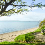
4) (SU826544) – Follow the path (blue marker) northwards alongside the stream (right) and at the raised wooden walkway keep ahead. Continue alongside the stream and then turn right over a footbridge to reach an open area (Sandy Bay) with some seats and a view out across Fleet Pond.
5) Turn sharp right and follow the raised walkway (blue and yellow marker) alongside a muddy track and at the junction, bear left. Cross a stream and keep ahead along the level track. After passing an information board the path splits, keep to the left-hand fork following the Brenda Parker Way. Soon a path on the left leads to a raised wooden viewpoint – Lions View. Keep ahead to the path junction with the railway beyond and turn right back to the car park.


