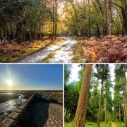
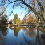
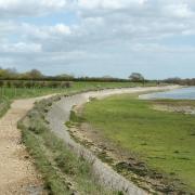
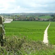
Head to Milford on Sea this month for a long, coastal walk with great views says Steve Davison
The coastal village of Milford on Sea, or Melleford as it was known in the Domesday Book, once belonged to Christchurch Priory and for several centuries it remained a small village with a scattering of thatched cottages. However, in the 1880s, Colonel Cornwallis-West of Newlands Manor tried, but ultimately failed due to a lack of funding, to remodel and enlarge the village into a ‘fashionable’ seaside resort similar to what his friend, the Duke of Devonshire, was doing at Eastbourne - it was during this time that ‘on Sea’ was added to the village name. There are some memorials to the Cornwallis-West family inside the 12th-century All Saints Church.
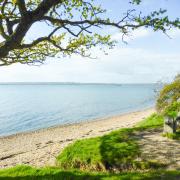
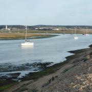
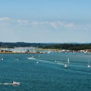
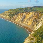
The walk sets out past Sturt Pond to reach Hurst Spit, an impressive mile and a half long curving shingle spit that protects the western approach to The Solent and shelters a large area of saltmarsh and mudflats. From here there are great views: south-east along the spit towards Hurst Castle and lighthouse, south across The Solent to the Isle of Wight and The Needles, and west across Christchurch Bay to Bournemouth and the Purbeck Hills.
For those following the longer route, the walk heads along the spit to reach Hurst Castle (01590 642344; www.hurstcastle.co.uk), just three quarters of a mile from the Isle of Wight.
Built by Henry VIII in 1544 to defend the western approach to The Solent, Hurst is one of a series built to defend the coastline. Just over a century later, Charles I was imprisoned here before being tried and executed in London.
The castle, which was extended during the Napoleonic Wars and again in the 1870s, remained part of Britain’s coastal defences until 1956. The nearby 19th-century lighthouse, built to help guide vessels through the hazardous western approaches to The Solent, replaced an earlier one built in the 1780s.
From the castle, the walk follows part of the 60-mile Solent Way which runs between Milford on Sea and Emsworth, to arrive at Keyhaven before heading inland back to Milford.
Information
• Distance: 6.5 miles (10.4km) or 3.75 miles (6km)
• Time: 3 or 2 hours without stops
• Terrain: Fairly level, tracks and paths, stiles and gates, sections of road
• Start/Finish: Pay and display car park in Sea Road near The Smugglers Inn, Milford on Sea (SZ291917)
• Map: OS Explorer OL22
• Refreshment: The Gun Inn (01590 642391) at Keyhaven; several choices in Milford on Sea
The walk
1 (SZ291917) - From the far left corner of the car park (stream on the left) follow the gravel path. Keep ahead as the path runs beside some houses and a road for a short distance, with reed beds on the right. Ignore paths off to the left and soon pass alongside Sturt Pond. Go right over the footbridge, then up the shingle bank and turn left along the top of Hurst Spit for 300m to draw level with a footbridge.
2 (SZ299908) - Here, the longer walk makes an out and back loop to Hurst Castle. Keep ahead along the top of the shingle spit for 1.25 miles and bear left at the split to reach the entrance to Hurst Castle and lighthouse. Now retrace your steps back to Point 4, or take the small ferry directly to Keyhaven. Once back at Point 4, turn right (left if coming from Milford on Sea) and cross the footbridge. Continue north-eastwards along Saltgrass Lane for 350m and then fork right through a kissing gate (Solent Way sign). Continue alongside the sea wall for 450m to a path junction and turn left to a lane in Keyhaven.
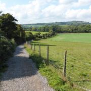
3 (SZ305914) - Keep ahead along Keyhaven Road passing a car park and then The Gun Inn. Keep ahead at the junction and at the next junction turn right along Lymore Lane, keeping left at the next junction. Follow the lane as it curves left and turn right over a stile beside a large gate. Follow the surfaced track northwards between open fields, then go left and right over a stile. Follow the path alongside the fence on your left to a stile in the far left field corner, opposite a thatched cottage. Turn left along Agarton Lane to a bend and dogleg left (footpath sign) to follow a path south-west across the field.
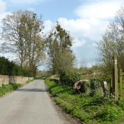
4 (SZ296926) - Turn right along Lymore Lane for 50m and then turn left, following a path across the middle of the field to a fingerpost and four-way path junction. Keep ahead (signed for Milford Church), later following the field edge to reach the field corner. Turn left along Lymington Road (B3054) for 250m and just before the junction with Church Hill, turn right across the road and through a small gate. Follow the lefthand path through the churchyard towards All Saints Church and leave through the lych gate. Turn right along Church Hill, keeping left at the junction to a reach a crossroads. Go straight over, keeping the village green on your right, to reach a staggered crossroads. Cross straight over heading along Sea Road to the car park on the left.
More walks
• Hampshire walk around Hawkley - Steve Davison heads to Hawkley for a walk in the South Downs National Park to the north of Petersfield
• Hampshire walk around Niton - Follow Steve Davison across to the Isle of Wight for a walk at Niton, visiting the fascinating St Catherine’s Oratory


