Follow Steve Davison as he heads to the Test Valley and the village of Longstock for a wander up Danebury Hill
Our walk this month starts out from the peaceful village of Longstock, which lies just to the north of Stockbridge. Known as Stoches in the 11th century, the village and surrounding area has a long history stretching back to at least the Iron Age. Close to Charity Farm is an old rectangular earthwork that some have suggested was a ‘Danish dock’ used to harbour flat-bottomed boats that could travel up the River Test from Romsey, and it may be related to skirmishes in the early 11th century between Edmund Ironside and Cnut. By the 14th century, the village was known as Longestoke which may be derived from stakes that were used to mark a safe route across the fairly wide River Test hereabouts.
For the first part of the walk, we follow the main street southwards past a number of picturesque 16th and 17th century thatched cottages, as well as The Peat Spade Inn - whilst walking through the village, keep a lookout for the lovely mosaics on the former bus shelter. On reaching St Mary’s Church, with its shingle-clad broach spire, take a quick look at the small book exchange in the old telephone box opposite, before calling in at the church to see some colourful stained glass windows.
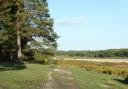
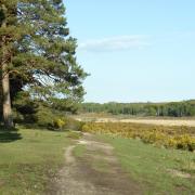
From the church the route heads west to Danebury Hill and the impressive earthworks of an Iron Age hill fort constructed some 2500 years ago - the name Danebury comes from the Old English ‘dun’ meaning hill and ‘bury’ meaning camp. The ancient earthworks, a double bank with ditch, cover an area of 13 acres and in places the inner bank is still 5m high. There have been a number of excavations here and some of the artefacts can be seen in the museum at Andover.
The land a short way to the south was, from around 1840 until 1898, home to the Stockbridge Racecourse, and the noted Victorian trainer, John Day, trained from stables at Danebury House - now home to Danebury Vineyards. In its heyday, the Prince of Wales (later Edward VIII) was a frequent visitor to the racecourse.
From the hill fort we retrace part of the route and then follow paths and bridleways through the gently rolling landscape back towards Longstock before returning along the main street, passing the village hall, where there are some more mosaics made by the villagers in 2002. Anyone wanting a shorter (4.75 mile) walk can miss out the loop to Danebury Hill.
Information
• Distance: 6 miles (9.7km)
• Time: 3 hours without stops
• Terrain: Some ups and downs, tracks and paths which can be muddy, some gates, sections of country road
• Start/Finish: Recreation ground in Longstock (SU360373); 1.5 miles north along minor road from the A30 in Stockbridge
• Map: OS Explorer 131
• Refreshment: The Peat Spade Inn (01264 810612) at Longstock; several choices in nearby Stockbridge
The walk
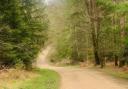
1 (SU360373) - From the recreation ground, turn left along the main street through the village, passing The Peat Spade Inn. Just before the church, turn right up Church Road for 1.5 miles - the lane soon becomes a hedge-lined track. On reaching a road, turn right for a few metres to a junction (if you don’t want to visit Danebury Hill turn left across the road at the junction and follow the hedge-lined bridleway).
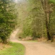
2 (SU335375) - To continue the walk, keep left at the junction and follow the road – taking extra care – for 350m as it curves left and heads downhill. Turn left at the entrance to Danebury Hill to reach the lower car park. Turn left through a kissing gate, then turn right up through the field, staying parallel with the access track and later bear right through a gate to reach a map and information board (alternatively follow the access track to the upper car park (toilet) and keep ahead to the information board). Head up to the trig point and admire the views from this commanding position. To explore the earthworks, continue westwards for 150m and go through a gate from where a path circles the earthworks, before returning to the trig point.
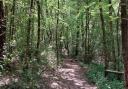
3 (SU326376) - From the trig point head back down to the lower car park and with care, retrace the route along the road back to the road junction at Point 2. Here, turn right across the road and follow the hedge-lined bridleway for three quarters of a mile (this later becomes a farm track) to reach a path junction with two large field gates and some trees on the right of the track. Ignore the stile on the left, but go through the gate just before it to follow a permissive bridleway along the right-hand field edge for 500m to a corner, marked by a solitary bush at Shepherd’s Bush (White Thorn).
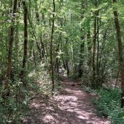
4 (SU335365) - Bear slightly left, down between fields and then follow the hedge-lined track to the road beside a barn. Cross over, turn left then right at the footpath sign, passing through a gap in the hedge and follow the left-hand field edge uphill. Go through a kissing gate and continue through two fields separated by a gate. Start heading downhill, leave through a kissing gate in the bottom-left corner and follow the track down to the road. Turn left back through the village passing the village hall, church and pub to arrive back at the start.
READ ON
• Hampshire walk - Burghclere and Sandham Memorial Chapel - Steve Davison leads the way on a walk in the north-west corner of Hampshire visiting the Sandham Memorial Chapel, home to a stunning series of murals
• Why the heathland of Hampshire needs protecting - Hampshire may have more heathland than any other English county, but now it needs protecting to preserve it for future generations to enjoy says Clive Chatters, Head of Conservation at the Hampshire and Isle of Wight Wildlife Trust