Do you know....
- Where British & Canadian troops shot Peak District rocks whilst practising for D-Day?
- Where to find the Peak District’s ‘Bermuda Triangle’?
- That the Victorians built a railway through the Peak with a curve so sharp, half the trains fell off?
- Or that the remains of an American plane that took photos of one of the first atomic bomb blasts and participated in the 1948 Berlin airlift, lies high on a Peak District moor?

I have walked in the Peak District for some 50+ years (and I’ll find my way home any day now! Joke, joke) & led a fair number of groups.
I’ve always tried to add something interesting to look at. My interests are archaeology and human history although I only possess an ‘Everyman’s’ knowledge, but it makes for an interesting day, hopefully.
So, here are my suggestions to make an enjoyable walk (and, let’s face it, that’s not difficult in the Peak) into an informative one too, where you can appreciate the history around us as well as the views.
I’m not prescribing any walking routes as half the fun is making your own to suit your circumstances, long walk, short walk or with the kids.

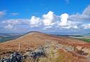
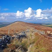
Halt rock! Friend or foe?
On Burbage Moor between the pub and Ringinglow car-park, you can find an iron-age hillfort (Carl Wark), mediaeval ‘slag’ heaps where the waste from the lead smelting furnaces was dumped, a 500 year old quarry, evidence of the ‘Enclosure’ acts and lots of large rocks and a packhorse bridge, both covered in numerous stone chips.
The chips are there because they were used as target practice by British and Canadian troops prior to D-day. The rocks perhaps were not the ideal opposition though as a), they didn’t move and b), they were not firing back! Along ‘Green Drive’ you may also spot the ruins of a farmhouse.
This is a relic from the ‘Enclosure Acts’ 18th to the 19th century. Briefly, the local landowners were empowered to seize the land and thereby, charge their tenants rent for what had previously been ‘common land’. The local vicar decided he wanted some of that action so set about having his new farm built. The story goes that his wife, on seeing the rocky, craggy, wild moorland, no doubt on a wet Wednesday in November, just said ‘No way’. So, he retreated to his Sheffield parish, tail between his legs.
Not far away is the beautiful Padley Gorge with the Martyr’s Chapel and Longshaw Lodge where Royalty was entertained by the Duke of Rutland.

Birchover Triangle, looking at it from my angle…
The area between Birchover, Elton and Winster is referred to as the Birchover Triangle in view of the plethora of weird stuff reported by walkers – strange lights, ghostly figures, black dogs. Spent too much time in the Druid Inn perhaps?
Apart from the spectral signs, there are countless historical sites nearby. Stanton Moor is the largest Bronze age burial site in Europe. There are 4 stone circles on the moor, but only 1 is easily found, over 70 barrows plus the Earl Grey Tower built to celebrate the Reform Act of 1832, (any excuse for a party!).
A mile to the west is the Noon Stones circle, an iron-age hillfort, a hermit’s cave with a Crucifixion carving and the two towers of Robin Hoods Stride. The midsummer full moon can be viewed through the two towers from the circle… apparently. I’m not going there after dark!
Back in Birchover, there are the extensive 17th century rock carvings, caves, steps and symbols on Rowtor rocks, the idea of the local vicar, Thomas Eyre who was a practising Druid! Isn’t this a conflict of interests?

Take the last train to Cromford and I’ll meet you…. oops!
The ‘Gotham Curve’ on the High Peak Trail near Pikehall was a tad too…..curvy and resulted in dozens of derailments until they imposed a maximum speed of 5 mph! There go the timetables!
Walk the trail and nearby lanes for open, expansive, big sky views. Nearby is Roystone Grange where you can find the monastic Grange itself founded by Cistercian monks in the 12th century, plus the remains of a Romano-British farm and a mediaeval farm building.
There’s also a Victorian compressed-air pumping house to serve the nearby quarries and it’s disguised as a chapel (obviously!). A mile to the east is the unmistakeable outline of Minninglow, a Bronze age and Neolithic chambered tomb, the largest in Derbyshire and great views, now accessible via a concessionary path.
Just beyond you can make out the route of the Roman road from Derby to Buxton which derailed absolutely nothing!
It’s Bleak alright… but not very low!
At 633 metres, Bleaklow Head is the 2nd highest point in the Peak, just 3 metres short of the un-named bit on Kinder Scout. Surprisingly, there’s an easy route to Bleaklow Head though, from the top of the Snake pass (open as many as 23 days per year!) and heading north on the Pennine way. Get there early to park and don’t even think about weekends. From Bleaklow head, it’s easy to visit the Wain Stones and ‘The Kiss’ - anything for some love action!. From there, the remains of B29 Super Fortress ‘Over Exposed’ can be found up on the ridge of Higher Shelf Stones, just NE of the trig point. The plane crashed there in 1948, killing all 13 crew members. There is a small memorial and poppies are laid every Remembrance Day. The site is reputed to be haunted but I’ve always found it uplifting and re-assuring. The bravery of all those who paid the ultimate price is easy to appreciate when you think of all they must have endured.
You can then simply return to the car by following the path east & down from the trig point, from where you can see your car, and re-join the Pennine way. You can also extend the walk a couple of ways. 1), On your way down from the trig point, you cross the head of Crooked Clough. Turn right and walk down the eastern edge to join Doctors Gate, the Roman road from Glossop to Brough. If Watling Street was the ‘M1’ of Roman roads, Doctors Gate is the B3750.
If you fancy a challenge and the opportunity to visit 2 more crash-sites, head west on the ridge path from the trig point, to the southern tip of James’ Thorn. There, you’ll find scant remains of a Lancaster plus a small memorial. Head back but bear gradually right and down into the head of Ashton Clough. There is a ruined wall running N -S just below the ridge alongside which you should spot scattered remnants of a Dakota. Dropping into the clough is steep and heading down it requires a bit of care, but you’ll come across more of the Dakota including part of one of the engine housings. At the bottom, you ford the brook then climb up to Doctors Gate.
So that’s it, an introduction to the Peak District and the vast range of history mysteries you’ll encounter. Bear in mind, with the Peak District, there are terms & conditions. Always take nothing but photos, leave nothing but footprints. Be prepared for someone to fall and break an ankle. The weather is ….’interesting’ so be adequately kitted. I’ve set off from home in T-shirts and sandals weather and arrived at Bleaklow Head to be confronted by gale-force winds and horizontal hail….in July!!! Happy Walking!