Enjoy a walk around Winchester combining city and countryside, taking in historic sights, lovely water meadows and hill-top views says Fiona Barltrop.
Situated on the edge of the South Downs National Park, the cathedral city of Winchester has a wealth of historic buildings, monuments and museums all within easy walking distance of one another. There’s its magnificent cathedral, of course, remarkable both for its spectacular architecture and hidden treasures - it has the longest medieval nave in Europe and also contains the grave of Jane Austen (she spent her final weeks in a nearby house). There’s also Winchester College – founded in 1382 and believed to be the oldest continuously running school in England, the old city walls and the ruins of Wolvesey Castle and hidden gems like the church of St Swithun upon Kingsgate. In the upper part of the city you’ll find the 13th century Great Hall, the only part of the medieval castle to survive above ground and home to the famous Round Table.

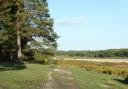
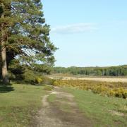
As a small and compact city, with countryside on its doorstep, you can easily combine the buzz of the city with stunning views, as this route does, heading south out of the city along the Itchen valley, followed by a climb up St Catherine’s Hill, a Wildlife Trust Nature Reserve. The views from the top, which is ringed by the ramparts of an Iron Age hill fort, well repay the effort. In the centre a copse of beech trees contains the site of the 12th-century chapel of St. Catherine. On the grassy summit, you’ll also find a turf maze cut into the chalk; known as the mizmaze its origin remains a mystery.
The return leg of the walk up the west side of the valley takes you past the Hospital of St Cross and its fine Norman church. The term hospital in this context is not the modern-day understanding of the word, but shares its origin with hospitality, and for over 850 years has provided food and shelter to people in need. Situated in the water meadows alongside the River Itchen, it is renowned for the tranquillity of its setting and the beauty of its architecture. It has been described as ‘England's oldest and most perfect almshouse’. Today it is a living community, home to gentlemen of more advanced years, known as The Brothers, who wear black or red robes, signifying respectively the original de Blois foundation and the later Beaufort foundation (the Order of Noble Poverty). Visitors are welcome, with tickets available at the Porter’s Lodge. From here the walk continues along the valley back to the city centre.

The walk
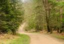
1 (SU484293) The walk starts from the Visitor Information Centre, located to the right of the steps at the Guildhall, an impressive Victorian gothic building. Facing the road, turn right along the Broadway passing the striking bronze statue of King Alfred on the left. Keep ahead at the roundabout to the City Bridge. Across the road is the City Mill, in the care of the National Trust. Just before crossing the bridge turn right alongside the River Itchen, passing on your right a surviving remnant of the original Roman town walls. Keep alongside the river (Medieval city wall over to right), bear left at the fork and left across the brick bridge by a former mill (now flats). Head right up the road and right again at the T-junction along Wharf Hill. As the road bends right, turn off left along the lane (signed Itchen Navigation) for 60m to a small gate on the right, just after a house (number 3).
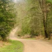
2 (SU485287) Turn right through the gate along the footpath, cross Wharf Bridge, then left along the waterside path, now by the Itchen Navigation. This disused canal once provided an important trading route between Winchester and Southampton. Continue beside it, keeping left at a fork through a gate (with a yellow Itchen Way waymark). On reaching the road, turn left over the bridge and immediately right into the Garnier Road car park.
3 (SU483280) Go through the car park and under the brick archway. Keep ahead through the gate by the St Catherine’s Hill Nature Reserve sign. Follow the path to a fork and bear left around the slope to steps on the right. Climb these towards the summit, turning left at the ramparts to reach the hill top. The beech copse is ahead of you, with the mizmaze in front of it.
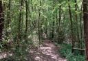
4 (SU484277) Head anti-clockwise around the trees, follow the wide grassy path, then steps on the right on the far side to descend to the foot of the hill, bearing right to a gate. Turn left along the tarmac track to continue beside the Itchen Navigation, going under another brick bridge.
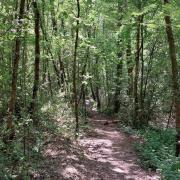
5 (SU479267) At the junction (close to the noisy M3), turn right (ignoring the left fork) and continue to a gate. Carry on along the surfaced track/road to a vehicle barrier. Soon after this, fork right along an access road, keeping ahead through a gate along a footpath leading to the Hospital of St Cross on the left.
6 (SU476277) Continue to the path junction, and keep ahead (or if muddy, follow the signed alternative route). Follow the footpath to the road, turn right then immediately left and continue along the footpath, eventually reaching a gate and road end by Winchester College.
7 (SU482288) Turn right, then left along College Walk and left again along College Street, passing the house (with plaque) where Jane Austen died. Turn right through Kingsgate (don’t miss St Swithun’s church entrance on the left on the other side), then right again through Prior’s Gate, passing Medieval Cheyney Court on the right. Head towards the Cathedral and go left round it to the west front. Keep ahead via The Square to the High Street and turn right back to the Broadway.

Compass Points
Start/finish: Winchester Visitor Information Centre, Guildhall, High Street (SU484293). Lots of car parks in and around Winchester, including Chesil Street Multi Storey (a few minutes' walk from the start of the route) or, along the way, Garnier Road car park or nearby St. Catherine’s Park & Ride. Other P&R car parks, too.
Map: OS Explorer OL32
Distance: 4¼ miles/6.8km
Terrain: Riverside paths, both grassy and surfaced, chalk downland (one significant ascent and descent), city roads/pavements. Part of outward leg of walk follows waymarked Itchen Way.
Time: 2½ - 3 hours (but allow extra time for sight-seeing)
Refreshments: Plenty of choice in Winchester, Handlebar Café, Garnier Road (at the foot of St Catherine’s Hill), tea room at Hospital of St Cross.
Public transport: Mainline trains to Winchester; Stagecoach bus services – routes around Winchester and the surrounding area; Bluestar buses – between Winchester and Southampton; Park & Ride bus service (Mon to Sat, not Sun) – four car parks outside city centre, available for use every day, winchester.gov.uk/parking/park-and-ride.
Further information: The Visitor Information Centre has many interesting and useful leaflets – it’s well worth calling in at the start of the walk for a city centre map, showing road names and places of note, to help with navigation round the city.