Walk in the footsteps of two famous Dorset dialect poets from the 19th century, Robert Young and William Barnes

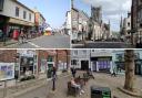
It only seems to happen in Sturminster Newton. People stop and chat to passers by, sometimes at length, probably because this ancient market town is well used to visitors. Since Henry III granted Sturminster a royal charter in 1219, farmers came to this market town in the heart of the Blackmore Vale to buy and sell livestock, to bring corn for milling, and wool for turning into Sturminster Swanskin for Newfoundland fishermen’s waterproof clothing.
As 21st-century visitors, we’ll be exploring the separate communities of Sturminster and Newton on opposite banks of the River Stour, and walking where Sturminster poets and famous literary residents have walked.
The Walk
1 Starting at the Georgian Swan Inn, opposite the 1921 Town Clock, head north to Station Road with the ’COVNTY POLICE’ station on the corner. Turn left into The Row with elegant Georgian Sturminster House on the right corner. Pass Sturminster Christian Fellowship, on the site of the Methodist Chapel where Dorset dialect poet Robert Young worshipped with his family when he was a child.
Continue along The Row passing old and new cottages including ‘Waterloo House’ built in 1835 and named by the owner who may have served in the great battle 20 years before. Go through the end ‘Colber Bridge’ kissing-gate. Down the stepped path, notice ’The Hive’, the large white house to your left. Through the lower kissing-gate, cross the footpath crossing signed ‘Stalbridge Lane’. Noticing the part-demolished railway arches to your right, cross Colber Bridge. Through the end kissing-gate, take the half-left ‘Stalbridge Lane’ footpath across the field to the hedge’s kissing-gate.

2 Into the enclosed path, walk to the Stalbridge Lane end with a footpath-stile opposite. Turning right would take you to Bagber Common and Stalbridge. Turn left. After passing several thatched cottages and the Sturminster Mill path at ‘Beech House’, arrive at the A357 in Newton. Turn right, cross over and pass the old Red Lion. Opposite the right cottage, signed ‘Newton’, take left Glue Hill. At the top, take left Hole House Lane, bending right between cottages and descending after right Homestead Lodge. Past the right ‘Rudge Hill Farm’ footpath, take the instant-left ‘Town Bridge’ footpath before Hole House.
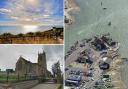
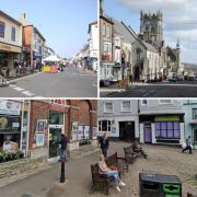
3 Follow the hedged path above Hole House and the deep valley below. Through the end footpath kissing-gate, turn right along the hedge and trees, not the arrow’s direction. Keep following the field edge above the right valley, bending left. Past a left cross-field path, go through the facing ‘Town Bridge’ footpath-gate. Cross to the fence’s footpath kissing-gate and cross to the right corner, catching the merest glimpse of Sturminster Castle through the right hedge on the way. Built within an Iron Age promontory fort in ‘Newentone belonging to Glastonbury Abbey’ in the 1086 Domesday Book, the ‘Castle’ is listed as the service range of a 14th-century manor house.
Through the kissing-gate, descend the stone steps and pass the 1870 Primitive Methodist Chapel. At the A357, signed back ‘Hole House Lane’, we’re going left to Sturminster Mill but, first, turn right to pass the B3092 bridge over the River Stour to visit the 15th-century Bull Inn. Barely 200 yards past The Bull is Sturminster Newton Cemetery where Robert Young was buried in 1908.
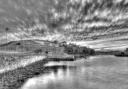
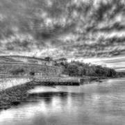
4 Returning, pass the end of the 16th-century bridge which was widened from 12ft to 18ft in 1820. Continue to the right turning down to Sturminster Mill.
Walk around the back of the mill and over the footbridges to the kissing-gate into the field corner. Walk up the left side for ‘Colber Bridge’ with the Stour below you. Past a cattle-ford, see Colber Bridge ahead-left. Reaching the gate into the Recreation Ground, walk up to ‘Riverside Villa’ on the corner. Turn right along the Tarmac path. Past some benches, continue into Ricketts Lane. Emerging at Oxford’s Bakery into Bridge Street, turn right down the hill. Passing the left raised pavement with the Old Clock House on Church Lane corner, continue down Bridge Street. Pass left thatched 17th-century Minster House and right William Barnes School.
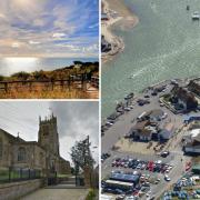
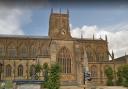
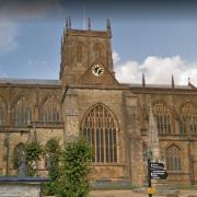
5 After left 17th-century Beech House and right-turn ‘Durrant’, cross to the footpath-signed ‘Coach Road’ kissing-gate into a meadow. Follow the raised Coach Road path, turning off left to a kissing-gate into a fenced path. Up into Church Lane, turn right along the narrow lane. Past Stour Grange, the much-extended vicarage which stood at the end of Coach Road drive, arrive at St Mary’s Church. Built in 1486 by Abbot John Selwood, St Mary’s was rebuilt in 1825 by the Reverend Lane Fox. Pass around the south (right) side, with fine views, and leave by the iron gate and steps. Turn left along Church Walk to Penny Street. Cross into Gotts Corner. French Huguenots fleeing Catholic oppression settled here in the 17th century and introduced cloth-making to Sturminster. ‘Dashwoods’, the original ‘Vine House’ where Barnes was first employed, is higher left up Penny Street. Walk between cottages to the end path and footpath kissing-gate. Through, turn left for ‘Butts Pond’ along the field’s left edge. Through the corner kissing-gate and up steps to the old railway ‘Trailway’, turn left.
6 Continue to the gateway into Sturminster Newton car park. Keep straight on to the top corner pedestrian exit. Cross right to the ‘Somerset and Dorset Joint Railway’ gates into Railway Gardens with Sturminster’s Exchange centre and monument to the old market on your right. Follow the meandering path to the top corner into Old Market Hill, passing the remnant of track perfectly aligned with the old railway route. The blocks of flats and houses here are built on the old livestock market site which started in 1272 and continued, with huge importance to the local economy, until 1997. Turn left into Bath Road. Rabin Hill, chosen by Robert Young as the name for his poetic railway traveller, is ¼ mile away to your right, but it’s all developed now, not as Robert Young would have known it. Walk down, past right Brinsley Close, back into Market Square where you started.
Distance: 3 miles/4.75 km
Time: 2½ hours
Exertion: Easy. A little mud in meadows
Start: Market Square, Sturminster Newton
Dogs: On leads at all times
Refreshments: Bull Inn and Swan Inn for good food and ale