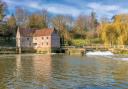
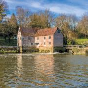
At the end of 2022, three different norths were over Poole. Rachel Henson, who teaches navigation to Purbeck Air Cadets, explains what is going on.
We learn the compass points in childhood: north, east, south, west; but nothing is ever simple! Navigators can choose from three different norths to measure direction, and for the first time they have all converged in a small, Dorset village.
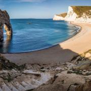
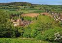
In 2022 Langton Matravers made mapping history by becoming the first place in Great Britain where the three north directions have all aligned. Although this unusual moment occurred in early November, the triple alignment of the norths over Britain will continue for the next three and a half years. During this time, the convergence will travel north, eventually leaving England at Berwick-Upon-Tweed before travelling up towards Scotland. Its last British destination should be Fraserburgh in 2026.
Map reading enthusiasts will be familiar with the different norths, but this may surprise others who find the idea of several norths disorientating. After all, the points of the compass seem non-negotiable. It’s important to remember that ‘north’ has not moved to Langton Matravers, but that Langton Matravers is the first place where the three ways of measuring the direction of north have all lined up.

The Three Norths
Grid north: When you look at an Ordnance Survey map, the blue vertical grid lines run north to south, up and down the page. These lines (and their east – west running counterparts) are the ‘National Grid’ and indicate grid north, at the top of the map. This is important to note, because whichever OS map you pick up, you can see which way is north and orientate yourself. People who are ‘bad at map reading’ can help themselves by orientating the map (rotating it as you walk so that what you see ahead matches what you see when you look at the map). If you keep the map the ‘right way up’, with north at the top, while you’re walking southwards, your mind has to flip everything 180 degrees, which makes navigating more complicated than necessary.
True north: This is indicated by the lines of longitude that eventually come together at the North Pole. Lines of longitude follow the curvature of the Earth, but grid lines don’t, so grid north and true north don’t usually match up. On the map, true north curves away from grid north. The one exception to this on our National Grid is the central meridian line of longitude at two degrees west, where these two norths are in line. This central meridian, where grid north and true north align, starts in Dorset and runs up through England and Scotland. Geographer and television presenter Nicholas Crane travelled this line in his book Two Degrees West.
Magnetic north: This is where the compass needle points to and leads to the magnetic North Pole. Magnetic north moves over time, due to changes within the Earth’s magnetic field. Historically, magnetic north has always been to the west of grid north in Britain, but it has been slowly moving towards it and, since 2014, past it. Magnetic north has now come into contact with the central meridian line where true and grid north already match, bringing all three norths into alignment. And, because magnetic north has a shallow curve, the zone where this alignment happens ends up travelling northwards, along the central meridian line.
Navigators consider the difference between magnetic north and grid north (the Grid Magnetic Angle) when making calculations about direction. This angle varies depending on where you are and over time, but magnetic north has always been to the west of grid north. The moving magnetic direction has now brought them into alignment so there is no difference between the two.
Putting Langton Matravers on the map
Now, it is Dorset’s turn to host the zone where the difference between grid north, true north and magnetic north is zero degrees. Mark Greaves, Earth Measurement Expert at Ordnance Survey, explains the significance of Langton Matravers in this event.
‘Langton Matravers is special because it already sits on the fixed line where grid north and true north line up. That’s not moving, it’s a fixed feature of our national mapping. Langton Matravers happens to be the most southerly populated place on that line, but it runs up the entire middle of the country. So anywhere on that two degrees west line is already slightly special, in that grid and true north line up exactly on that particular line. As the magnetic north pole slowly moves, the direction towards magnetic north is briefly lining up with the other two to create this triple alignment.’ The coincidence of grid and true north coming together on the central meridian line comes about because mapmakers have to represent a curved planet on flat surfaces such as paper or computer screens. To do this, experts use a mathematical process called a map projection. There are different projections for different types of maps, for example whether they’re mapping the whole planet or an individual country. Each country uses its own national mapping system and has its own meridian line where true north and grid north align. As a result, this special event is not only unique to Great Britain but it also won’t happen again anywhere for several hundred years. So, does this mean something spooky or magical is going on in Dorset?
‘It's just a quirk of our mapping,’ says Mark. ‘We already have true north and grid north lined up, it’s just a nice little coincidence that magnetic north is happening to sweep across them at the moment. It’s nothing more than that!’ The convergence of the three norths will stay in Dorset for several months, reaching Poole by Christmas and continuing its northward travel through Dorset in the early part of 2023.