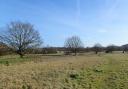
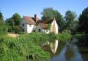
Enjoy some easy walking through unspoilt and rural countryside in mid-west Essex
Willingale was once divided into two parishes – Willingale Spain and Willingale Doe – does that explain why two churches would exist in such close proximity? A romantic tale claims two wealthy sisters fell out so badly that one built a separate church in which to worship. The truth is likely far more practical, in that the 14th century wool boom meant the population outgrew the older church so the newer one was built to accommodate everybody.
The interesting name of the hamlet derives from the Old English for ‘winding river’ and Lambert de Buella, the Norman Lord in the latter part of the 11th century. For keen walkers, Chipping Ongar, three miles south-west, is a veritable spaghetti junction, with the Essex Way and Three Forests Way long-distance paths passing through and the starting point for the St. Peter’s Way pilgrimage route.

The walk
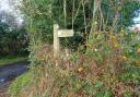
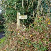
1. From the churchyard, head south along The Street (the churches will be on your right) past the large yew tree. At the junction, turn left on Fyfield Road. The lanes are quiet and have verges but always be alert for passing vehicles. Heading out of the village, keep right at the junction with Wood Lane. Pass Spains Hall Farm then, at a sharp right-hand bend, leave the lane onto a field-edge track, the footpath indicated by a wooden fingerpost. After 500 metres, at the end of the hedgerow, the path veers off across the arable field. Cross a footbridge on the opposite side, then pass Bridge Farm and emerge onto the lane via a wooden gate.
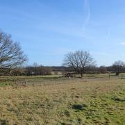
2. Head straight along the lane, and at the next bend, continue straight to take a track beside Rolls Farm. Pass through a gap beside metal gates and skirt the property on the left before taking the cross-field path heading off uphill to the right. Cross two fields, then pass alongside the hedge of a cottage called Willowcroft to emerge, via a footbridge, onto a tarmac lane. Turn right along the lane, pass Quires Green Cottage then head out across the fields again, with the hedge on your right (passing an old blue-painted tank, if it’s still there). Ignore a bridge and path on your right; instead, at the end of the hedge, cross a footbridge and follow a path across the field, heading directly towards a farmhouse visible in the distance over the crest. The path leads to Shellow Road, opposite Shellow Cross Farm.
3. Turn left along the roadside verge and in 400 metres take the footpath on the right, accessed via another footbridge. After a right-hand bend, the path crosses yet another footbridge, turning immediately right to follow the other side of the ditch. Pass through a field access by a telegraph pole then round to a waymark post opposite a tree. Now follow the path with the ditch on your left. In 370 metres, cross a footbridge by a red post then continue with the ditch still on your left. Skirt Rowe’s Farm then a well-marked cross-field path heads off towards a distant oak, at which a footbridge down a few steps leads onto a track (along which the Essex Way runs). Cross the track and a field-edge path proceeds alongside a tall mature hedge of bramble and blackthorn. Soon the imposing trees of a small woodland, known as Black Spring, come into view. Just past the wood, turn left across another footbridge and cross a field, heading towards a row of cream-coloured cottages.

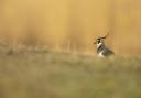
4. At the cottages cross the footbridge onto the lane and turn left, heading south. At this time of year, the verges will be blooming with wildflowers and the hedges chattering with birdsong (this is a good area for yellowhammers). At a right-hand bend in the lane, the path passes into the adjacent field, crossing to the hedge and then off again to meet another track (the one crossed earlier). From here until the end, the walk follows the Essex Way. Turn right and follow the attractive track south to meet Shellow Road.
5. Cross the road onto the field-edge footpath opposite. After 290 metres, cross a footbridge and turn right. Follow the field edge, round a corner, then kink right and left to cross into the next field, continuing with the hedgerow still on your left. Cross another footbridge and turn right, still on a field edge but with the hedgerow now on your right. At the corner of the field, kink right then left to continue on the southern edge of the next field, the hedgerow now on your left, before emerging onto the edge of the local cricket ground. Keep straight on, along the southern boundary of the ground, then a short, fenced path returns to The Street, opposite the two churches.
COMPASS POINTS
Distance: 6.5 miles (10.5km).
Starting point: The two churches, The Street, Willingale, CM5 0SJ, grid reference TL596073.
Access: On-street parking is available. There is a bus stop served by the 46 bus (Ongar-Chelmsford) (essexbus.info).
Map: OS Explorer 183 Chelmsford & The Rodings.
Refreshment: There are no pubs or shops. The nearest are in Fyfield, two miles to the west.
Places of interest: The most notable feature of Willingale is the curious existence of two churches in the same churchyard: the smaller and older St. Andrew’s, with a weather-boarded belfry and spire, and St. Christopher’s with a castellated stone tower.
Interactive map: essexhighways.org/getting-around/public-rights-of-way/prow-interactive-map