This walk from Haslingden through glorious countryside to the Halo panopticon artwork on Cribden Hill takes in some spectacular views.
I had heard of the Halo and seen it when driving along the A56 and M66 but had never walked up to it. For years I had told myself I would do the walk one day, but because it is quite close to home, it tends to slip behind the hills of Bowland and the Lakes in preference for choosing a walk.
As it was, John my friend and I both had to be home early on the day and I looked for something relatively easy and close to home. The Halo fitted the bill and I worked out a route that made it a fine shortish walk with stunning views.
The walk also brought back some memories of Cribden Hill that forms part of this walk. In the late 1970s I ran the Rossendale Fell Race a few times. It was pretty tough as it also took in Cowpe Lowe on the opposite side of the Rossendale Valley, it was I think nine miles long, with around 2,500 ft of uphill running.
1 Leave the car park and turn right to enter the churchyard of St James and follow the path through, bearing right and through the car park then bear left to join Church Street. Keep left towards High Street then turn left at the sign for The Halo and follow the road to reach High Street and go straight up Higher Lane, the road facing across High Street.
Follow this uphill to a point where the road bends sharp right with a track leading straight ahead. There is a sign saying: ‘Unsuitable for Motor Vehicles’. Follow the track and, at the gates to Old Swallow Barn, follow the footpath to the right of these. Reach a path junction and turn left heading downhill to eventually reach a track and follow this.
There is a road coming up from the left but carry straight on, passing ‘Forest School for Children’ on the left, the track is now called Laund Lane. Keep following the now concrete track passing the gates of Makingate Farm on the left to reach a cattle grid leading into a track that says: ‘Footpath Only No Bikes or Horses’. Follow the track.

2 The track ends at a house but the footpath goes to the right of this next to a wall on the right. The path then becomes narrow and a little indistinct through long grass but keep following it as it turns right into a wood. Ignore the stile on the left leading into a field with a yellow footpath sign on a post, there is a green Public Footpath sign pointing uphill into the woods, follow this.
Carry on steeply uphill to reach a yellow footpath sign pointing left to some steps, climb these and follow the path as it passes a small building on the left to reach a stile leading onto a track. Cross the stile and the track and follow a wire fence on the right and go steeply uphill. Reach a stile at a wall corner and cross this and, with the wall on the left, follow the path. The wall turns sharp left and here there is a stile in a wire fence, cross this and turn right. Keeping the wire fence on the right, carry on. The ground here is a little rough underfoot.
3 Reach a stile on the right and cross this and, with a wall on the left, follow the path until a stile on the left. Cross this and turn right and, with a wire fence on the right, carry straight on, following the fence and passing through a series of stiles to finally reach a metal gate stile. Cross this onto Cribden Hill summit.
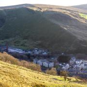
Note: The view from the top of Cribden takes in the Rossendale Valley that makes its way up to Bacup. In the past this was the one of the main footwear manufacturing sites in the country and many of the factory buildings still in existence were footwear manufacturers. Competition from abroad all but killed the trade although there are still some survivors.

4 Once through the stile, turn sharp right and follow the obvious path steeply downhill towards the Halo with a wire fence on the left. Cross a stile on the right then turn left and carry on towards the Halo and a farm with a wall on the left. There is a gateway into the farm and about 25 metres to the left of this is a stile in the wall. Cross this and turn left and head downhill then turn right into a car park and then immediate right onto a track that leads up to the Halo.
Note: The Halo is one of a series of panopticons in the hills of east Lancashire. It was designed by John Kennedy and is 18 metres in diameter and sits on a five metre high tripod. It is illuminated at night with the power for the lamps coming from a wind turbine next to the structure.

5 Pass the Halo, keeping to the left of it and follow the track left down to a stile leading into the main road, cross the stile and turn right and follow the road downhill to meet the route up from the start of the walk and then reverse this back to the car.
Compass points

Start and finish: Car park off Salem Street, Haslingden, BB4 5HT
Distance: 3.7 miles/5.95 km
Time: Two hours
Terrain: Good walking, the majority being on tracks although the section through the woods up to Cribden Moor and over to Cribden Hill is on footpaths and could be boggy in or after wet weather. Boots are a good idea.
Map: OS Explorer 287 West Pennine Moors.
Facilities: Public toilets in Haslingden.


