In a roundabout way, Lancashire Life led me to buy an electric mountain bike. I borrowed one from Ribble Valley E-Bikes for a feature a couple of years ago and I was hooked, in fact I liked it so much I bought my own.
That time I devised an 18 mile route around the Ribble Valley starting and finishing in Dunsop Bridge to put the bike through its paces but we are taking a slightly longer route this month.
Scorton is always a good place to start a bike ride. The village is only small, but it’s very popular with cyclists and it is a rare sight to see the cafes without bikes outside while the owners stock up on energy inside.
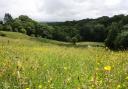
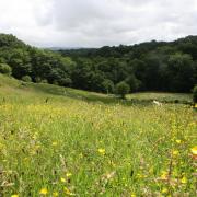
Sitting on the edge of the beautiful Forest of Bowland Area of Outstanding Natural Beauty it is no wonder the village is so popular with cyclists, walkers, birdwatchers and, of course, sightseers who simply like to drive along the many lanes that command some stunning views.
This month’s ride takes in some of the most beautiful countryside in Lancashire on reasonably quiet roads. It’s a great route with some steep hill sections where the e-bike really comes into its own and some of the finest scenery you’ll find anywhere.

1. Leave The Square in the centre of the village and take the main road, Factory Brow, and keep on this as it becomes Long Lane. At the crossroads, Four Lane Ends, keep straight on. At the road junction, turn right then keep on to another road junction with Tinkers Lane coming from the left and Trough Road going right, follow Trough Road and keep on this as it eventually becomes Cam Brow. The road forks, with the left going to Abbeystead. Keep right, following Cam Brow until it reaches the main road junction.
Note: Cam Brow goes steeply downhill then crosses a bridge over Cam Brook and then abruptly goes very steeply uphill so be ready for this in choosing the correct gear as you cross the bridge. Steep hills are the reason e-bikes are popular as they are no problem to ride up.
2. Turn left, following the sign saying ‘Lancaster and Quernmore’ and follow Rakehouse Brow as it mainly goes uphill to reach the Jubilee Tower which is a good place to stop for a while.
At this point the road is 950ft above sea level and the views are stunning. The tower was built to commemorate Queen Victoria’s Diamond Jubilee by James Harrison a shipbuilder who lived locally. It has no real purpose other than a viewing platform and has no interior access or door.
Continue following Rakehouse Brow as it drops steeply down to Quernmore – be prepared, it’s a pretty exhilarating descent on a bike but if you can take them in, the view towards the Lake District from here is incredible.
Reach a road junction and keep left following Quernmore and Lancaster sign.

3. Reach a crossroads and turn left and follow Bay Horse Road.
4. Reach another crossroad and turn left into Proctor Moss Road following the sign saying Abbeystead and follow this road to reach a tee junction.
5. Turn right and follow Abbeystead Road into Dolphinholme.
Note: The name Dolphinholme comes from the Norse meaning Dolfins the man’s name and Island or Promontory.

6. In the village centre turn sharp left and follow Wagon Road to reach a T-junction and turn right keeping on Wagon Road to reach and cross the crossroads at Street. It is a strange crossroads as the roads meet at different angles. We want to take the road to Scorton and Garstang.
7. Reach another crossroads, Four Lane Ends, and turn right into Long Lane and follow the road.
8. Turn left into Brewers Lane. It is now single-track roads and there is a ford across the stream that although signposted does come as a surprise, so take care.
9. Turn right into Higher Lane and keep on the road.
10. Turn right into an unmarked road and follow this then bear left at the entrance to Wyresdale Park and keep on Snowhill Lane down into Scorton.
 OS Maps")
COMPASS POINTS
START AND FINISH: Scorton
DISTANCE: 23 miles/35.4 km
TIME: 2.5 hours
MAP: OS Map OL41 Forest of Bowland and Ribblesdale
TERRAIN: Good roads but single track in places
FACILITIES: Cafés in Scorton and public toilet