Edward Griffiths follows in the footsteps of one of Dorset’s most famous smugglers, Issac Gulliver, on this Bournemouth walk
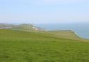
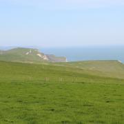
Long before Bournemouth existed, there were hamlets and clusters of houses scattered over the mysterious heathland which covered vast areas of Dorset. One of these hamlets was Kinson, listed in Domesday as Kingston and held by Edward of Salisbury. Kinson, and nearby Longham, feature heavily in the life of Dorset’s most famous smuggler, Isaac Gulliver (1745-1822). On this walk you will explore remnants of ancient heathland and pass through the remaining fields and woods of Kinson, following the routes where Gulliver’s men and pack-horses once trod, and passing over some of the reputed labyrinth of smugglers’ tunnels hidden beneath your feet.
Information
• Distance: 3 miles (4.75 km)
• Time: 2½ hours
• Exertion: Easy. No stiles. Some mud after rain.
• Start: St Andrew’s Church, Kinson, Bournemouth (Grid Ref: SZ067969)
• Map: OS Landranger Sheet 195
• Public Transport: Yellow Buses 2a, 2b, 4a, 5a, 5b, 27, 36
• Dogs: On leads in nature reserves and on roads
• Refreshments: The Bear Cross, Wimborne Road, for lunches and bar meals; Gullivers in Kinson for Sunday lunches
The walk
1 At St Andrew’s Church, notice the rope marks on the parapet where Gulliver’s contraband was hauled up the tower. Walk down Millhams Lane. Past the left car park and kissing-gate into Millhams Mead Local Nature Reserve, cross the Leaden Stour bridge. Look out for the resident kingfisher, there are also buzzards, jays and robins. Now, take the left fork into trees. Follow the track alongside the Leaden Stour. Reaching a left kissing-gated footbridge, turn right up steps into a clearing. Past the right bench, turn left at the footpaths’ crossing with a Gulliver’s Trail (GT) arrow post. Follow the grass path with Millhams Mead Common right and the tree-filled valley left.
2 Nearing a right fence and gate, the facing kissing-gate leads onto Ringwood Road which crosses Longham Bridge down to the right. Gulliver once lived at the White Hart in Longham. Before this, take the lesser left path into the trees. Meander through the trees, parallel with the road, before swinging left on the widening path to meet the right Leaden Stour again. Keep straight on back to that footbridge. Go over and up the stepped path into Garsdale Close. Continue to Wimborne Road and turn left along the Tarmac path (with Anstey Road opposite) before crossing on the pedestrian crossing. Continue along Wimborne Road, crossing Durdells Avenue. In 150 yards, take the right Tarmac path into a remnant of the wood which once bordered Pitts Farm. In 30 yards, take the left path, passing a GT-post, into a small field.
3 Cross to the far right corner GT-post and path up into a bigger field’s corner. Follow the right edge down to a banked gap onto Poole Lane’s wide verge and a GT-post. Cross over and turn right. Pass left Addington Clinic. Opposite Durdells Avenue, take the left kissing-gate into a field corner. Bear half-left over the field to the fence’s kissing-gate. Cross the paddock to another kissing-gate onto a fenced track. Turn left down to the stream bridge and waterfall. We are in Kinson Common Local Nature Reserve, a remnant of the extensive heathland and a SSSI. Over the bridge, ignore the facing GT-post but turn right along the stream. Pass a right bridge by another GT-post and keep straight on, leaving the stream and rising gently (hearing traffic left).
4 Reaching the exit posts at a ‘Kinson Common LNR’ notice and a ‘Poole Lane’ signed Tarmac path, cross Kinson Road into Brook Road. Cross left Highlands Crescent and follow the pavement to a wire-fenced area. Here, note a GT-post and the fenced drive before it. You’ll be coming back here later. Now, continuing past left Long Road and right Pearl Road, descend to East Howe Lane. Turn right and pass right Thatched House, opened as a pub in 1953 but previously a private house reputed to have one of Gulliver’s smuggling tunnels. Continue up the hill. At the top, turn right into Pearl Road and continue to Brook Road again. Turn left. Back to the GT-post, turn right into the Tarmac drive between fenced gardens. Past left Brook Road Allotments, go through the kissing-gate into a hedged track. Past a right kissing-gate and GT-post, go into the long field.
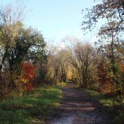
5 Follow the hedge path, known as Gulliver’s Walk, with houses right. At the end, continue down to the kissing-gate into the last remaining field of land once owned by the Bankes Family of Kingston Lacy. Follow the left edge along Cuckoo Woods - a relic of the oldest woodland in Bournemouth as confirmed by the ancient oaks. Past another GT-post, go into Kitscroft Road and walk to Wimborne Road at the end. Turn left. Continue beyond right Tesco before crossing over to Kinson Village Green. See Gulliver’s Inn opposite Kinson Hub. Walk into Millhams Lane. Pass right Weymans Avenue, Pelhams Park and Pelhams House. Next right is Manor Farm Road. Manor Farm was previously Kinson Farm, another of Gulliver’s properties. Now, continue back to St Andrew’s where you started.